Podcast
Questions and Answers
Which of the following is NOT a component of a GIS?
Which of the following is NOT a component of a GIS?
- Software
- Buildings (correct)
- People
- Hardware
Which data model represents geographic features as points, lines, and polygons?
Which data model represents geographic features as points, lines, and polygons?
- Raster
- Attribute
- Vector (correct)
- Image
Which data model represents geographic features as grid cells?
Which data model represents geographic features as grid cells?
- Vector
- Geodatabase
- Shapefile
- Raster (correct)
What are objects in vector format (point, line, or polygon) representing a geographic entity called?
What are objects in vector format (point, line, or polygon) representing a geographic entity called?
What is a collection of features representing the same type of geographic entity called?
What is a collection of features representing the same type of geographic entity called?
In GIS, what are non-spatial characteristics or properties of a geographic feature called?
In GIS, what are non-spatial characteristics or properties of a geographic feature called?
What is a file with the extension '.aprx' associated with?
What is a file with the extension '.aprx' associated with?
Which part of the ArcGIS Pro user interface displays a collection of data layers?
Which part of the ArcGIS Pro user interface displays a collection of data layers?
A representation of a real-world object on a map is called a:
A representation of a real-world object on a map is called a:
Which of the following is a common file format for geospatial vector data?
Which of the following is a common file format for geospatial vector data?
What is the term for information describing the data?
What is the term for information describing the data?
What does GIS stand for?
What does GIS stand for?
Which geometry type is used to represent a city on a small-scale map?
Which geometry type is used to represent a city on a small-scale map?
What do features in a 'feature class' share?
What do features in a 'feature class' share?
If a feature is selected, what happens to it's record in the attribute table?
If a feature is selected, what happens to it's record in the attribute table?
In the ArcGIS Pro interface, what is the purpose of the 'Ribbon'?
In the ArcGIS Pro interface, what is the purpose of the 'Ribbon'?
When creating a new project, what is a crucial decision to make?
When creating a new project, what is a crucial decision to make?
What is the purpose of the 'Map View' in ArcGIS Pro?
What is the purpose of the 'Map View' in ArcGIS Pro?
In GIS, what represents a real-world object, such as a building or a river, on a map?
In GIS, what represents a real-world object, such as a building or a river, on a map?
When you add a feature class to a map, you're creating what?
When you add a feature class to a map, you're creating what?
A shapefile is a:
A shapefile is a:
What is the more useful function of Geodatabase?
What is the more useful function of Geodatabase?
Is multi-user access possible on both Shapefiles and Geodatabases?
Is multi-user access possible on both Shapefiles and Geodatabases?
Which term defines the 'virtual paper' used to visualizing the data?
Which term defines the 'virtual paper' used to visualizing the data?
When visualizing your data during lab, what is a major step?
When visualizing your data during lab, what is a major step?
Which of the following is NOT the description of 'Feature'?
Which of the following is NOT the description of 'Feature'?
GIS is used as a perspective on our:
GIS is used as a perspective on our:
Data entry and display function is on:
Data entry and display function is on:
Is proprietary included in:
Is proprietary included in:
Which of the following is related to attributes?
Which of the following is related to attributes?
Flashcards
People (GIS)
People (GIS)
Researchers, technicians and analysts that ask questions and collect the data.
Hardware (GIS)
Hardware (GIS)
Computer systems, technical equipment, and networks where GIS operates.
Data (GIS)
Data (GIS)
Spatial data (spatially located), Vector, Raster, Image, Attribute(non-spatial).
Software (GIS)
Software (GIS)
Signup and view all the flashcards
Methods (GIS)
Methods (GIS)
Signup and view all the flashcards
Vector Data
Vector Data
Signup and view all the flashcards
Raster Data
Raster Data
Signup and view all the flashcards
Feature (GIS)
Feature (GIS)
Signup and view all the flashcards
Features
Features
Signup and view all the flashcards
Feature Class
Feature Class
Signup and view all the flashcards
Vector Data Model
Vector Data Model
Signup and view all the flashcards
ArcGIS Pro Project
ArcGIS Pro Project
Signup and view all the flashcards
Attribute (GIS)
Attribute (GIS)
Signup and view all the flashcards
Attribute Table
Attribute Table
Signup and view all the flashcards
Record (GIS)
Record (GIS)
Signup and view all the flashcards
Map View / Contents panel
Map View / Contents panel
Signup and view all the flashcards
Feature Layer
Feature Layer
Signup and view all the flashcards
ArcGIS Pro Map View
ArcGIS Pro Map View
Signup and view all the flashcards
ArcGIS Pro Layout View
ArcGIS Pro Layout View
Signup and view all the flashcards
Common Geospatial Data Types
Common Geospatial Data Types
Signup and view all the flashcards
Shapefile
Shapefile
Signup and view all the flashcards
Geodatabase
Geodatabase
Signup and view all the flashcards
Study Notes
- GIS is the focus of the Midterm 2 review.
- The Midterm 2 will be a 20-minute closed book paper test, followed by a short lecture on 'Spatial Analysis', during lecture time on Tuesday.
Five Components of GIS
- People: Researchers, technicians, and analysts use GIS to ask questions, choose data, collect, analyze, and interpret results.
- Hardware: Computer systems, technical equipment, and networks are used for GIS operations.
- Data: GIS uses spatial data (spatially located) like vector and raster data, image data, and attribute data (non-spatial).
- Software: GIS software provides functions to store, analyze, and display geographic information.
- Methods: Guidelines, procedures, and standards are used for analyzing and applying GIS.
Geospatial Data Models
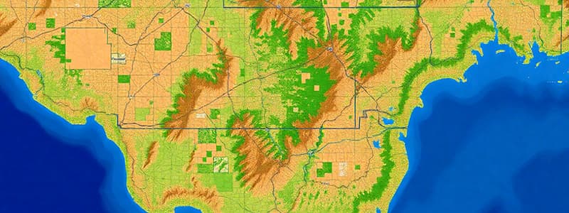
- Geospatial data models include vector and raster data.
- Vector data consists of points, lines, and polygons.
- Raster data consists of cells/pixels.
Raster Data Model
- Rasters typically represent continuous surfaces but sometimes have discrete breaks.
Vector Data Model
- Vector data consists of points, lines, and polygons.
The Vector Data Model
- Objects in vector format (point, line, or polygon) that represent a geographic entity on a digital map are called "features".
- Features that represent the same type of geographic entity are grouped into a "feature class."
- Features are distinct and saved in feature classes.
Vector Model Attributes
- Point, lines, and polygons can have 'attributes' that provide non-spatial information about the geographic feature.
- Attributes are stored in a table, acting as a spreadsheet.
- Features are linked to their attributes in the table.
- Each feature is linked to a record (row) in the table, with a one-to-one correspondence between features and records.
- When a feature is selected, its corresponding record in the table is also selected.
Projects in ArcGIS Pro
- ArcGIS Pro projects are a collection of related items like maps, layouts, tables, charts, and data connections.
- The *.aprx file connects to the data but does not save the data itself.
ArcGIS Pro User Interface
- The ArcGIS Pro user interface is made up of a Ribbon, View and Panes
Creating a Project
- When creating a project, the project must be named and a save location needs to be selected.
- A default 'geodatabase' (*.gdb) is created with the same name as the project.
Map View
- Map View displays a collection of layers drawn in a particular order for a given map extent and map projection.
Features
- A feature is a representation of a real-world object on a map
- Features must have a geometry type and spatial/location information to be displayed on a map
- Features utilize vector data
Feature Class
- A feature class is data that thematically groups similar features recorded in a vector file
- All features in a feature class share the same geographic extent, coordinate system, and attributes
- Note: Feature class is not the same as a feature layer. Where the data is saved as a file, is not the same as deciding how to display it
Feature Layer
- Feature layer is created when a feature class (data) is added to the map
- Displayed as a feature layer
- This layer is linked to the data stored on the network
- The layer contains the common properties for displaying data on the map, original data is not changed (unless you're in editing mode)
- the 'in-memory' representation of the feature data
Lay out View Maps
- Layout view maps are a representation of geospatial data.
- Layout views is designed to convey information.
Geospatial Data Types
- Shapefile is a non-proprietary common sharing format
- Geodatabase files are ESRI-specific with more functionalities.
Shapefile
- An earlier ArcGIS data model is vector data only.
- The open data model is useful for sharing data.
- Similar basic functionality, but lacks some functionality such as geoprocessing, topology, network, and routing.
Geodatabase
- Geodatabases can store complex data types, such as rasters, vector datasets, relationships, topology, and networks.
- They are fully supported by ArcGIS and allows for multi-user access.
- Geodatabases are proprietary.
Studying That Suits You
Use AI to generate personalized quizzes and flashcards to suit your learning preferences.