Podcast
Questions and Answers
What does SIG stand for?
What does SIG stand for?
Système d'Information Géographique (Geographic Information System)
Which of the following are key functions typically associated with a SIG?
Which of the following are key functions typically associated with a SIG?
- Collecte (Collection)
- Maintenance
- Stockage (Storage)
- Analyse (Analysis)
- Production
- Diffusion de l'information (Information Sharing)
- All of the above (correct)
A SIG can only contain information that has a spatial component.
A SIG can only contain information that has a spatial component.
False (B)
What are the six parts of a SIG?
What are the six parts of a SIG?
A SIG used to only have five parts, but a sixth part was added due to the popularity of the internet.
A SIG used to only have five parts, but a sixth part was added due to the popularity of the internet.
Which of the following is the role the 'people' component fulfills in a SIG?
Which of the following is the role the 'people' component fulfills in a SIG?
Name two types of geographic information system software.
Name two types of geographic information system software.
What is the problem that too much data creates?
What is the problem that too much data creates?
What makes a SIG the 'telescope, the microscope, the computer and the Xerox machine'?
What makes a SIG the 'telescope, the microscope, the computer and the Xerox machine'?
Flashcards
Qu'est-ce qu'un SIG ?
Qu'est-ce qu'un SIG ?
Système Informatique qui facilite la collecte, la maintenance, le stockage, l'analyse, la production et la distribution de données spatiales et non spatiales.
Composantes d'un SIG
Composantes d'un SIG
Un SIG est composé de six éléments essentiels : le matériel, le logiciel, les données, les méthodes, le réseau et les personnes.
Matériel (SIG)
Matériel (SIG)
Composants physiques nécessaires au fonctionnement des SIG.
Logiciel (SIG)
Logiciel (SIG)
Signup and view all the flashcards
Données (SIG)
Données (SIG)
Signup and view all the flashcards
Méthodes (SIG)
Méthodes (SIG)
Signup and view all the flashcards
Personnes (SIG)
Personnes (SIG)
Signup and view all the flashcards
Réseau (SIG)
Réseau (SIG)
Signup and view all the flashcards
Informations spatiales / géoréférencées
Informations spatiales / géoréférencées
Signup and view all the flashcards
Informations non spatiales / attributaires
Informations non spatiales / attributaires
Signup and view all the flashcards
Applications des SIG : Informations Cadastrales
Applications des SIG : Informations Cadastrales
Signup and view all the flashcards
Applications des SIG : Livraisons
Applications des SIG : Livraisons
Signup and view all the flashcards
Applications des SIG : Militaire
Applications des SIG : Militaire
Signup and view all the flashcards
Applications des SIG : Agriculture
Applications des SIG : Agriculture
Signup and view all the flashcards
Study Notes
- Module 1: Basics of Geospatial Sciences introduces Geographic Information Systems (GIS) and their core components.
- Explores the advantages and applications of GIS across various sectors.
- Focuses on coordinate systems and cartographic projections for spatial representation.
- Addresses data models used in GIS (vector or raster) and data sources ranging from field surveys to satellite images.
Learning Objectives
- Explain GIS concepts and primary components.
- Describe GIS benefits and applications across areas.
- Explain spatial reference systems and select adapted projections.
- Compare vector and raster data models per analysis needs.
- Identify and assess the relevance of various GIS data sources
What is a GIS?
- GIS = Geographic Information System
- A GIS is an information system designed to facilitate: Data collection, maintenance, storage, analysis, production, and distribution of spatial and non-spatial data and information.
- Action words typically associated with a GIS: Collect, maintain, store, analyze, produce, and distribute.
GIS Functionalities Summarized
- Collection involves ingesting multiple types of information. One of the main advantages of a GIS.
- Maintenance is the task to maintain the collected data up to date. Flexibility in handling both static and dynamic data is key.
- Storage involves coding the structure of information digitally, in various formats. GIS can handle datasets from kilobytes to terabytes.
- Analysis refers to the analytical capacities of a GIS, transforming collected data into information.
- Production results in maps, reports, and statistics; the primary output of a GIS, representing a spatial reality.
- Information diffusion allows sharing spatial and non-spatial data globally, making GIS a central information hub.
Components of a GIS
- GIS can be seen as an umbrella made of six parts that produce a system with numerous capacities when operating together.
- Material, software, data, methods, network, and people are the six components of a GIS.
- The human part of a GIS is the part who operates and maintains the GIS.
- The network was added with the advent of the internet popularity.
Hardware
- Most easier part of the GIS to explain.
- Full IT Kit; including printers, scanners, monitors, input peripherals, and large disk space for SIG datasets.
- Standard SIG workstation has a CPU, RAM (12 to 16 GB), large screens, network infrastructure, and disk space/servers.
- Enterprise GIS may use network gear.
Software
- Refers to free (QGIS) and commercial (ArcGIS) software.
- Enables users to perform functions, manipulate, store, query, and analyze information.
- Examples include ArcGIS Pro, QGIS, and MapWindow.
Data
- Refers to spatial and non-spatial information stored digitally.
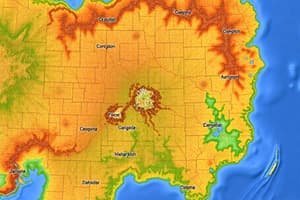
- Spatial data is associated with positions on Earth via coordinates or projections, representing elements.
- Non-spatial data don't have direct geographic reference, describing characteristics of geographic objects.
- A GIS can ingest various types of data which can make the system overloaded with data.
- SIG organizes this data through maps, charts, etc, which allows people to see understand all this data.
- Data is prepared for maintenance, warehousing, analysis, and production.
Methods
- Involves the formulas, statistics, analyses, and algorithms used to transform data into information
- Humans can use it transforms into knowledge via interpretation.
- Methods involves numerous big methods to manage and analyze data.
Methods for Spatial Analysis
- Data collection through GPS and satellite images
- Spatial models using vector and matrix data structures
- Spatial analysis involving techniques like interpolation.
- Proximity analysis to extract object relationships.
- Map making and visualization to results
- Automating via scripts and algorithms for analysis and decision-making.
People
- "People" refers to anyone who utilizes a SIG system.
- Ranges from the public using a map to skilled GIS experts.
- Expertise is needed for collecting, processing and analyzing based on needs.
- Making decisions depends on use of data
Network
- "Network" both the information network and social networks are considered
- Both contribute to the spread of data
- Whether the sharing is done through data transfers or transfers.
- Networks allows posting info using web maps
Studying That Suits You
Use AI to generate personalized quizzes and flashcards to suit your learning preferences.