Podcast
Play an AI-generated podcast conversation about this lesson
Download our mobile app to listen on the go
Get App
Questions and Answers
What is geomorphometry?
What is geomorphometry?
- The science of measuring Earth's surface shapes and their effects on natural forces (correct)
- The discipline focused on the study of weather patterns and climate change
- The study of ecosystems and their interactions with the physical environment
- The science of mapping geographical features using satellite imagery
How is a Digital Elevation Model (DEM) defined?
How is a Digital Elevation Model (DEM) defined?
- The digital representation of land surface elevation with respect to any reference datum (correct)
- A software for simulating geological processes
- A type of satellite used for environmental monitoring
- A digital tool for measuring atmospheric conditions and air quality
What does a Digital Terrain Model (DTM) encompass?
What does a Digital Terrain Model (DTM) encompass?
- A three-dimensional representation of a terrain surface consisting of X, Y, Z coordinates stored in digital form (correct)
- A software for tracking wildlife migration patterns
- A tool for measuring soil properties and composition
- A type of radar system for detecting underground water sources
What is the relationship between DEM and DTM?
What is the relationship between DEM and DTM?
Signup and view all the answers
What do Digital Surface Models (DSM) represent?
What do Digital Surface Models (DSM) represent?
Signup and view all the answers
Flashcards are hidden until you start studying
Study Notes
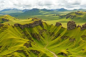
Geomorphometry
- Geomorphometry is the science of measuring and analyzing the shape of the Earth's surface.
Digital Elevation Model (DEM)
- A Digital Elevation Model (DEM) is a digital representation of the topographic surface of the Earth, describing the relief of the terrain.
- It defines the height of each point on the Earth's surface, creating a 3D model of the terrain.
Digital Terrain Model (DTM)
- A Digital Terrain Model (DTM) encompasses the terrain's natural features, such as valleys, hills, and ridges.
- It represents the bare-Earth model, excluding above-ground features like buildings and vegetation.
Relationship between DEM and DTM
- A DEM can be considered a broader term that includes both the DTM (bare-Earth model) and above-ground features.
- A DTM is a specific type of DEM that focuses on the natural terrain, excluding above-ground features.
Digital Surface Model (DSM)
- A Digital Surface Model (DSM) represents the topographic surface, including above-ground features like buildings, bridges, and trees.
- It provides a comprehensive model of the Earth's surface, including both natural and man-made features.
Studying That Suits You
Use AI to generate personalized quizzes and flashcards to suit your learning preferences.