Podcast
Questions and Answers
What occurs at convergent boundaries when two oceanic plates collide?
What occurs at convergent boundaries when two oceanic plates collide?
- Both plates melt and form new oceanic crust.
- Both plates push upwards to create mountain ranges.
- The denser oceanic plate is subducted. (correct)
- The less dense plate rises above the denser plate.
What is the primary driving force behind the movement of tectonic plates?
What is the primary driving force behind the movement of tectonic plates?
- The rotation of the Earth.
- Wind patterns influencing the ocean currents.
- Convection currents in the earth's mantle. (correct)
- Gravitational pull of the moons.
What characterizes transform boundaries?
What characterizes transform boundaries?
- New crust is generated as plates diverge.
- Plates slide past each other with no crust creation or destruction. (correct)
- Volcanic activity occurs regularly.
- Crust is destroyed as plates collide.
What type of geological formation is expected at continental-continental convergent boundaries?
What type of geological formation is expected at continental-continental convergent boundaries?
What happens to the crust during seafloor spreading at divergent boundaries?
What happens to the crust during seafloor spreading at divergent boundaries?
The Benioff zone is related to which tectonic activity?
The Benioff zone is related to which tectonic activity?
How does the age of oceanic crust relate to ocean depth?
How does the age of oceanic crust relate to ocean depth?
What is a significant consequence of volcanic ash on commercial aircraft?
What is a significant consequence of volcanic ash on commercial aircraft?
Which is the result of the process of subduction?
Which is the result of the process of subduction?
Which of the following effects can volcanic eruptions have on global temperatures?
Which of the following effects can volcanic eruptions have on global temperatures?
What does volcanic tremor indicate in terms of monitoring volcanoes?
What does volcanic tremor indicate in terms of monitoring volcanoes?
What is the significance of InSAR in volcanic monitoring?
What is the significance of InSAR in volcanic monitoring?
What characterizes a supervolcano?
What characterizes a supervolcano?
Which method is NOT used for monitoring heat and hydrothermal activity?
Which method is NOT used for monitoring heat and hydrothermal activity?
Which volcanic gas monitoring technique involves collecting samples from fumaroles?
Which volcanic gas monitoring technique involves collecting samples from fumaroles?
Which of the following is an implication of global climate change due to volcanic activity?
Which of the following is an implication of global climate change due to volcanic activity?
Which of the following describes the sequence of wave arrival during an earthquake?
Which of the following describes the sequence of wave arrival during an earthquake?
What is a necessary condition for tsunami waves to be generated by undersea volcanic eruptions?
What is a necessary condition for tsunami waves to be generated by undersea volcanic eruptions?
What role does the depth of water above a rupture play in tsunami generation?
What role does the depth of water above a rupture play in tsunami generation?
Which of the following is NOT a method of tsunami hazard mitigation?
Which of the following is NOT a method of tsunami hazard mitigation?
What primarily influences the generation of tsunami waves during an asteroid impact?
What primarily influences the generation of tsunami waves during an asteroid impact?
During an earthquake, what does a short time between P waves and S waves indicate?
During an earthquake, what does a short time between P waves and S waves indicate?
Which type of wave is responsible for the most significant property damage during an earthquake?
Which type of wave is responsible for the most significant property damage during an earthquake?
Which geological feature is crucial for the formation of tsunami waves when a fault ruptures?
Which geological feature is crucial for the formation of tsunami waves when a fault ruptures?
Which type of earthquake hazard does NOT contribute to tsunami generation?
Which type of earthquake hazard does NOT contribute to tsunami generation?
What function do tsunami warning systems serve?
What function do tsunami warning systems serve?
What is one of the main advantages of delta regions for human settlement?
What is one of the main advantages of delta regions for human settlement?
Which of the following is NOT a method of mitigating landslide risks?
Which of the following is NOT a method of mitigating landslide risks?
What primarily causes global sea level changes?
What primarily causes global sea level changes?
What role does 16O and 18O play in ocean and glacier dynamics?
What role does 16O and 18O play in ocean and glacier dynamics?
What happens to the river profile as deltas grow seaward?
What happens to the river profile as deltas grow seaward?
How do foraminifera provide a proxy for past climate conditions?
How do foraminifera provide a proxy for past climate conditions?
What significant climatic observation has been made about the past 10,000 years?
What significant climatic observation has been made about the past 10,000 years?
Which delta is recognized as the greatest in the world?
Which delta is recognized as the greatest in the world?
How does the city elevation change relative to the river as deltas grow?
How does the city elevation change relative to the river as deltas grow?
In terms of temperature and glacier length, what does a lower temperature indicate?
In terms of temperature and glacier length, what does a lower temperature indicate?
What is the relationship between oxygen isotope ratios and snowfall temperatures as recorded in the Antarctic ice sheet?
What is the relationship between oxygen isotope ratios and snowfall temperatures as recorded in the Antarctic ice sheet?
Which feature of delta regions contributes to high agricultural productivity?
Which feature of delta regions contributes to high agricultural productivity?
Which factor primarily affects sea level rise in Southeast Asia?
Which factor primarily affects sea level rise in Southeast Asia?
What historic climatic event is characterized by significantly lower global temperatures?
What historic climatic event is characterized by significantly lower global temperatures?
What has been the increase in global average temperatures over the past 200 years, according to proxy data?
What has been the increase in global average temperatures over the past 200 years, according to proxy data?
What primary factor influences the composition of foraminifera shells during an ice age?
What primary factor influences the composition of foraminifera shells during an ice age?
What is the primary factor that determines frictional resistance in geological contexts?
What is the primary factor that determines frictional resistance in geological contexts?
Which type of landslide is characterized by high speed and short runout?
Which type of landslide is characterized by high speed and short runout?
How does increased pore fluid pressure affect landslide potential?
How does increased pore fluid pressure affect landslide potential?
What typical speed range is associated with debris flows?
What typical speed range is associated with debris flows?
What is a common source of weakness in rock that can lead to landslides?
What is a common source of weakness in rock that can lead to landslides?
What significant impact did the Vajont Dam landslide have during the initial filling?
What significant impact did the Vajont Dam landslide have during the initial filling?
Which of the following landslide types can potentially transform into a debris avalanche?
Which of the following landslide types can potentially transform into a debris avalanche?
What role does cohesion play in soil mechanics?
What role does cohesion play in soil mechanics?
Flashcards
Mid-ocean ridges
Mid-ocean ridges
Areas where tectonic plates move apart, creating new oceanic crust.
Mantle Convection
Mantle Convection
The movement of hot rock in the Earth's mantle, a key driver of plate tectonics.
Convergent Boundaries
Convergent Boundaries
Areas where tectonic plates collide.
Subduction Zones
Subduction Zones
Signup and view all the flashcards
Benioff Zones
Benioff Zones
Signup and view all the flashcards
Transform Boundaries
Transform Boundaries
Signup and view all the flashcards
Plate Tectonics
Plate Tectonics
Signup and view all the flashcards
Tectonic Plates
Tectonic Plates
Signup and view all the flashcards
Oceanic Crust
Oceanic Crust
Signup and view all the flashcards
Continental Crust
Continental Crust
Signup and view all the flashcards
Seafloor Spreading
Seafloor Spreading
Signup and view all the flashcards
Volcanic Eruption Impact
Volcanic Eruption Impact
Signup and view all the flashcards
Supervolcano
Supervolcano
Signup and view all the flashcards
Volcanic Monitoring
Volcanic Monitoring
Signup and view all the flashcards
Volcanic Tremor
Volcanic Tremor
Signup and view all the flashcards
Ground Deformation
Ground Deformation
Signup and view all the flashcards
InSAR
InSAR
Signup and view all the flashcards
Gas Monitoring
Gas Monitoring
Signup and view all the flashcards
Hydrothermal Activity
Hydrothermal Activity
Signup and view all the flashcards
Thermal Features
Thermal Features
Signup and view all the flashcards
Infrasound
Infrasound
Signup and view all the flashcards
Earthquake Hazards
Earthquake Hazards
Signup and view all the flashcards
Ground Shaking
Ground Shaking
Signup and view all the flashcards
P-waves
P-waves
Signup and view all the flashcards
S-waves
S-waves
Signup and view all the flashcards
Surface Waves
Surface Waves
Signup and view all the flashcards
Ground Failure
Ground Failure
Signup and view all the flashcards
Landslides
Landslides
Signup and view all the flashcards
Liquefaction
Liquefaction
Signup and view all the flashcards
Earthquake Tsunami
Earthquake Tsunami
Signup and view all the flashcards
Tsunami Wave Generation
Tsunami Wave Generation
Signup and view all the flashcards
Undersea Landslides
Undersea Landslides
Signup and view all the flashcards
Undersea Volcanic Eruptions
Undersea Volcanic Eruptions
Signup and view all the flashcards
Asteroid Impact Tsunami
Asteroid Impact Tsunami
Signup and view all the flashcards
Tsunami Hazard Mitigation
Tsunami Hazard Mitigation
Signup and view all the flashcards
Tsunami Warning Systems
Tsunami Warning Systems
Signup and view all the flashcards
Friction
Friction
Signup and view all the flashcards
Sources of weakness (landslides)
Sources of weakness (landslides)
Signup and view all the flashcards
Cohesion
Cohesion
Signup and view all the flashcards
Rockfall
Rockfall
Signup and view all the flashcards
Debris flow
Debris flow
Signup and view all the flashcards
Translational landslide
Translational landslide
Signup and view all the flashcards
Creep
Creep
Signup and view all the flashcards
Landslide impacts
Landslide impacts
Signup and view all the flashcards
Landslide monitoring
Landslide monitoring
Signup and view all the flashcards
Landslide Potential Index
Landslide Potential Index
Signup and view all the flashcards
Landslide Mitigation
Landslide Mitigation
Signup and view all the flashcards
Delta Region Hazards
Delta Region Hazards
Signup and view all the flashcards
Delta Region Advantages
Delta Region Advantages
Signup and view all the flashcards
Delta Formation
Delta Formation
Signup and view all the flashcards
Ganges-Brahmaputra Delta
Ganges-Brahmaputra Delta
Signup and view all the flashcards
Distributary Rivers
Distributary Rivers
Signup and view all the flashcards
Sea Level Rise Impact on Deltas
Sea Level Rise Impact on Deltas
Signup and view all the flashcards
Sea Level Rise Causes
Sea Level Rise Causes
Signup and view all the flashcards
Oxygen Isotopes in Shells
Oxygen Isotopes in Shells
Signup and view all the flashcards
Ice Age & 18O
Ice Age & 18O
Signup and view all the flashcards
Proxy Record
Proxy Record
Signup and view all the flashcards
Antarctic Ice Sheet Temperatures
Antarctic Ice Sheet Temperatures
Signup and view all the flashcards
Glacier Length as a Proxy
Glacier Length as a Proxy
Signup and view all the flashcards
Little Ice Age
Little Ice Age
Signup and view all the flashcards
Dansgaard-Oeschger Events
Dansgaard-Oeschger Events
Signup and view all the flashcards
Heinrich Events
Heinrich Events
Signup and view all the flashcards
Study Notes
Week 1 - Lectures 1 & 2 - 12 Aug 2024
- Topography of Earth is more dynamic and active than Mars, with its crust being more plastic and deforming more readily.
- Natural hazards are increasing due to the exponential growth of the global human population.
- Human population growth, increased life expectancy, and efficient food production are linked to improved science and technology.
- Everyday geological processes and interactions between spheres (hydrosphere, biosphere, etc.) contribute to natural disasters.
- Human impact plays a role in the size and location of events. More people and buildings lead to more damage and casualties.
- Catastrophe predictions are possible but challenging, with unpredictable cycles and many variables.
- Recurrence interval increases linearly on a log scale and exponentially on a linear scale.
- Magnitude is inversely proportional to frequency.
Week 2 - Lecture 3 - 19 Aug 2024
- Earth's structure has unique chemical compositions and physical states impacting surface life.
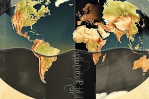
- Plate tectonics theory explains how major landforms are created from lithosphere movements.
- Continental drift (1912) describes continents moving over geologic time.
- Magnetic anomalies are evident in the Earth's magnetic field and its periodic reversals.
Week 2 - Lecture 3 - 19 Aug 2024 (cont.)
- Divergent boundaries occur where plates move apart.
- Convergent boundaries occur where plates collide, leading to subduction and mountain building.
- Transform boundaries involve plates sliding past each other, causing earthquakes.
Week 3 - Lecture 4 - 26 Aug 2024
- Stress and strain cause earthquakes.
- Elastic deformation (reversible) and plastic deformation (not reversible) describe rock behaviour.
- Elastic rebound theory explains energy release during earthquakes.
- Seismic waves (body waves: P and S waves; surface waves: Rayleigh and Love waves) propagate during earthquakes.
Week 3 - Lecture 4 - 26 Aug 2024 (cont'd)
- Different fault types (normal, reverse/thrust, strike-slip) relate to various geological environments (convergent, divergent and transform environments).
- Magnitude of earthquakes is measured using seismic moment (related to length, width and slip of rupture x shear modulus).
Week 4 - Lecture 5 - 2 Sep 2024
- Ground failure (fault rupture, landslides, liquefaction) are earthquake hazards.
- Ground shaking is an adverse effect of earthquakes, with devastating impacts depending on the distance from the source.
- Surface faulting results in visible offsets and is a hazard to structures.
- Earthquakes can trigger landslides, affecting populated regions.
Week 4 - Lecture 5 - 2 Sep 2024 (cont'd)
- Flooding due to landslides impacting water bodies can generate a disastrous situation.
- Liquefaction, a ground failure, involves saturated, loosely packed soils becoming fluid during earthquakes.
- The effect of earthquakes on changes in land level and shoreline is considerable.
Week 5 - Lecture 6 - 9 Sep 2024
- Tsunamis are generated by vertical deformation/movement from earthquakes.
- Tsumanis have very large wavelengths and wave heights, which lead to significant damages and harm in coastal areas.
- Tsunami wave speed is controlled by water depth, causing faster waves in deep water and slower waves in shallow water.
Week 5 - Lecture 6 - 9 Sep 2024 (cont'd)
- Factors influencing tsunami wave height include earthquake magnitude (greater magnitude - larger tsunami); area of rupture and rate of water displacement.
- Underwater ruptures of normal faults, thrust faults and megathrust faults are significant sources for tsunamis.
Week 6- Lecture 7 - 16 Sep 2024
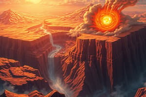
- Different types of volcanoes (shield volcanoes, stratovolcanoes, cinder cones and Calderas) have different eruptive styles.
- Explosive volcanic eruptions can lead to dangerous pyroclastic flows, ash falls, and lahars, which have widespread effects.
- Volcanic eruptions can cause changes to topography and bathymetry.
Week 6 - Lecture 7 - 16 Sep 2024 (cont'd)
- Volcanic eruptions can cause changes to topography and bathymetry.
- Types of magma (basaltic, andesitic, rhyolitic) have different compositions, viscosity, and temperatures which affect eruptive styles.
Week 7 - Lecture 8 - 23 Sep 2024
- Volcanic hazards occur without eruptions (e.g. ground shaking, fractures and fissures)
- Gases released during volcanoes and volcanic activities could cause harm to humans and animals through CO2 suffocation
Week 7 - Lecture 8 - 23 Sep 2024 (cont'd)
- Volcanic hazards include volcanic mudslides (lahars) and landslides, which can result in considerable losses and harms.
- Monitoring volcanic activity helps to predict eruptions and mitigate related risks.
Week 8- Lecture 9 - 7 Oct 2024
- Landslides are the downslope movement of rock, debris and/or mud, depending on the slope angle, moisture content, water saturation and external factors like earthquakes/explosions.
- Rotational and translational slides are different types of landslide movements.
Week 8 - Lecture 9 - 7 Oct 2024 (cont'd)
- The processes involve the interplay of driving forces (gravity) and resisting forces (cohesion, friction and strength of materials).
- Landslides can result in different damages depending on the driving force, the angle of repose, and external factors.
- Types of monitoring/mitigation strategies for landslides are also included
Week 9 - Lecture 10 - 14 Oct 2024
- Delta regions are typically located where rivers enter oceans, seas or lakes.
- The factors causing people to choose to live in delta regions include the flat terrain (for easy transport, farming), and fresh water
- Deltas develop over time, as rivers carry sediment.
- The rising of sea level will threaten delta regions and lead to various impacts on people and their livelihoods.
Week 9 - Lecture 10 - 14 Oct 2024 (cont.)
- Rising sea levels are a global concern, caused by various factors (e.g., glacial melt, thermal expansion of seawater).
- Sea levels are rising leading to floods and the salinization of fresh water resources from the aquifers near the coasts in the delta regions.
Week 10- Lecture 11 - 21 Oct 2024
- Cyclones are rotating storms that derive energy from warm ocean water.
- Warm water, strong winds, and latent heat of vaporisation from oceans are essential for cyclone formation.
- Cyclones develop in tropical and subtropical areas of oceans near the equator.
Week 10 - Lecture 11 - 21 Oct 2024 (cont.)
- Cyclones are associated with strong winds (that can damage infrastructure, knock down buildings etc), heavy rainfall (that can lead to flooding), storm surges (which push ocean water onto coastal areas).
- The Coriolis effect influences the rotational direction of cyclones in different hemispheres
- Cyclones (e.g. hurricanes, typhoons) can cause wide-ranging damages, including death, injuries, building destruction, infrastructure damage (for example, knocking down buildings) and substantial economic losses.
Week 11/12 - Lecture 12 - 28 Oct 2024 / 4 Nov 2024
- Climate change is the long-term shift of weather that affects various aspects of the Earth's system, including atmosphere, hydrosphere, geosphere, biosphere, and cryosphere.
- Variations in Earth's orbit affect solar radiation receipt, which in turn leads to temperature variations.
- Greenhouse gases trap heat radiated from the Earth, warming the planet. Human activities are major contributors, especially burning fossil fuels.
Week 11-12 - Lecture 12 - 28 Oct 2024 / 4 Nov 2024 (cont.)
- Natural factors (e.g., volcanic eruptions and Milankovitch cycles) can also influence climate.
- Increased greenhouse gases and their warming effects have global consequences, including rising sea levels, more extreme weather events, and threats to human societies.
- Monitoring and measuring climate conditions include methods like analyses of ice cores, tree rings and sediments, which can provide insights into past climate conditions.
Week 11/12 - Lecture 12 - 28 Oct 2024 / 4 Nov 2024 (cont.)
- The idea of geoengineering addresses ways to manage the direct consequences of climate change.
- Geoengineering approaches attempt to physically manipulate the Earth's environment to reduce global warming, such as increasing reflectivity of clouds, promoting plant growth, or capturing CO2 from the atmosphere.
Studying That Suits You
Use AI to generate personalized quizzes and flashcards to suit your learning preferences.