Podcast
Questions and Answers
What is the primary focus of the law enacted by Professor Haydar Bakr in the UAE?
What is the primary focus of the law enacted by Professor Haydar Bakr in the UAE?
- To establish guidelines for urbanization in drought areas
- To regulate water consumption during droughts
- To mandate geophysical studies before construction begins (correct)
- To reduce desertification risks through construction processes
Which of the following statements accurately differentiates drought from desertification?
Which of the following statements accurately differentiates drought from desertification?
- Drought can end with the return of water supply, while desertification results in permanent land loss. (correct)
- Drought is a permanent condition while desertification is temporary.
- Drought results from urbanization, whereas desertification occurs naturally.
- Desertification can recover with water supply, but drought is irreversible.
What factor does NOT influence the volcanic risk area according to the characteristics mentioned?
What factor does NOT influence the volcanic risk area according to the characteristics mentioned?
- Volcanic ash quantity
- Lava viscosity
- Silica content
- Distance from the nearest city (correct)
What human activities contribute primarily to desertification according to the provided content?
What human activities contribute primarily to desertification according to the provided content?
In what context are volcanoes primarily mentioned in the material?
In what context are volcanoes primarily mentioned in the material?
What happens at the focus of an earthquake?
What happens at the focus of an earthquake?
Which wave type arrives first during an earthquake?
Which wave type arrives first during an earthquake?
What is the primary cause of earthquakes according to the Elastic Rebound Theory?
What is the primary cause of earthquakes according to the Elastic Rebound Theory?
Which statement about surface waves is correct?
Which statement about surface waves is correct?
Which of the following cities is NOT known for being near a tectonic plate boundary?
Which of the following cities is NOT known for being near a tectonic plate boundary?
What is the term for the point on the Earth's surface directly above where an earthquake originates?
What is the term for the point on the Earth's surface directly above where an earthquake originates?
What are the potential hazards associated with earthquakes?
What are the potential hazards associated with earthquakes?
During which geological phenomenon does liquefaction typically occur?
During which geological phenomenon does liquefaction typically occur?
What phenomenon occurs when water escapes from an aquifer to the earth's surface during an earthquake?
What phenomenon occurs when water escapes from an aquifer to the earth's surface during an earthquake?
Which factor is NOT a contributor to landslides?
Which factor is NOT a contributor to landslides?
Which structure is used to absorb wave energy and protect the coast from coastal erosion?
Which structure is used to absorb wave energy and protect the coast from coastal erosion?
What is a potential consequence of coastal erosion on agricultural land?
What is a potential consequence of coastal erosion on agricultural land?
Which of the following structures is built to protect against longshore currents?
Which of the following structures is built to protect against longshore currents?
What is one method to manage landslide risks mentioned?
What is one method to manage landslide risks mentioned?
Which of the following natural processes contribute to coastal erosion?
Which of the following natural processes contribute to coastal erosion?
In which scenario is liquefaction most likely to occur?
In which scenario is liquefaction most likely to occur?
What are retaining walls primarily used for?
What are retaining walls primarily used for?
Which of the following structures is built on the coast to minimize the impact of storm waves?
Which of the following structures is built on the coast to minimize the impact of storm waves?
Which of the following is NOT a cause of flooding?
Which of the following is NOT a cause of flooding?
What is one effect of flooding on infrastructure?
What is one effect of flooding on infrastructure?
Which technique is specifically used to divert excess water during floods?
Which technique is specifically used to divert excess water during floods?
How can the risks associated with karsts be minimized during construction?
How can the risks associated with karsts be minimized during construction?
What major incident occurred in February 2007 in Guatemala related to geological risks?
What major incident occurred in February 2007 in Guatemala related to geological risks?
What dual benefit do dams provide concerning flooding?
What dual benefit do dams provide concerning flooding?
Which of the following is a notable effect of karst formations?
Which of the following is a notable effect of karst formations?
When was the Shaikha Salama Mosque destroyed due to karst-related issues?
When was the Shaikha Salama Mosque destroyed due to karst-related issues?
What are levees designed to accomplish?
What are levees designed to accomplish?
What environmental condition can lead to the formation of karsts?
What environmental condition can lead to the formation of karsts?
What does the Richter scale measure?
What does the Richter scale measure?
What is a primary function of the seismograph instrument?
What is a primary function of the seismograph instrument?
How does the Mercalli scale differ from the Richter scale?
How does the Mercalli scale differ from the Richter scale?
What is a significant limitation of the Mercalli scale?
What is a significant limitation of the Mercalli scale?
What phenomenon is described as a series of huge waves caused by earthquakes?
What phenomenon is described as a series of huge waves caused by earthquakes?
What characteristic is true of aftershocks?
What characteristic is true of aftershocks?
Which hazard is associated with ground displacement during an earthquake?
Which hazard is associated with ground displacement during an earthquake?
Why might two earthquakes of similar energy have different Mercalli scale ratings?
Why might two earthquakes of similar energy have different Mercalli scale ratings?
How does the energy level on the Richter scale change with each magnitude increase?
How does the energy level on the Richter scale change with each magnitude increase?
Which of the following is NOT a probable hazard associated with earthquakes?
Which of the following is NOT a probable hazard associated with earthquakes?
Flashcards
Elastic Rebound Theory
Elastic Rebound Theory
The process where tectonic plates, under stress, build up and store energy until reaching a breaking point. This sudden release of stored energy causes the rocks to snap back to their original shape, resulting in an earthquake.
Earthquake Focus
Earthquake Focus
The point beneath the Earth's surface where the initial rupture of an earthquake occurs. It's the origin point of the seismic energy release.
Earthquake Epicenter
Earthquake Epicenter
The point on the Earth's surface directly above the earthquake's focus. This is where the earthquake's impacts are usually felt most strongly.
P-Wave (Primary Wave)
P-Wave (Primary Wave)
Signup and view all the flashcards
S-Wave (Secondary Wave)
S-Wave (Secondary Wave)
Signup and view all the flashcards
Surface Waves
Surface Waves
Signup and view all the flashcards
Love Waves
Love Waves
Signup and view all the flashcards
Earthquake Risk Management
Earthquake Risk Management
Signup and view all the flashcards
Seismic Waves
Seismic Waves
Signup and view all the flashcards
Primary Wave (P-wave)
Primary Wave (P-wave)
Signup and view all the flashcards
Secondary Wave (S-wave)
Secondary Wave (S-wave)
Signup and view all the flashcards
Seismograph
Seismograph
Signup and view all the flashcards
Seismogram
Seismogram
Signup and view all the flashcards
Epicenter
Epicenter
Signup and view all the flashcards
Richter Scale
Richter Scale
Signup and view all the flashcards
Mercalli Scale
Mercalli Scale
Signup and view all the flashcards
Tsunami
Tsunami
Signup and view all the flashcards
Geophysical Studies Law
Geophysical Studies Law
Signup and view all the flashcards
Drought
Drought
Signup and view all the flashcards
Desertification
Desertification
Signup and view all the flashcards
Volcano Risk Area
Volcano Risk Area
Signup and view all the flashcards
Volcanic Hazards
Volcanic Hazards
Signup and view all the flashcards
Flooding
Flooding
Signup and view all the flashcards
Causes of Flooding
Causes of Flooding
Signup and view all the flashcards
Effects of Flooding
Effects of Flooding
Signup and view all the flashcards
Levees
Levees
Signup and view all the flashcards
Diversion Canals
Diversion Canals
Signup and view all the flashcards
Dams
Dams
Signup and view all the flashcards
Karsts
Karsts
Signup and view all the flashcards
Karst Formation
Karst Formation
Signup and view all the flashcards
Karst Effects
Karst Effects
Signup and view all the flashcards
Karst Risk Mitigation
Karst Risk Mitigation
Signup and view all the flashcards
Liquefaction
Liquefaction
Signup and view all the flashcards
Landslide
Landslide
Signup and view all the flashcards
Coastal Erosion
Coastal Erosion
Signup and view all the flashcards
Seawall
Seawall
Signup and view all the flashcards
Breakwater
Breakwater
Signup and view all the flashcards
Groin
Groin
Signup and view all the flashcards
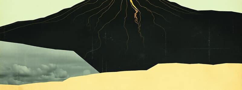
Volcano
Volcano
Signup and view all the flashcards
Study Notes
Natural Hazards and Risk Management
- The course is delivered primarily online by Dr. Dalal Alshamsi from the Geology Department of the College of Science at the United Arab Emirates University.
Outline
- Earthquakes and associated hazards (faults, tsunamis, aftershocks, liquefaction, landslides)
- Coastal erosion
- Floods
- Karsts (cavities)
- Droughts and desertification
- Volcanoes
- Risk management of each hazard
Earthquakes (Seismic Activity)
- Many large cities (Istanbul, Tokyo, Jakarta) are near plate boundaries, zones of frequent seismic activity.
- Over 2 million people died in the 20th century due to earthquakes and associated phenomena.
Earthquake Theory (Elastic Rebound Theory)
- When tectonic plates move, stress builds.
- If the stress becomes too great, rocks separate (faulting).
- An earthquake occurs, and the rock returns to its original shape.
Earthquake Faults
- Faults are fractures in rock masses where movement has occurred.
Earthquake Lingo
- The focus is the point on a fault where rupture first occurs (subsurface)
- The epicenter is the point on the surface directly above the focus.
- This data is helpful for earthquake risk management
Earthquake Waves (Seismic Waves)
- Body waves (propagate subsurface) include primary (P-waves) which are fastest, and secondary (S-waves).
- Surface waves (propagate on the surface) include love and Raleigh waves, traveling the slowest.
Seismograph
- Instruments used to record seismic waves.
- The seismogram shows the times when P-waves, then S-waves, then surface waves arrive.
Minimizing Earthquake Risk in Surrounding Areas
- Speed of seismic waves varies, arriving at different times at observation points.
- Calculation of time difference helps determine the distance to an epicenter.
- The time it takes for seismic waves to reach surrounding cities can be used to warn populations.
Earthquake Measurement
- Richter scale measures earthquake energy (quantified).
- Mercalli scale measures earthquake effects on people and buildings (descriptive).
- Richter scale measures energy by 32 raised to the power of the magnitude.
Hazards Associated with Earthquakes
- Fault: Displacement in rock beds
- Tsunami: Series of large waves originating from earthquake epicenter
- Aftershocks: Subsequent smaller quakes after a major quake
- Liquefaction: Escape of water from aquifers to the surface due to ground shaking, causing damage to buildings.
- Landslides: Mass movement of soil and rock due to seismic activity or water/gravity
How to minimize the risk of landslides
- Techniques used to reduce landslide risk include wire mesh, concrete cover, and retaining walls.
Coastal Erosion
- Human and natural processes shape coastlines.
- Wave action is a major natural process.
- Human modifications include structures along coastlines.
- Coastal erosion can damage structures, cause sea-water intrusion.
Types of Coastal Structures
- Seawalls: designed to minimize wave energy and protect coastlines
- Breakwaters: structures designed to absorb wave energy
- Groins: barriers built into the sea to prevent beach erosion
Floods
- Flooding is the submerging of dry land with water.
- Causes include heavy precipitation, ground's water absorption capacity, evaporation rates, river bank characteristics, and human modifications to the land.
- Effects include loss of life, damage to structures, destruction of crops, collapsing river banks, and release of toxic materials
Minimizing Flood Risk
- Techniques include building levees, diversion canals, and dams.
- Levees are raised riverbanks; diversion canals redirect flow to a purpose built canal; dams control and store flood waters.
Karsts (Cavities)
- Karsts are landforms formed by the chemical weathering of limestone or other carbonate rocks.
- They can cause significant problems like collapse of structures and loss of life, creating economic drains
- To reduce the risk of karsts formation, geophysical investigations are compulsory for all construction projects in Abu Dhabi.
Droughts and Desertification
- Drought is a prolonged period of low rainfall.
- Desertification is the process by which fertile land becomes desert.
- Human factors like deforestation and urbanization often cause desertification.
- Prevention measures should be taken early on.
Volcanoes
- Volcanoes are located mainly at convergent plate boundaries.
- Risk estimates consider lava viscosity, silica content, temperature, and volcanic ash.
- Example volcanoes include Fuji in Japan and Cleveland in Alaska.
Studying That Suits You
Use AI to generate personalized quizzes and flashcards to suit your learning preferences.


