Podcast
Questions and Answers
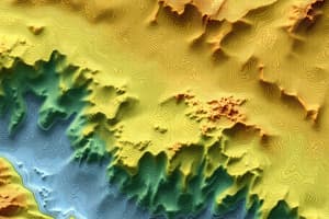
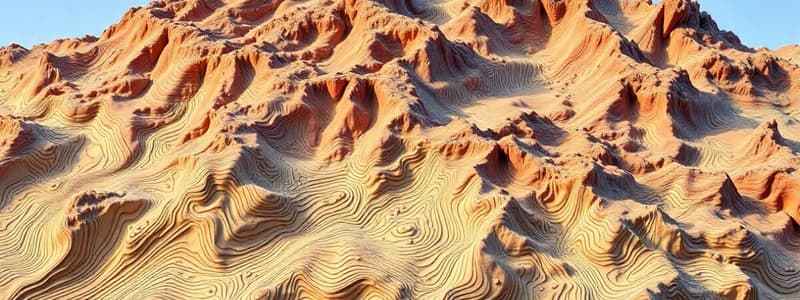
What does a close spacing of contour lines on a map indicate?
What does a close spacing of contour lines on a map indicate?
- A depression
- A flat plain
- A steep slope (correct)
- A gentle slope
Which of the following is usually represented by contour lines that run together and then separate?
Which of the following is usually represented by contour lines that run together and then separate?
- A river
- A gentle plain
- A cliff (correct)
- A valley
Which of the following geological features is formed when magma solidifies horizontally along a bedding plane?
Which of the following geological features is formed when magma solidifies horizontally along a bedding plane?
- Batholith
- Dike
- Laccolith
- Sill (correct)
What is the term for the difference in altitude between two successive contour lines?
What is the term for the difference in altitude between two successive contour lines?
Which term describes a volcano that has not erupted in recorded history?
Which term describes a volcano that has not erupted in recorded history?
Which of the following best describes index contour lines?
Which of the following best describes index contour lines?
What immediate effect can volcanic eruptions have on the surrounding soil?
What immediate effect can volcanic eruptions have on the surrounding soil?
What is the significance of pecked lines on a contour map?
What is the significance of pecked lines on a contour map?
What is the term for the location where an earthquake begins?
What is the term for the location where an earthquake begins?
Contour lines are always numbered in the direction towards which...
Contour lines are always numbered in the direction towards which...
If you observe branching lines on a map that are not contour lines, what could they represent?
If you observe branching lines on a map that are not contour lines, what could they represent?
What is the name of the instrument used to measure the intensity of an earthquake?
What is the name of the instrument used to measure the intensity of an earthquake?
What geological feature is most commonly associated with earthquakes?
What geological feature is most commonly associated with earthquakes?
Apart from vertical cliffs and overhanging cliffs, under which condition can contour lines merge or cross one another on maps?
Apart from vertical cliffs and overhanging cliffs, under which condition can contour lines merge or cross one another on maps?
On the Richter scale, how much stronger is an earthquake with a magnitude of $5.0$ compared to one with a magnitude of $3.0$?
On the Richter scale, how much stronger is an earthquake with a magnitude of $5.0$ compared to one with a magnitude of $3.0$?
Which of the following is NOT listed as a benefit of volcanic eruptions?
Which of the following is NOT listed as a benefit of volcanic eruptions?
Which approach emphasizes the study of a particular area, focusing on its various interconnected aspects?
Which approach emphasizes the study of a particular area, focusing on its various interconnected aspects?
What does political geography primarily investigate?
What does political geography primarily investigate?
What is the focus of the topical approach in geography?
What is the focus of the topical approach in geography?
What does the term 'Quantitative Revolution' refer to in the context of geography?
What does the term 'Quantitative Revolution' refer to in the context of geography?
Which statement encapsulates a modern understanding of geography?
Which statement encapsulates a modern understanding of geography?
How do humans interact with their environment, according to a contemporary geographical viewpoint?
How do humans interact with their environment, according to a contemporary geographical viewpoint?
Which field of geography studies the dynamic and static aspects of population?
Which field of geography studies the dynamic and static aspects of population?
Which of the following claims would a supporter of environmental possibilism make?
Which of the following claims would a supporter of environmental possibilism make?
Which of the following best describes the common thread among various definitions of geography?
Which of the following best describes the common thread among various definitions of geography?
What is a central focus that emerged in geography in the mid-20th century?
What is a central focus that emerged in geography in the mid-20th century?
Which of the following represents a modern approach to studying geography?
Which of the following represents a modern approach to studying geography?
According to the provided information, what makes geography a science?
According to the provided information, what makes geography a science?
What does the term 'spatial-temporal-areal science' imply about modern geography?
What does the term 'spatial-temporal-areal science' imply about modern geography?
Which question is most aligned with geographical studies as described by the content?
Which question is most aligned with geographical studies as described by the content?
Which task aligns with the modern geographic approach to spatial investigations?
Which task aligns with the modern geographic approach to spatial investigations?
Which element is considered essential when defining geography?
Which element is considered essential when defining geography?
Which of the following best describes erosion?
Which of the following best describes erosion?
What is the primary force behind sheet erosion?
What is the primary force behind sheet erosion?
How does the volume of water typically change as a river transitions from its upper course to its middle course?
How does the volume of water typically change as a river transitions from its upper course to its middle course?
Which feature is most characteristic of a river's upper course?
Which feature is most characteristic of a river's upper course?
What geological process primarily contributes to the formation of waterfalls?
What geological process primarily contributes to the formation of waterfalls?
What characterizes the flow of a river in its upper course, contributing to its erosive power?
What characterizes the flow of a river in its upper course, contributing to its erosive power?
How does gully erosion differ from rill erosion?
How does gully erosion differ from rill erosion?
What is the defining characteristic of river meanders, typically observed in the middle course?
What is the defining characteristic of river meanders, typically observed in the middle course?
How does convection transfer heat?
How does convection transfer heat?
Which of the following is the best description of climate?
Which of the following is the best description of climate?
Which of the following is the primary source of heat for the Earth and its atmosphere?
Which of the following is the primary source of heat for the Earth and its atmosphere?
Which heat transfer process is most effective at transferring heat in solids?
Which heat transfer process is most effective at transferring heat in solids?
What are the key components that define weather?
What are the key components that define weather?
How does radiation transfer heat energy?
How does radiation transfer heat energy?
Which of the following materials are poor conductors of heat?
Which of the following materials are poor conductors of heat?
Flashcards
Sea Level Contour Line
Sea Level Contour Line
The only contour line present both on maps and in the field.
Vertical Interval (V.I.)
Vertical Interval (V.I.)
The difference in altitude between two successive contour lines.
Contour Line Merger
Contour Line Merger
Contour lines cannot cross except at vertical cliffs or overhanging cliffs.
Contour Line Branching
Contour Line Branching
Signup and view all the flashcards
Altitude Representation
Altitude Representation
Signup and view all the flashcards
Contour Line Numbering
Contour Line Numbering
Signup and view all the flashcards
Slope Indication
Slope Indication
Signup and view all the flashcards
Index Contour Lines
Index Contour Lines
Signup and view all the flashcards
Eratosthenes' Definition of Geography
Eratosthenes' Definition of Geography
Signup and view all the flashcards
Concise Oxford Dictionary Definition
Concise Oxford Dictionary Definition
Signup and view all the flashcards
Hartshorne's Definition of Geography
Hartshorne's Definition of Geography
Signup and view all the flashcards
Yeates' Definition of Geography
Yeates' Definition of Geography
Signup and view all the flashcards
Geography as Spatial Science
Geography as Spatial Science
Signup and view all the flashcards
Modern Definition of Geography
Modern Definition of Geography
Signup and view all the flashcards
Key Questions in Geography
Key Questions in Geography
Signup and view all the flashcards
Scientific Methods in Geography
Scientific Methods in Geography
Signup and view all the flashcards
Sill
Sill
Signup and view all the flashcards
Active volcano
Active volcano
Signup and view all the flashcards
Dormant volcano
Dormant volcano
Signup and view all the flashcards
Extinct volcano
Extinct volcano
Signup and view all the flashcards
Epicenter
Epicenter
Signup and view all the flashcards
Seismometer
Seismometer
Signup and view all the flashcards
Richter scale
Richter scale
Signup and view all the flashcards
Focus
Focus
Signup and view all the flashcards
Erosion
Erosion
Signup and view all the flashcards
Agents of Erosion
Agents of Erosion
Signup and view all the flashcards
Sheet Erosion
Sheet Erosion
Signup and view all the flashcards
Rill Erosion
Rill Erosion
Signup and view all the flashcards
Gully Erosion
Gully Erosion
Signup and view all the flashcards
Upper Course of a River
Upper Course of a River
Signup and view all the flashcards
Waterfalls
Waterfalls
Signup and view all the flashcards
Meanders
Meanders
Signup and view all the flashcards
Weather
Weather
Signup and view all the flashcards
Climate
Climate
Signup and view all the flashcards
Major Elements of Weather
Major Elements of Weather
Signup and view all the flashcards
Temperature
Temperature
Signup and view all the flashcards
Radiation
Radiation
Signup and view all the flashcards
Conduction
Conduction
Signup and view all the flashcards
Convection
Convection
Signup and view all the flashcards
Insolation
Insolation
Signup and view all the flashcards
Quantitative revolution
Quantitative revolution
Signup and view all the flashcards
Environmental determinism
Environmental determinism
Signup and view all the flashcards
Environmental possibilism
Environmental possibilism
Signup and view all the flashcards
Topical approach
Topical approach
Signup and view all the flashcards
Regional approach
Regional approach
Signup and view all the flashcards
Political geography
Political geography
Signup and view all the flashcards
Applied geography
Applied geography
Signup and view all the flashcards
Demography
Demography
Signup and view all the flashcards
Study Notes
Pre-University Remedial Program for the 2014 E.C. ESSLCE Examinees - Geography Module
- This program covers geography for students preparing for the 2014 Ethiopian Secondary School Leaving Certificate Examination.
- The course is 4 credit hours.
- It was developed by Dr. Tesema Lendebo (PhD), Melese Semebo, Alem Tesfaye (Assistant Prof.), Tesfaye Letebo (Assistant Prof.), Solomon Chufamo, and Alemu Ersino.
- Teaching material and content is dated 2015
Unit One - Introduction
- Geography is the description of the earth;
- It uses the Ancient Greek words for "earth" (geo) and "writing" (graphy);
- It involves investigating place and space, along with their distribution, interaction, causes, and effects;
- Geography as a science involves observation, systematic description, and mapping; it’s a spatial science;
- It has two main branches: physical and human geography.
Unit Two - Map Reading and Interpretations
- A map is a simplified representation of part or all of the Earth's surface;
- Maps are drawn to scale to show the correct proportions between measurements on the map and corresponding areas on the surface;
- Scales can be linear, and are in terms of ratio or areal;
- Maps use symbols to represent natural and man-made features, and use a legend or key;
- Maps show different classifications and levels of detail, based on the purpose it serves; this includes general-purpose and specific-purpose maps;
- Marginal information helps map users to understand the map, such as title, publication year, author, scale, legend, projection type, and direction, etc.
Unit Three - The Physical Environment of the Earth (30 hours)
- Physical Environment of the World: Includes the earth in the universe, forces that alter the Earth’s surface, weather and climate, natural regions of the Earth, and ecosystems;
- Physical Environment of Africa: Covers the position, size, shape, geological structure and relief, climate, drainage, natural vegetation, and wild animals;
- Physical Environment of Ethiopia: Includes geological structure and relief of the Horn of Africa, climate of Ethiopia, and natural vegetation and wild animals of Ethiopia;
- Soils of Africa: Describes the characteristics and problems of conservation of soils;
- Soils of Ethiopia: Covers the soil structure and relief of the Horn of Africa, climate in Ethiopia and soils in Ethiopia.
Unit Four - Human Population (27 hours)
- Human Population: This unit explores the number of people residing in a given location;
- Components of Population Change: This section examines the factors impacting population growth, including fertility, mortality, and migration;
- Spatial Distribution of Human Population: This includes densely populated and sparsely populated regions;
- Population characteristics: This will determine population size, distribution, and composition;
- Population of Africa: This includes size, growth trend, economic and natural resources of Africa;
- Population of Ethiopia: This covers detailed population size, growth trends, and aspects of the population, economy and natural resources of Ethiopia.
- Population Theories: Covers various theories related to population such as Malthusian and anti-Malthusian theories.
Studying That Suits You
Use AI to generate personalized quizzes and flashcards to suit your learning preferences.