Podcast
Play an AI-generated podcast conversation about this lesson
Download our mobile app to listen on the go
Get App
Questions and Answers
Which of the following best defines geography?
Which of the following best defines geography?
- The study of the Earth's imaginary lines of latitude and longitude
- The study of the largest areas of land on Earth
- The study of the Earth's physical features and how living things use the Earth (correct)
- The study of the largest areas of water on Earth
What is a map?
What is a map?
- The areas at the top and bottom of a globe
- A model of the Earth shaped like a sphere
- A flat model of the Earth (correct)
- Half of a sphere, divided by the equator or prime meridian
Which imaginary line divides the Earth into northern and southern parts?
Which imaginary line divides the Earth into northern and southern parts?
- Equator (correct)
- International Date Line
- Arctic Circle
- Prime Meridian
What are the four cardinal directions?
What are the four cardinal directions?
Signup and view all the answers
Which continent is the most crowded?
Which continent is the most crowded?
Signup and view all the answers
Which continent is a frozen desert?
Which continent is a frozen desert?
Signup and view all the answers
What is distortion in the context of maps?
What is distortion in the context of maps?
Signup and view all the answers
Which of the following statements about the Earth's oceans is true?
Which of the following statements about the Earth's oceans is true?
Signup and view all the answers
Flashcards are hidden until you start studying
Study Notes
Key Geography Terms
- Geography: Studies Earth's physical features and living things' interaction with the Earth.
- Ocean: Largest body of water, interconnected, includes Pacific, Atlantic, Indian, Southern, and Arctic Oceans.
- Continent: Major landmass; Earth has seven continents: Asia, Africa, North America, South America, Antarctica, Europe, and Australia.
- Globe: Spherical model representing Earth.
- Poles: Northern and Southern extremities of the globe.
- Hemisphere: Divides the globe into two equal halves.
- Equator: Imaginary line that separates the Earth into northern and southern hemispheres.
- Prime Meridian: Imaginary line dividing the Earth into eastern and western hemispheres.
- Map: Flat representation or model of the Earth’s surface.
- Distortion: Changes in shape and size of objects when represented on a map.
- Cardinal Directions: Basic directions: north, south, east, and west.
- Intermediate Directions: Directions between cardinal points: northeast, southeast, northwest, southwest.
- Symbols: Map representations for real-world objects.
- Linear Scale: Straight-line representation on a map to indicate distance.
- Word Scale: Descriptive scale using words to explain distances on a map.
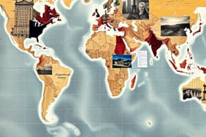
Earth's Land and Water
- Ability to label the seven continents and five oceans is crucial.
- All oceans are connected and form one global body of water.
- Earth’s five oceans:
- Pacific Ocean
- Atlantic Ocean
- Indian Ocean
- Southern Ocean
- Arctic Ocean
- Continents Defined:
- Asia: Largest continent.
- Australia: Smallest continent.
- Europe: Most densely populated continent.
- Antarctica: Recognized as a frozen desert.
- Equator's Role: Passes through the central portion of Africa.
- South America: Renowned for vast rainforests.
- Habitation: Human population currently resides in North America.
Studying That Suits You
Use AI to generate personalized quizzes and flashcards to suit your learning preferences.