Podcast
Questions and Answers
GIS tools rely solely on GPS data to function.
GIS tools rely solely on GPS data to function.
False (B)
Antarctica is the only continent without permanent human settlements.
Antarctica is the only continent without permanent human settlements.
True (A)
The Isthmus of Panama separates North America and South America within the Western Hemisphere.
The Isthmus of Panama separates North America and South America within the Western Hemisphere.
True (A)
The Mappa Mundi is an example of a modern map that shows contemporary world regions.
The Mappa Mundi is an example of a modern map that shows contemporary world regions.
Africa's regions are separated mostly by the Saharan Desert.
Africa's regions are separated mostly by the Saharan Desert.
Eurasia is a combined name for the continents of North and South America.
Eurasia is a combined name for the continents of North and South America.
Vernacular regions are based on legal boundaries and administrations.
Vernacular regions are based on legal boundaries and administrations.
Eratosthenes, who first used the term geography, is often acclaimed as the Father of Geography.
Eratosthenes, who first used the term geography, is often acclaimed as the Father of Geography.
Physical geography is solely concerned with the study of political boundaries.
Physical geography is solely concerned with the study of political boundaries.
Geography was officially named as a field of study around 1500 B.C.
Geography was officially named as a field of study around 1500 B.C.
Oceania is considered one of the five macrogeographic regions.
Oceania is considered one of the five macrogeographic regions.
Anthropogeography is another term for physical geography.
Anthropogeography is another term for physical geography.
GPS is a modern geographical tool that surpasses the accuracy of ancient clay tablet maps.
GPS is a modern geographical tool that surpasses the accuracy of ancient clay tablet maps.
Cartography, the ancient science of map-making, remains unchanged since the Babylonians' era.
Cartography, the ancient science of map-making, remains unchanged since the Babylonians' era.
Political boundaries are always aligned with physical features like mountains and rivers.
Political boundaries are always aligned with physical features like mountains and rivers.
Flashcards
What is geography?
What is geography?
The study of Earth and how it's been shaped by both physical and human forces.
What is physical geography?
What is physical geography?
The branch of geography that focuses on the natural events that have shaped Earth.
What is human geography?
What is human geography?
The branch of geography that focuses on how human culture and society have shaped the Earth.
What is a physical boundary?
What is a physical boundary?
Signup and view all the flashcards
What is a political boundary?
What is a political boundary?
Signup and view all the flashcards
What is GPS?
What is GPS?
Signup and view all the flashcards
What is a Mercator projection?
What is a Mercator projection?
Signup and view all the flashcards
What is a map?
What is a map?
Signup and view all the flashcards
What is a formal region?
What is a formal region?
Signup and view all the flashcards
What is a functional region?
What is a functional region?
Signup and view all the flashcards
What is a vernacular region?
What is a vernacular region?
Signup and view all the flashcards
What is a continent?
What is a continent?
Signup and view all the flashcards
What is a country?
What is a country?
Signup and view all the flashcards
Study Notes
Geography Overview
- Geography is the study of Earth and how it's shaped by physical and human forces.
- Eratosthenes, a Greek scholar, is considered the "Father of Geography" for using the term for the first time.
- Geography is divided into physical and human geography.
- Physical geography examines Earth's natural features and processes.
- Human geography (anthropogeography) focuses on how human cultures and societies impact the Earth.
- Geography's history dates back to 1500 B.C., but the term "geography" emerged around 200 B.C.
Geographic Regions
- Physical boundaries are natural features, and political boundaries are human-made.
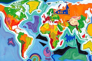
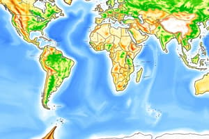
- There are five macrogeographic regions: Oceania, The Americas, Africa, Asia, and Europe. These regions encompass subregions, which can further be divided into states and territories.
Geographic Tools and Concepts
- Geography is both a natural and social science.
- Cartography (mapmaking) is an ancient practice, evolving from clay tablets to modern tools.
- The Mercator projection is a common map projection.
- GPS (Global Positioning System) uses satellites for precise location determination.
- GIS (Geographic Information System) uses GPS data and other information to create interactive maps.
Defining Geographic Regions
- Mapmakers (cartographers) use different types of regions when representing the world.
- Types of regions include administrative, formal, functional, and vernacular regions.
- The seven continents are North America, South America, Eurasia, Africa, Australia, Oceania, and Antarctica. (Eurasia is a combination of Europe and Asia).
- Only North and South America are in the Western Hemisphere. The remaining continents are in the Eastern Hemisphere.
- Antarctica has no permanent human civilizations.
- Africa's regions are often defined by the Sahara Desert.
Locating Places on a Map
- Locating places involves progressively narrowing down locations from continents to countries, states/counties, and ultimately specific places.
- Continents, countries, states/counties, and cities are fundamental geographic units.
Studying That Suits You
Use AI to generate personalized quizzes and flashcards to suit your learning preferences.