Podcast
Questions and Answers
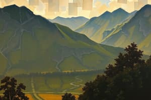
Geography is defined as the study of the Earth and the forces that have shaped it, including both human and physical influences.
Geography is defined as the study of the Earth and the forces that have shaped it, including both human and physical influences.
True (A)
Aristotle, a Greek scholar, is credited with being the first person to use the term geography and is known as the Father of Geography.
Aristotle, a Greek scholar, is credited with being the first person to use the term geography and is known as the Father of Geography.
False (B)
Physical geography is concerned with the study of how human cultures and societies have shaped the Earth over time.
Physical geography is concerned with the study of how human cultures and societies have shaped the Earth over time.
False (B)
Anthropogeography is another term used to describe the field of physical geography.
Anthropogeography is another term used to describe the field of physical geography.
The history of geography as a field of study can be traced back to approximately 1500 A.D.
The history of geography as a field of study can be traced back to approximately 1500 A.D.
Political boundaries are naturally occurring divisions of territory, such as rivers or mountain ranges.
Political boundaries are naturally occurring divisions of territory, such as rivers or mountain ranges.
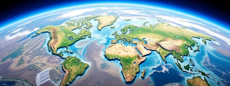
There are six recognized macrogeographic regions in the world, including Antarctica.
There are six recognized macrogeographic regions in the world, including Antarctica.
The Global Positioning System, commonly known as GPS, is a well-known tool used in the field of geography.
The Global Positioning System, commonly known as GPS, is a well-known tool used in the field of geography.
Global Positioning System (GPS) determines the locations of objects by measuring the frequencies of light signals emitted from satellites.
Global Positioning System (GPS) determines the locations of objects by measuring the frequencies of light signals emitted from satellites.
Geographic Information System (GIS) enhances Global Positioning System (GPS) data by incorporating maps and diverse information types.
Geographic Information System (GIS) enhances Global Positioning System (GPS) data by incorporating maps and diverse information types.
The Mappa Mundi, a map from the 13th century, illustrates how mapmakers' preconceived notions can impact their depiction of geographical and cultural landscapes.
The Mappa Mundi, a map from the 13th century, illustrates how mapmakers' preconceived notions can impact their depiction of geographical and cultural landscapes.
Modern geographers categorize territories into administrative, formal, structural, and vernacular regions.
Modern geographers categorize territories into administrative, formal, structural, and vernacular regions.
The seven major global regions consist of North America, South America, Eurasia, Africa, Asia, Oceania, and Antarctica.
The seven major global regions consist of North America, South America, Eurasia, Africa, Asia, Oceania, and Antarctica.
Both North America and South America are situated in the Eastern Hemisphere.
Both North America and South America are situated in the Eastern Hemisphere.
Antarctica is distinguished as the sole continent globally that lacks any permanent human civilizations.
Antarctica is distinguished as the sole continent globally that lacks any permanent human civilizations.
Flashcards
Geography
Geography
The study of the Earth, encompassing both its physical features and human impacts.
Physical Geography
Physical Geography
The branch of geography focusing on analyzing the natural forces that shaped the Earth, including mountains, rivers, and climates.
Human Geography
Human Geography
The branch of geography examining how human societies and cultures have altered the Earth, including cities, infrastructure, and population patterns.
Physical Boundary
Physical Boundary
Signup and view all the flashcards
Political Boundary
Political Boundary
Signup and view all the flashcards
Macrogeographic Region
Macrogeographic Region
Signup and view all the flashcards
Cartography (Map-making)
Cartography (Map-making)
Signup and view all the flashcards
GPS (Global Positioning System)
GPS (Global Positioning System)
Signup and view all the flashcards
What is GPS?
What is GPS?
Signup and view all the flashcards
What is GIS?
What is GIS?
Signup and view all the flashcards
Who is a cartographer?
Who is a cartographer?
Signup and view all the flashcards
What is a formal region?
What is a formal region?
Signup and view all the flashcards
What is a functional region?
What is a functional region?
Signup and view all the flashcards
What is a vernacular region?
What is a vernacular region?
Signup and view all the flashcards
What is a continent?
What is a continent?
Signup and view all the flashcards
Study Notes
Geography Overview
- Geography studies Earth's features, shaped by natural and human forces.
- Eratosthenes, a Greek scholar, is considered the "Father of Geography."
- Geography is divided into two main branches:
- Physical geography: Examines natural processes shaping Earth.
- Human geography (anthropogeography): Studies human cultures and societies' impact.
- Geography's history dates back to 1500 BCE; the term "geography" emerged around 200 BCE.
Geographic Boundaries
- Physical boundaries are natural features (mountains, rivers).
- Political boundaries are human-created lines demarcating territories.
- Macrogeographic regions are major world areas: Oceania, The Americas, Africa, Asia, Europe.
- Macroregions encompass subregions, states, and territories.
Geographic Tools and Methods
- Geography is both a natural and social science.
- Cartography (mapmaking) is a crucial tool.
- Mapping tools have evolved significantly through time, from clay tablets to digital technologies.
- Modern Geographic tools include GPS (Global Positioning System) & GIS (Geographic Information System).
- GPS locates objects via satellite signals.
- GIS integrates maps and data.
Regional Divisions
- Cartographers divide the world into regions.
- The Mappa Mundi (13th-century European map) is an example.
- Regions in modern geography include:
- Administrative/legal regions
- Formal regions (shared characteristics)
- Functional regions (shared dependencies)
- Vernacular regions (perceived)
- Continents are a major regional division.
- Eurasia (Europe and Asia), North and South America, Africa, Australia/Oceania, Antarctica.
- Continents are often separated by oceans.
- Continents' regions are sometimes broken down by natural elements or features like the Sahara desert.
Locating Places
- Continents are large landmasses; countries have governments, states/counties are political/administrative units within countries. Cities are populated areas.
- To find a location on a map:
- Identify the continent.
- Locate the country.
- Find the state/county.
- Identify the specific place.
Studying That Suits You
Use AI to generate personalized quizzes and flashcards to suit your learning preferences.