Podcast
Questions and Answers
What is the significance of the Indo-Gangetic Plain?
What is the significance of the Indo-Gangetic Plain?
- It is an arid region with little agricultural value.
- It is a mountain range with the highest peaks.
- It is a volcanic plateau rich in minerals.
- It comprises fertile alluvial plains that support agriculture. (correct)
Which of the following rivers is considered sacred and flows from the Himalayas to the Bay of Bengal?
Which of the following rivers is considered sacred and flows from the Himalayas to the Bay of Bengal?
- Indus
- Ganges (correct)
- Brahmaputra
- Yamuna
What type of climate is predominantly found in Northern India?
What type of climate is predominantly found in Northern India?
- Mediterranean Climate
- Humid Subtropical Climate (correct)
- Desert Climate
- Tropical Monsoon Climate
Which statement about the Deccan Plateau is true?
Which statement about the Deccan Plateau is true?
Which administrative divisions are recognized in India?
Which administrative divisions are recognized in India?
Which of the following is NOT a significant tributary or river with cultural importance in India?
Which of the following is NOT a significant tributary or river with cultural importance in India?
What major challenge does India face due to rapid urbanization?
What major challenge does India face due to rapid urbanization?
Which mountain range is known to contain the world’s highest peaks?
Which mountain range is known to contain the world’s highest peaks?
Flashcards are hidden until you start studying
Study Notes
Location and Size
- Situated in South Asia.
- 7th largest country by land area (3.287 million km²).
- Bordered by Pakistan, China, Nepal, Bhutan, Bangladesh, and Myanmar.
- Surrounded by the Indian Ocean, Arabian Sea, and Bay of Bengal.
Major Landforms
- Himalayas:
- Youngest mountain range.
- Contains the world’s highest peaks, including Mount Everest.
- Indo-Gangetic Plain:
- Fertile alluvial plains between the Himalayas and the Deccan Plateau.
- Deccan Plateau:
- Elevated region in southern India.
- Volcanic in origin, rich in minerals.
- Western and Eastern Ghats:
- Mountain ranges running parallel to the western and eastern coasts.
- Biodiversity hotspots.
Rivers
- Ganges:
- Sacred river, known as Ganga.
- Flows from the Himalayas to the Bay of Bengal.
- Indus:
- Originates in Tibet, flows through India and Pakistan.
- Brahmaputra:
- Flows from Tibet, through India into Bangladesh.
- Yamuna, Godavari, Krishna, and Kaveri:
- Significant tributaries and rivers with cultural importance.
Climate
- Tropical Monsoon Climate:
- Distinct wet (June-September) and dry seasons.
- Influenced by the southwest monsoon.
- Regions:
- Northern India: Humid subtropical.
- Western India: Arid and semi-arid.
- Southern India: Tropical wet.
Natural Resources
- Rich in minerals (coal, iron ore, bauxite).
- Significant agricultural producer (rice, wheat, cotton).
- Diverse ecosystems: forests, wetlands, deserts.
Biodiversity
- Home to unique flora and fauna.
- Protected Areas:
- National parks (e.g., Jim Corbett, Kaziranga).
- Wildlife sanctuaries (e.g., Periyar, Bandhavgarh).
Administrative Divisions
- 28 states and 8 Union territories.
- Major states: Maharashtra, Uttar Pradesh, Tamil Nadu, Andhra Pradesh, West Bengal.
Urbanization
- Rapid urban growth, with major cities like:
- Mumbai: Financial hub.
- Delhi: Political capital.
- Bengaluru: IT center.
- Challenges: Overpopulation, pollution, and infrastructure strain.
Cultural Geography
- Diverse cultural practices across regions.
- Languages: 22 officially recognized languages; Hindi and English widely used.
- Major religions: Hinduism, Islam, Christianity, Sikhism, Buddhism, Jainism.
Economic Geography
- Agriculture remains vital but declining in % contribution to GDP.
- Growing service and industrial sectors, particularly IT and manufacturing.
Location and Size
- India is situated in South Asia and is the 7th largest country by land area, covering 3.287 million km².
- It shares borders with Pakistan, China, Nepal, Bhutan, Bangladesh, and Myanmar.
- The Indian Ocean, Arabian Sea, and Bay of Bengal surround the country.
Major Landforms
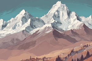
- The Himalayas, the youngest mountain range in the world, are home to the highest peaks including Mount Everest.
- The fertile Indo-Gangetic Plain stretches between the Himalayas and the Deccan Plateau.
- The Deccan Plateau is an elevated region in southern India, volcanic in origin and rich in minerals.
- The Western and Eastern Ghats are mountain ranges running parallel to the western and eastern coasts, known for their biodiversity.
Rivers
- The Ganges, also known as Ganga, is a sacred river flowing from the Himalayas to the Bay of Bengal.
- The Indus, originating in Tibet, flows through India and Pakistan.
- The Brahmaputra flows from Tibet through India and into Bangladesh.
- The Yamuna, Godavari, Krishna, and Kaveri are important tributaries and rivers with cultural significance.
Climate
- India experiences a tropical monsoon climate with distinct wet and dry seasons.
- The southwest monsoon influences the climate.
- Northern India has a humid subtropical climate, while Western India is arid and semi-arid.
- Southern India has a tropical wet climate.
Natural Resources
- India is rich in minerals, including coal, iron ore, and bauxite.
- It is a significant agricultural producer, cultivating rice, wheat, and cotton.
- India possesses diverse ecosystems, including forests, wetlands, and deserts.
Biodiversity
- India is known for its unique flora and fauna.
- Protected areas include national parks like Jim Corbett and Kaziranga, and wildlife sanctuaries like Periyar and Bandhavgarh.
Administrative Divisions
- India is divided into 28 states and 8 Union territories.
- Major states include Maharashtra, Uttar Pradesh, Tamil Nadu, Andhra Pradesh, and West Bengal.
Urbanization
- India experiences rapid urban growth, with major cities like Mumbai (financial hub), Delhi (political capital), and Bengaluru (IT center).
- Challenges include overpopulation, pollution, and infrastructure strain.
Cultural Geography
- Cultural practices vary across regions in India.
- The country has 22 officially recognized languages, with Hindi and English widely used.
- Major religions include Hinduism, Islam, Christianity, Sikhism, Buddhism, and Jainism.
Economic Geography
- Agriculture remains vital but its contribution to GDP is declining.
- Service and industrial sectors, particularly IT and manufacturing, are growing.
Studying That Suits You
Use AI to generate personalized quizzes and flashcards to suit your learning preferences.


