Podcast
Questions and Answers
Which river in Ladakh is not mentioned in the text?
Which river in Ladakh is not mentioned in the text?
- Drass
- Zanskar
- Ganges (correct)
- Sindhu
At what height is the Suru Valley situated approximately?
At what height is the Suru Valley situated approximately?
- 3,000 meters
- 4,000 meters
- 3,500 meters
- 3,350 meters (correct)
Which mountain range is NOT mentioned to be present in Ladakh?
Which mountain range is NOT mentioned to be present in Ladakh?
- Karakoram range
- Great Himalayan Range
- Appalachian Mountains (correct)
- Smaller mountain chains
What is the highest point in Ladakh as mentioned in the text?
What is the highest point in Ladakh as mentioned in the text?
Which valley is situated at the lowest average height among the three main regions of Ladakh?
Which valley is situated at the lowest average height among the three main regions of Ladakh?
Where do the major tributaries of the river Indus originate from?
Where do the major tributaries of the river Indus originate from?
Flashcards are hidden until you start studying
Study Notes
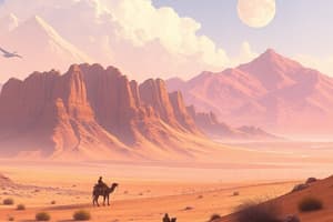
Ladakh is a region located in the northernmost part of India's state of Jammu & Kashmir. It covers an area of approximately 97,000 square kilometers (about three times larger than Switzerland) with its highest point being Rinchen Zangpo Peak at over 6,500 meters above sea level. This high altitude terrain largely determines the climate of Ladakh, which is characterized by extremely cold winters and short summers.
Geographically speaking, Ladakh can be divided into three main regions: Leh, Nubra Valley, and Suru Valley. Each of these valleys has unique features due to their varying elevations and climatic conditions. For instance, Leh is situated at an average height of around 3,500 meters while the Nubra Valley lies near 3,000 meters, both considerably lower than the surrounding mountains. The Suru Valley, however, is much higher, averaging around 3,350 meters above sea level. Despite this variation, all the major tributaries of the river Indus originate from the north of the Himalayas in Ladakh.
The topography of the area is mostly rugged, consisting of barren mountain ranges like the Karakoram range, the Great Himalayan Range, and other smaller chains. These mountain ranges have caused numerous rivers including Zanskar, Drass, Sindhu, Pungtseg and Yulzun, to flow down through deep gorges and ravines. In contrast, the central parts of Ladakh plateau feature wide plains along the valley floors where agriculture can thrive.
In terms of human habitation, most people live in small villages scattered across the plateaus between the mountainous ridges. Some towns like Leh act as hubs serving the local population, providing essential services such as hospitals, schools, shops, etc.. The landscape is dominated by settlements of different sizes and shapes bearing witness to the struggles faced by inhabitants who often must contend with harsh weather conditions.
Overall, the geographical makeup of Ladakh creates a distinct environment, shaped by its altitudes, landscapes, and climates. Its isolation and remoteness make it one of the world's last untouched wilderness areas, offering visitors a glimpse into a place outside modern civilization.
Studying That Suits You
Use AI to generate personalized quizzes and flashcards to suit your learning preferences.