Podcast
Questions and Answers
What was the primary function of the Barangay Walled City of Jolo during Spanish colonization?
What was the primary function of the Barangay Walled City of Jolo during Spanish colonization?
- A commercial trading hub for local goods
- A bastion of Spanish colonial power and administration (correct)
- The center of Spanish military operations
- A residential area for Spanish officials
Which significant event led to Jolo coming under American colonial administration?
Which significant event led to Jolo coming under American colonial administration?
- Japanese occupation during World War II
- The Philippine-American War (correct)
- Spanish colonial rule ending
- The Sulu Sultanate's decline
What key cultural group thrived in Jolo prior to Spanish colonization?
What key cultural group thrived in Jolo prior to Spanish colonization?
- The Spanish conquistadors
- The Tausug people (correct)
- The Chinese traders
- The Christian settlers
During which century did the Sulu Sultanate emerge as a powerful maritime state centered in Jolo?
During which century did the Sulu Sultanate emerge as a powerful maritime state centered in Jolo?
What were the consequences of the Japanese occupation of Jolo during World War II?
What were the consequences of the Japanese occupation of Jolo during World War II?
What is the principal economic activity of Jolo?
What is the principal economic activity of Jolo?
Which significant historical event occurred in 1876 in Jolo?
Which significant historical event occurred in 1876 in Jolo?
Which ethnic groups predominantly inhabit Jolo?
Which ethnic groups predominantly inhabit Jolo?
What geographical feature is prominent in Jolo's landscape?
What geographical feature is prominent in Jolo's landscape?
What is the approximate population of Jolo as of 2020?
What is the approximate population of Jolo as of 2020?
Flashcards are hidden until you start studying
Study Notes
Geography and Environment
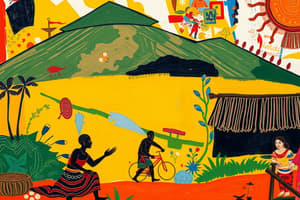
- Jolo is an island and town located in the Sulu Archipelago, Philippines, between the Sulu and Celebes seas.
- The island features lush tropical vegetation, short streams, and several extinct volcanoes, including Mount Tumatangas (2,664 feet/812 meters).
- Mount Dajo National Park serves as a 526-acre (213 hectares) game refuge and contributes to the island's biodiversity.
- Agricultural production includes rice, coconuts, cassava, and fruits, alongside a dominant fishing industry.
- Key population centers include Jolo town, Parang, Patikul, and Talipaw.
Jolo Town
- Jolo town, situated on the northwestern coast, functions as the capital of Sulu province and a significant trade port.
- The town has trade routes to Zamboanga City, Manila, Singapore, and Borneo, featuring a pier that accommodates large vessels and an airport.
- Initially settled before the 14th century, the town was the residence of the Sulu sultans.
- In 1876, the Spanish attempted to assert control by burning Jolo, leading to the construction of a fortified town.
- Jolo experienced devastation in 1974 due to conflicts between Muslims and government troops.
Economy
- Jolo has a unique agricultural economy; it is the only island in the region with significant agricultural production.
- Notable local marine resources include button shell, mother-of-pearl, coral, shark fins, sea cucumbers, turtle shells, turtle eggs, and sponges.
- Turtle fisheries are concentrated in the Turtle Islands, although marine resources remain largely untapped and underutilized.
- Rice is often imported, while significant mineral resources and developed forestry are absent.
Ethnic Groups
- The largest ethnic communities are the Tausug, primarily coastal dwellers, and the Samal, who are transitioning from a maritime to an inland lifestyle.
- Main settlements include Jolo, Siasi, Sitangkai, and Talipaw, with a population of approximately 1,000,108 as of 2020.
Historical Context
- Jolo has served as the capital of Sulu province in the Mindanao region, with a history spanning several centuries.
- The Sulu Sultanate emerged in the 13th century, establishing Jolo as a powerful maritime state controlling much of southern Philippines and parts of northern Borneo.
- Spanish colonial control over the Sulu Archipelago began in the late 19th century after conflicts with the Sulu Sultanate.
- Following the Philippine-American War, Jolo fell under American colonial administration, maintaining its importance in commerce and governance.
- The Japanese occupation during World War II caused extensive damage and loss of life in Jolo.
Spanish Colonial Influence
- The Sulu Archipelago was previously part of the Sultanate of Sulu, which had strong connections with other Malay and Islamic kingdoms.
- Spanish colonizers arrived in the late 16th century, aiming to expand their empire and impose Catholicism, with Jolo as a key target.
- The construction of the Barangay Walled City of Jolo involved local and Spanish resources, creating smaller administrative units, or barangays, within the city's structure.
- The walled city established Jolo as the center of Spanish power in the Sulu Archipelago.
Studying That Suits You
Use AI to generate personalized quizzes and flashcards to suit your learning preferences.