Podcast
Questions and Answers
What direction did Mehar travel from Hyderabad to Bhopal?
What direction did Mehar travel from Hyderabad to Bhopal?
- North (correct)
- South
- North-East
- East
What is the purpose of a scale on a map?
What is the purpose of a scale on a map?
- To identify the symbols on the map
- To show the direction of a place
- To measure distance between places (correct)
- To show the boundary of a state
What symbol would you use to show Delhi on a map of India?
What symbol would you use to show Delhi on a map of India?
- An area symbol (colour or pattern)
- A point (·) (correct)
- A track line (――――)
- A line (―――)
What is the purpose of a point symbol on a map?
What is the purpose of a point symbol on a map?
What would you use to show the railway line on a map?
What would you use to show the railway line on a map?
What is the term for the boundary of a state?
What is the term for the boundary of a state?
How would you show the area of Medak district on a map of Telangana?
How would you show the area of Medak district on a map of Telangana?
What is the term for the symbol used to show a physical object on a map?
What is the term for the symbol used to show a physical object on a map?
Which states are the Eastern Ghats spread across?
Which states are the Eastern Ghats spread across?
What is the purpose of a rain gauge?
What is the purpose of a rain gauge?
What is the unit of measurement for rainfall?
What is the unit of measurement for rainfall?
How do you find out if Nizamabad has more rain or Rangareddy?
How do you find out if Nizamabad has more rain or Rangareddy?
What is the first step in making a rain gauge?
What is the first step in making a rain gauge?
What is the purpose of making the top and bottom of the bottle have the same circumference?
What is the purpose of making the top and bottom of the bottle have the same circumference?
What is the region where Western and Eastern Ghats intersect?
What is the region where Western and Eastern Ghats intersect?
What is the purpose of marking the bottle with numbers?
What is the purpose of marking the bottle with numbers?
What is the primary factor that determines the distance between two contour lines?
What is the primary factor that determines the distance between two contour lines?
What is the significance of the height of the sea level in reading maps?
What is the significance of the height of the sea level in reading maps?
What is the reason for the constant change in the level of the sea?
What is the reason for the constant change in the level of the sea?
What can be inferred from the distance between contour lines on a map?
What can be inferred from the distance between contour lines on a map?
What is the range of heights between which the lowest land is located?
What is the range of heights between which the lowest land is located?
What is the purpose of contour lines on a map?
What is the purpose of contour lines on a map?
What is the relationship between the slope of the land and the distance between contour lines?
What is the relationship between the slope of the land and the distance between contour lines?
What is the significance of the sea level in measuring heights on a map?
What is the significance of the sea level in measuring heights on a map?
What is the usual form of a river at its source?
What is the usual form of a river at its source?
What happens to the river as it flows further?
What happens to the river as it flows further?
What are smaller rivers or streams that join a large river called?
What are smaller rivers or streams that join a large river called?
What happens to the river's flow as it gets bigger and broader?
What happens to the river's flow as it gets bigger and broader?
What is deposited on the river's bed and banks as it slows down?
What is deposited on the river's bed and banks as it slows down?
What is formed as a result of the river's deposition of silt and sand?
What is formed as a result of the river's deposition of silt and sand?
What happens to the river as it nears the sea?
What happens to the river as it nears the sea?
What is the origin of rivers like Krishna and Godavari?
What is the origin of rivers like Krishna and Godavari?
What is the main benefit of vegetation in preventing floods?
What is the main benefit of vegetation in preventing floods?
What is the result of sudden flooding in a river?
What is the result of sudden flooding in a river?
What is the purpose of the government's tree plantation program?
What is the purpose of the government's tree plantation program?
What happens when rainwater flows over soil without vegetation?
What happens when rainwater flows over soil without vegetation?
How does vegetation help to increase the amount of water in the soil?
How does vegetation help to increase the amount of water in the soil?
What is the target of the government's tree plantation program in each village?
What is the target of the government's tree plantation program in each village?
What is the result of soil erosion caused by rainwater?
What is the result of soil erosion caused by rainwater?
What is the role of tree roots in preventing soil erosion?
What is the role of tree roots in preventing soil erosion?
Flashcards are hidden until you start studying
Study Notes
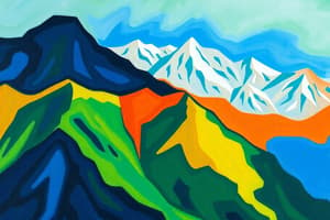
Eastern Ghats
- Spread across the states of Telangana, _____, _____,
Rain Gauge
- An instrument used to measure rainfall
- Measures the amount of rainfall for a unit area in centimeters
Direction
- Mehar traveled from Hyderabad to Bhopal in a _____ direction
- Ashok traveled from Lucknow to Chennai in a _____ direction
- Regina traveled from Mumbai to Bhubaneshwar in a _____ direction
- Weprechu traveled from Kohima to Jaipur in a _____ direction
Map Skills
- Use symbols to show physical objects on a map (point, line, area)
- Point symbol: used to show Delhi in the map of India
- Line symbol: used to show the river Manjeera
- Area symbol: used to show the area of Medak or Hyderabad district
Contour Lines
- Show the shape and height of the land
- The distance between two contour lines depends on the landscape
- Steep climb: contour lines are near each other
- Gentle slope: contour lines are far apart
Sea Level
- Mean Sea Level is the standard height
- Sea level is affected by high and low tides
- 0 meter height is the sea level or Mean Sea Level
River Formation
- Rivers start as thin streams in the mountains
- As the river flows, it gets bigger and broader
- Tributaries are smaller rivers or streams that join a large river
- River courses and river valleys are formed through erosion and deposition
River Flow
- As the river becomes bigger and broader, its flow gets slower
- The river deposits silt and sand on its bed and banks
- This causes the formation of plains
Flooding
- Floods are caused by a sudden increase in the volume of water reaching a river
- Vegetation helps to prevent flooding by allowing water to flow slowly into the river
- Vegetation also helps to increase the amount of water that goes into the soil
Soil Erosion
- Vegetation prevents soil erosion by reducing the amount of soil carried by rainwater
- Without vegetation, rainwater cuts and carries top soil, leading to soil erosion
Studying That Suits You
Use AI to generate personalized quizzes and flashcards to suit your learning preferences.