Podcast
Questions and Answers
What is the name given to the region where the rivers and streams re-emerge after disappearing in the bhabar belt?
What is the name given to the region where the rivers and streams re-emerge after disappearing in the bhabar belt?
- Doab
- Indus Plains
- Shiwaliks
- Terai (correct)
Which of the following is not one of the five rivers that originate in the Himalaya and form the Punjab Plains?
Which of the following is not one of the five rivers that originate in the Himalaya and form the Punjab Plains?
- Chenab
- Ravi
- Narmada (correct)
- Jhelum
What does the term 'doab' mean?
What does the term 'doab' mean?
- Five waters
- Marshy region
- Narrow belt
- Two waters (correct)
Which of the following rivers does not flow through the Ganga Plain?
Which of the following rivers does not flow through the Ganga Plain?
Which of the following is not a feature of the Northern Plains described in the text?
Which of the following is not a feature of the Northern Plains described in the text?
Which of the following is NOT a component of the Purvachal or Eastern hills and mountains?
Which of the following is NOT a component of the Purvachal or Eastern hills and mountains?
What is the primary cause for the formation of the Northern Plains?
What is the primary cause for the formation of the Northern Plains?
Which of the following statements about the Northern Plains is NOT true?
Which of the following statements about the Northern Plains is NOT true?
What is the approximate length of the Northern Plains?
What is the approximate length of the Northern Plains?
Which of the following is the largest inhabited riverine island in the world?
Which of the following is the largest inhabited riverine island in the world?
Which rivers drain the region described in the text?
Which rivers drain the region described in the text?
Which of the following describes the Central Highlands correctly based on the text?
Which of the following describes the Central Highlands correctly based on the text?
What lies south of the Narmada River according to the text?
What lies south of the Narmada River according to the text?
Which hill ranges form the eastern extensions of the Deccan Plateau?
Which hill ranges form the eastern extensions of the Deccan Plateau?
Which ranges mark the western and eastern edges of the Deccan Plateau respectively as per the text?
Which ranges mark the western and eastern edges of the Deccan Plateau respectively as per the text?
Which of the following statements is true regarding the Northern Plains region of India?
Which of the following statements is true regarding the Northern Plains region of India?
Which of the following statements accurately describes the Peninsular Plateau region?
Which of the following statements accurately describes the Peninsular Plateau region?
What is the name given to the region of the Peninsular Plateau lying to the north of the Narmada river?
What is the name given to the region of the Peninsular Plateau lying to the north of the Narmada river?
Which of the following statements accurately describes the physical features of the Indian Desert region?
Which of the following statements accurately describes the physical features of the Indian Desert region?
Which of the following mountain ranges is located in the Peninsular Plateau region?
Which of the following mountain ranges is located in the Peninsular Plateau region?
Which type of coral reef is characterized by a circular or horseshoe-shaped structure?
Which type of coral reef is characterized by a circular or horseshoe-shaped structure?
Which region of India is described as a 'storehouse of minerals' in the text?
Which region of India is described as a 'storehouse of minerals' in the text?
What is the main function of the Himalayan mountains according to the text?
What is the main function of the Himalayan mountains according to the text?
Which of the following is not a type of coral reef mentioned in the text?
Which of the following is not a type of coral reef mentioned in the text?
Which region of India is described as the 'granaries of the country' in the text?
Which region of India is described as the 'granaries of the country' in the text?
What is the unique feature of Barren Island mentioned in the text?
What is the unique feature of Barren Island mentioned in the text?
Which region of India is described as providing 'sites for fishing and port activities' in the text?
Which region of India is described as providing 'sites for fishing and port activities' in the text?
Which of the following is not a characteristic of the coral reefs mentioned in the text?
Which of the following is not a characteristic of the coral reefs mentioned in the text?
Which region of India 'complements the other and makes the country richer in its natural resources'?
Which region of India 'complements the other and makes the country richer in its natural resources'?
Which of the following is not mentioned as a major source of water and forest wealth in the text?
Which of the following is not mentioned as a major source of water and forest wealth in the text?
Which of the following statements about the Himalayas is correct?
Which of the following statements about the Himalayas is correct?
Which of the following statements about the Peninsular Plateau is correct?
Which of the following statements about the Peninsular Plateau is correct?
Which of the following physical features is not found in India?
Which of the following physical features is not found in India?
Which of the following regions is formed by alluvial deposits?
Which of the following regions is formed by alluvial deposits?
Which of the following statements about the Indian Desert is correct?
Which of the following statements about the Indian Desert is correct?
Which of the following statements accurately describes the Western Coastal Plains of India?
Which of the following statements accurately describes the Western Coastal Plains of India?
Which of the following statements accurately describes the Indian Desert?
Which of the following statements accurately describes the Indian Desert?
Which of the following statements accurately describes the Eastern Coastal Plains of India?
Which of the following statements accurately describes the Eastern Coastal Plains of India?
Which of the following statements is true about the Peninsular Plateau of India?
Which of the following statements is true about the Peninsular Plateau of India?
Which of the following is NOT a feature of the Eastern Coastal Plains of India?
Which of the following is NOT a feature of the Eastern Coastal Plains of India?
Flashcards are hidden until you start studying
Study Notes
The Northern Plain
- The Northern Plain is divided into three sections: the Punjab Plains, the Ganga Plain, and the Brahmaputra Plain.
- The Punjab Plains are formed by the Indus and its tributaries, and the larger part of this plain lies in Pakistan.
- The Indus and its tributaries originate in the Himalayas.
- The Ganga Plain extends between the Ghaggar and Teesta rivers, and is spread over North India in Haryana, Delhi, U.P., Bihar, and part of Jharkhand and West Bengal.
- The Brahmaputra Plain lies in the East, particularly in Assam.
Relief Features of the Northern Plain
- The Northern Plain is not entirely flat, but has diverse relief features.
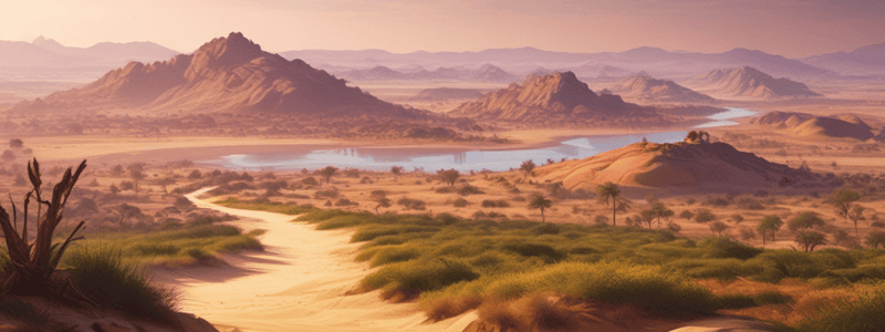
- The rivers, after descending from the mountains, deposit pebbles in a narrow belt of about 8 to 16 km in width, known as the bhabar.
- All the streams disappear in this bhabar belt.
- South of this belt, the streams and rivers re-emerge and create a wet, swampy, and marshy region known as terai.
- The terai region is a thickly forested area full of wildlife.
The Purvachal or Eastern Hills and Mountains
- The Purvachal comprises the Patkai hills, the Naga hills, the Manipur hills, and the Mizo hills.
- These hills are mostly composed of strong sandstones, which are sedimentary rocks.
- They are covered with dense forests and run as parallel ranges and valleys.
The Formation of the Northern Plain
- The Northern Plain has been formed by the interplay of three major river systems, namely the Indus, the Ganga, and the Brahmaputra, along with their tributaries.
- The plain is formed of alluvial soil.
- The deposition of alluvium in a vast basin lying at the foothills of the Himalaya over millions of years formed this fertile plain.
- The plain spreads over an area of 7 lakh sq.km and is a densely populated physiographic division.
The Rivers and their Features
- The rivers coming from the northern mountains are involved in depositional work.
- In the lower course, due to the gentle slope, the velocity of the river decreases, resulting in the formation of riverine islands.
- Majuli, in the Brahmaputra river, is the largest inhabited riverine island in the world.
- The rivers in their lower course split into numerous channels due to the deposition of silt.
The Central Highlands
- The Central Highlands are wider in the west but narrower in the east.
- The eastward extensions of this plateau are locally known as the Bundelkhand and Baghelkhand.
- The Chotanagpur plateau marks the further eastward extension, drained by the Damodar river.
The Deccan Plateau
- The Deccan Plateau is a triangular landmass that lies to the south of the river Narmada.
- The Satpura range flanks its broad base in the north, while the Mahadev, the Kaimur hills, and the Maikal range form its eastern extensions.
- The Deccan Plateau is higher in the west and slopes gently eastwards.
- An extension of the Plateau is also visible in the northeast, locally known as the Meghalaya, Karbi-Anglong Plateau, and North Cachar Hills.
The Peninsular Plateau
- The Peninsular plateau is a tableland composed of old crystalline, igneous, and metamorphic rocks.
- It was formed due to the breaking and drifting of the Gondwana land, making it a part of the oldest landmass.
- The plateau has broad and shallow valleys and rounded hills.
- It consists of two broad divisions, namely the Central Highlands and the Deccan Plateau.
The Coastal Plains
- The Peninsular plateau is flanked by a stretch of narrow coastal strips, running along the Arabian Sea on the west and the Bay of Bengal on the east.
- The western coast is a narrow plain, consisting of three sections: the Konkan, the Kannad Plain, and the Malabar coast.
- The Indian Desert lies towards the western margins of the Aravali Hills.
- It is an undulating sandy plain covered with sand dunes.
- This region receives very low rainfall below 150 mm per year and has an arid climate with low vegetation cover.
Other Features
- Luni is the only large river in the Indian Desert.
- The plains along the Bay of Bengal are wide and level, with large rivers, such as the Mahanadi, the Godavari, the Krishna, and the Kaveri, having formed extensive deltas on this coast.
- Lake Chilika is an important feature along the eastern coast.
- The Chilika Lake is the largest saltwater lake in India.
Studying That Suits You
Use AI to generate personalized quizzes and flashcards to suit your learning preferences.


