Podcast
Questions and Answers
What is the highest altitude noted in the region mentioned?
What is the highest altitude noted in the region mentioned?
- 4200 m a.m.s.l. (correct)
- 2500 m a.m.s.l.
- 3500 m a.m.s.l.
- 3000 m a.m.s.l.
Which of the following highlands is NOT mentioned as a high point in the region?
Which of the following highlands is NOT mentioned as a high point in the region?
- Argentinian Highlands (correct)
- Gamo-Konso Highlands
- Dawuro-Konta Highlands
- Maji-Korma Highlands
What geological feature is primarily associated with the Ethiopian Rift Valley System?
What geological feature is primarily associated with the Ethiopian Rift Valley System?
- Mountain ranges
- Fractures in the earth's crust (correct)
- Sedimentary basins
- Coastal plains
How long does the Ethiopian Rift Valley System extend within Ethiopia and Eritrea?
How long does the Ethiopian Rift Valley System extend within Ethiopia and Eritrea?
What geographical feature is indicated to separate the southeastern highlands from the northwestern highlands?
What geographical feature is indicated to separate the southeastern highlands from the northwestern highlands?
Which lowland is described as the wettest compared to others in its division?
Which lowland is described as the wettest compared to others in its division?
Which of the following correctly identifies a major part of the Ethiopian Rift Valley System?
Which of the following correctly identifies a major part of the Ethiopian Rift Valley System?
Communities in the western lowlands primarily engage in which type of lifestyle due to climatic conditions?
Communities in the western lowlands primarily engage in which type of lifestyle due to climatic conditions?
Which feature characterizes the Afar Triangle in the Ethiopian Rift Valley?
Which feature characterizes the Afar Triangle in the Ethiopian Rift Valley?
Which highland is specifically listed as part of the southeastern highlands?
Which highland is specifically listed as part of the southeastern highlands?
What is the altitude range of the Afar Triangle?
What is the altitude range of the Afar Triangle?
What is one characteristic feature of the western lowlands?
What is one characteristic feature of the western lowlands?
Which lake is located in the Afar Triangle region?
Which lake is located in the Afar Triangle region?
Which of the following plants is NOT associated with production in the highlands?
Which of the following plants is NOT associated with production in the highlands?
What geological activity is evident in the Ethiopian Rift Valley System?
What geological activity is evident in the Ethiopian Rift Valley System?
What percentage of Ethiopia's total area does the Ethiopian Rift Valley cover?
What percentage of Ethiopia's total area does the Ethiopian Rift Valley cover?
What are the major components of the floor of the Afar Triangle?
What are the major components of the floor of the Afar Triangle?
Which subdivision of the Ethiopian Rift is described as the wettest, most densely vegetated, and densely populated?
Which subdivision of the Ethiopian Rift is described as the wettest, most densely vegetated, and densely populated?
What distinctive feature characterizes the Chew-Bahir Rift region?
What distinctive feature characterizes the Chew-Bahir Rift region?
What type of agriculture is primarily practiced in the Main Ethiopian Rift?
What type of agriculture is primarily practiced in the Main Ethiopian Rift?
What separates the Chew-Bahir Rift from the Lakes’ Region to the north?
What separates the Chew-Bahir Rift from the Lakes’ Region to the north?
Which geographic feature characterizes the central part of the Ethiopian Rift system?
Which geographic feature characterizes the central part of the Ethiopian Rift system?
Which of the following statements is true about the Afar Triangle?
Which of the following statements is true about the Afar Triangle?
How does Ethiopia rank in terms of size compared to other African countries?
How does Ethiopia rank in terms of size compared to other African countries?
Which of the following best describes the primary difference between weather and climate?
Which of the following best describes the primary difference between weather and climate?
Which of the following elements is NOT typically associated with weather?
Which of the following elements is NOT typically associated with weather?
What factors can be considered controls of weather and climate?
What factors can be considered controls of weather and climate?
In studying the climate of Ethiopia, which of the following would NOT be classified as a climatic region?
In studying the climate of Ethiopia, which of the following would NOT be classified as a climatic region?
Which of the following statements is true regarding the spatial variations of climate?
Which of the following statements is true regarding the spatial variations of climate?
What is the significance of distinguishing between elements of weather and their controls?
What is the significance of distinguishing between elements of weather and their controls?
Which of the following best describes the temporal variations of climate?
Which of the following best describes the temporal variations of climate?
What aspect is crucial in defining climate as opposed to weather?
What aspect is crucial in defining climate as opposed to weather?
What is primarily responsible for the seasonal variation of temperature in Ethiopia?
What is primarily responsible for the seasonal variation of temperature in Ethiopia?
During which season does Ethiopia experience the highest diurnal range of temperature?
During which season does Ethiopia experience the highest diurnal range of temperature?
What factor causes the spatial variation of rainfall in Ethiopia?
What factor causes the spatial variation of rainfall in Ethiopia?
Which area in Ethiopia records the highest temperatures, above 45°C?
Which area in Ethiopia records the highest temperatures, above 45°C?
What is the role of the Inter-Tropical Convergence Zone (ITCZ) in Ethiopia's climate?
What is the role of the Inter-Tropical Convergence Zone (ITCZ) in Ethiopia's climate?
What defines the Bega season in Ethiopia?
What defines the Bega season in Ethiopia?
Which of the following statements about temperature variation in Ethiopia during March to June is correct?
Which of the following statements about temperature variation in Ethiopia during March to June is correct?
During what time of the year is the ITCZ located at the Tropic of Cancer?
During what time of the year is the ITCZ located at the Tropic of Cancer?
What is a primary characteristic of the Kolla zone climate?
What is a primary characteristic of the Kolla zone climate?
Which of the following factors contribute to soil erosion in the Dega zone?
Which of the following factors contribute to soil erosion in the Dega zone?
What distinguishes the Woina-Dega zone from the Dega zone?
What distinguishes the Woina-Dega zone from the Dega zone?
In which zone is the average annual rainfall typically below 400 mm?
In which zone is the average annual rainfall typically below 400 mm?
What is a significant challenge for agriculture in the Bereha zone?
What is a significant challenge for agriculture in the Bereha zone?
Which of the following is a common feature of the humid areas within the Dega zone?
Which of the following is a common feature of the humid areas within the Dega zone?
What defines the rainfall pattern in Kolla areas?
What defines the rainfall pattern in Kolla areas?
Which of the following is NOT a characteristic of the Woina-Dega zone?
Which of the following is NOT a characteristic of the Woina-Dega zone?
Flashcards
Western Highlands
Western Highlands
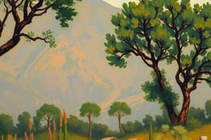
The Western Highlands are a significant geographic region in Ethiopia, characterized by their relatively low elevation compared to other highland regions, with only a few areas exceeding 2,500 meters.
Sub-Regions of the Western Highlands
Sub-Regions of the Western Highlands
The Western Highlands are home to various sub-regions with unique features and economic activities. These sub-regions include the Gamo-Konso Highlands, Maji-Korma Highlands, Dawuro-Konta Highlands, Tullu Wallel, and Benishangul mountain.
Economic Activities in Western Highlands
Economic Activities in Western Highlands
The Western Highlands are a significant agricultural producer, contributing to coffee, spices, timber, rubber, cattle, honey, and maize. The region also boasts a high percentage of forest cover.
Western Lowlands
Western Lowlands
Signup and view all the flashcards
Climate of Western Lowlands
Climate of Western Lowlands
Signup and view all the flashcards
Sub-Regions of the Western Lowlands
Sub-Regions of the Western Lowlands
Signup and view all the flashcards
Livelihood in Western Lowlands
Livelihood in Western Lowlands
Signup and view all the flashcards
Towns in Western Lowlands
Towns in Western Lowlands
Signup and view all the flashcards
What is the Great East African Rift System?
What is the Great East African Rift System?
Signup and view all the flashcards
What is the Tertiary Period?
What is the Tertiary Period?
Signup and view all the flashcards
What is Epeirogenic activity?
What is Epeirogenic activity?
Signup and view all the flashcards
What is the Afar Triangle?
What is the Afar Triangle?
Signup and view all the flashcards
What is a Graben?
What is a Graben?
Signup and view all the flashcards
What are Cinder Cones?
What are Cinder Cones?
Signup and view all the flashcards
What are Faulted Depressions?
What are Faulted Depressions?
Signup and view all the flashcards
What is the Main Ethiopian Rift or the Lakes Region?
What is the Main Ethiopian Rift or the Lakes Region?
Signup and view all the flashcards
What is a rift valley?
What is a rift valley?
Signup and view all the flashcards
Describe the Ethiopian Rift Valley.
Describe the Ethiopian Rift Valley.
Signup and view all the flashcards
What are the key features of the Afar Triangle?
What are the key features of the Afar Triangle?
Signup and view all the flashcards
Define a graben.
Define a graben.
Signup and view all the flashcards
What is the Main Ethiopian Rift?
What is the Main Ethiopian Rift?
Signup and view all the flashcards
Describe the Chew-Bahir Rift.
Describe the Chew-Bahir Rift.
Signup and view all the flashcards
What are lacustrine and fluvial deposits?
What are lacustrine and fluvial deposits?
Signup and view all the flashcards
What are the Amaro Mountains?
What are the Amaro Mountains?
Signup and view all the flashcards
Weather
Weather
Signup and view all the flashcards
Climate
Climate
Signup and view all the flashcards
Climate Controls
Climate Controls
Signup and view all the flashcards
Elements of Weather & Climate
Elements of Weather & Climate
Signup and view all the flashcards
Spatial Variation of Climate
Spatial Variation of Climate
Signup and view all the flashcards
Temporal Variation of Climate
Temporal Variation of Climate
Signup and view all the flashcards
Average Climate
Average Climate
Signup and view all the flashcards
Climate Fluctuation
Climate Fluctuation
Signup and view all the flashcards
What is the Woina-Dega zone?
What is the Woina-Dega zone?
Signup and view all the flashcards
What is the Woina-Dega zone known for?
What is the Woina-Dega zone known for?
Signup and view all the flashcards
What is the Kolla zone climate like?
What is the Kolla zone climate like?
Signup and view all the flashcards
What is the Bereha zone climate like?
What is the Bereha zone climate like?
Signup and view all the flashcards
Why does the term 'Woina Dega' come after 'Dega'?
Why does the term 'Woina Dega' come after 'Dega'?
Signup and view all the flashcards
What makes the Woina-Dega zone important for Ethiopia's agriculture?
What makes the Woina-Dega zone important for Ethiopia's agriculture?
Signup and view all the flashcards
What is the rainfall pattern like in the Kolla zone?
What is the rainfall pattern like in the Kolla zone?
Signup and view all the flashcards
Can crops be grown in the Bereha zone?
Can crops be grown in the Bereha zone?
Signup and view all the flashcards
Seasonal Temperature Variation
Seasonal Temperature Variation
Signup and view all the flashcards
Diurnal Temperature Range
Diurnal Temperature Range
Signup and view all the flashcards
Spatial Variation of Rainfall
Spatial Variation of Rainfall
Signup and view all the flashcards
Temporal Variation of Rainfall
Temporal Variation of Rainfall
Signup and view all the flashcards
Inter-Tropical Convergence Zone (ITCZ)
Inter-Tropical Convergence Zone (ITCZ)
Signup and view all the flashcards
Bega Season
Bega Season
Signup and view all the flashcards
Danakil Depression
Danakil Depression
Signup and view all the flashcards
Ethiopia during Bega Season
Ethiopia during Bega Season
Signup and view all the flashcards
Study Notes
Textbook Information
- Title: Geography
- Student Textbook
- Grade 9
- Authors: Muluemebet Worku (Ph.D) and Kidanemariam Paulos (Ph.D)
- Editors: Sintayehu Teka (M.Sc.), Kassie Molla (M.A.), Hirut Woldemichael (M.A.)
- Illustrator: Agenchw Nega (M.Sc.)
- Designer: Geda Hoka (M.A.)
- Evaluators: Not listed
- Publisher: Federal Democratic Republic of Ethiopia, Ministry of Education
- Publication Year: 2022
Textbook Care Instructions
- Cover the book with protective materials.
- Keep the book in a clean dry place.
- Keep hands clean while using the book.
- Do not write on cover or inside pages.
- Use paper or cardboard as a bookmark.
- Do not tear or cut out pages.
- Repair any torn pages.
- Pack the book carefully in a school bag.
- Handle the book with care.
- When using a new book, lay it flat.
- Open a few pages at a time.
- Press lightly along the bound edge while turning pages.
Table of Contents
- Unit One: Geological History and Topography of Ethiopia
- Geographical meaning, scope and branches
- Location, size, and shape of Ethiopia
- Geological history of Ethiopia
- Unit Two: Climate of Ethiopia
- Meaning of weather and climate
- Elements of weather and climate
- Controls of weather and climate in Ethiopia
- Climatic regions and seasonal variation in Ethiopia
- Measurements of weather and climate
- Unit Three: Natural Resource Base of Ethiopia
- Meaning of natural resources
- Drainage systems of Ethiopia
- Water resources of Ethiopia
- Major soil types of Ethiopia
- Major mineral resources and their distribution
- Biotic resources of Ethiopia
- Unit Four: Population and Demographic Characteristics of Ethiopia
- Concept of human population
- Trends of population growth in Ethiopia
- Population composition
- Population distribution
- Urban and rural settlement patterns
- Health and disease in Ethiopia
- Impacts of population growth on sustainable development
- Language and religious diversity in Ethiopia
- Unit Five: Major Economic and Cultural Activities in Ethiopia
- Major economic activities in Ethiopia
- Contribution of subsistence farming and cash crops to the Ethiopian economy
- Problems of agriculture in Ethiopia
- Trade and transportation in Ethiopia
- Cultural landscapes and tourism
- Unit Six: Human-Natural Environment Interactions in Ethiopia
- Human-environment relationship
- Optimum population and resource use
- Overpopulation
- Underpopulation
- Impacts of rapid population growth
- Unit Seven: Contemporary Geographic Issues and Public Concerns in Ethiopia
- Natural Resource Degradation
- Soil
- Water
- The Ethiopian "Green Legacy" Movement
- Unit Eight: Geography Inquiry Skills and Techniques
- Map and its basic components
- Scale, scale conversion and measurements on maps
- Position on maps
- Map sketching
- Interpreting maps and graphs
Studying That Suits You
Use AI to generate personalized quizzes and flashcards to suit your learning preferences.