Podcast
Questions and Answers
What is the primary difference between political maps and physical maps?
What is the primary difference between political maps and physical maps?
- Political maps demonstrate tourist attractions, while physical maps assist in navigation and route optimization.
- Political maps illustrate property ownership, while physical maps highlight administrative divisions.
- Political maps display country borders and capitals, while physical maps show natural features like mountains and rivers. (correct)
- Political maps focus on vegetation and economic activity, while physical maps emphasize population density and climate zones.
Which type of map would be most useful for urban planning and infrastructure development?
Which type of map would be most useful for urban planning and infrastructure development?
- Thematic maps (correct)
- Political maps
- Cadastral maps
- Physical maps
In which scenario would cadastral maps be the most beneficial?
In which scenario would cadastral maps be the most beneficial?
- Land value taxation and property ownership records (correct)
- Education and learning about cultural differences
- Assessing disaster risks and emergency preparedness strategies
- Scientific studies and natural resource management
What is a key advantage of digital platforms and GIS software in the cartographic industry?
What is a key advantage of digital platforms and GIS software in the cartographic industry?
How have technology advancements impacted the role of geography maps in human understanding?
How have technology advancements impacted the role of geography maps in human understanding?
What is the purpose of a scale bar in a map?
What is the purpose of a scale bar in a map?
Which cartographic element helps in accurate positioning on a map?
Which cartographic element helps in accurate positioning on a map?
What do topographic maps primarily focus on representing?
What do topographic maps primarily focus on representing?
Which cartographic element provides information about specific symbols and colors used on a map?
Which cartographic element provides information about specific symbols and colors used on a map?
What purpose do grid systems serve in geographical mapping?
What purpose do grid systems serve in geographical mapping?
Study Notes
Geography Maps: Unraveling Our World's Spatial Complexity
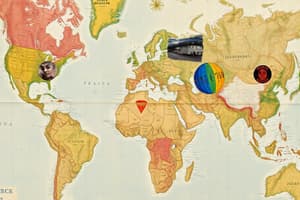
Geography maps are visual tools designed to help us understand our planet's physical features, landforms, natural resources, human settlement patterns, political boundaries, and more. These dynamic representations have been guiding explorers, travelers, scientists, businesspeople, and everyday individuals alike throughout history. Here we delve into several aspects of geographical mapping to reveal their diverse applications.
Cartographic Elements
A map is composed of various cartographic elements:
- Base lines: Straight lines used to establish orientation within the map.
- Scale bar: An illustration depicting how much distance is represented by units of length.
- Grid systems: A structured arrangement divided with longitude and latitude to allow accurate positioning.
- Map symbols: Icons and text representing places, objects, and characteristics.
- Legends: Key providing information regarding specific symbols and colors used on the map.
Types of Maps
There exist numerous types of maps based on their contents—each fulfilling different needs and serving unique purposes:
- Topographic maps display elevations using contours and shading, enabling us to study relief, drainage, vegetation, etc.
- Political maps contain country borders, capitals, and sometimes administrative divisions
- Physical maps demonstrate continents, oceans, mountains, deserts, rivers, lakes, and other natural features
- Thematic maps emphasize particular phenomena like climate zones, population density, vegetation, economic activity, meteorological data, soil types, transportation networks, and others
- Cadastral maps show property ownership, including legal descriptions of real estate parcels and other land records
- Tourist maps assist people in finding accommodations, attractions, restaurants, shopping centers, and other points of interest
Applications & Advantages
Due to their versatile nature, geography maps serve multiple roles across disciplines and daily life:
- Scientific studies and natural resource management
- Land value taxation, urban planning, and infrastructure development
- Environmental conservation efforts, such as habitat restoration initiatives and wildlife migration corridors preservation
- Assessments of potential disaster risks and emergency preparedness strategies
- Navigation, route optimization, and logistics operations
- Marketing and demographics analysis in businesses
- Education and learning about the world's cultural differences and environmental variability
- Travel planning and recreational activities
As technology progresses, digital platforms, GIS software, and online mapping services have revolutionized the cartographic industry, presenting new opportunities for innovation and creativity while streamlining communication and collaboration among professionals worldwide. Regardless of where you stand on the technological spectrum, there is hardly any doubt that geography maps will continue playing essential roles in human understanding of this vast, interconnected globe.
Studying That Suits You
Use AI to generate personalized quizzes and flashcards to suit your learning preferences.
Description
This quiz delves into the significance and elements of geography maps, exploring their diverse applications in scientific studies, urban planning, environmental conservation, disaster risk assessments, navigation, marketing, education, and more. Learn about different types of maps and their unique features while understanding the advantages they offer in various fields.