Podcast
Download our mobile app to listen on the go
Get App
Questions and Answers
What are the Rocky Mountains?
What are the Rocky Mountains?
- A type of desert
- A mountain range (correct)
- An ocean
- A river
What is the Tropic of Cancer?
What is the Tropic of Cancer?
- An ocean
- A circle of latitude (correct)
- A desert
- A mountain
What is the Pacific Ocean?
What is the Pacific Ocean?
- A desert
- A river
- A mountain range
- An ocean (correct)
What is the Equator?
What is the Equator?
Signup and view all the answers
What are the Andes Mountains?
What are the Andes Mountains?
Signup and view all the answers
What is the Tropic of Capricorn?
What is the Tropic of Capricorn?
Signup and view all the answers
What is the Atacama Desert?
What is the Atacama Desert?
Signup and view all the answers
What is the Antarctic Circle?
What is the Antarctic Circle?
Signup and view all the answers
Flashcards are hidden until you start studying
Study Notes
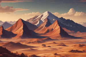
Rocky Mountains
- Major mountain range in North America, stretching over 3,000 miles from Canada to New Mexico.
- Renowned for its stunning landscapes, biodiversity, and recreational opportunities like hiking and skiing.
Tropic of Cancer
- Latitude line at approximately 23.5° N of the Equator.
- Marks the northernmost point where the sun can be directly overhead during the summer solstice.
Pacific Ocean
- Largest and deepest ocean, covering more than 63 million square miles.
- Bordered by Asia and Australia to the west, and the Americas to the east.
Equator
- Imaginary line around the Earth's circumference, equidistant from the poles at 0° latitude.
- Divides the Earth into the Northern and Southern Hemispheres; characterized by a tropical climate.
Andes Mountains
- Longest continental mountain range in the world, stretching over 4,300 miles along the western edge of South America.
- Home to diverse ecosystems and significant archaeological sites, including Machu Picchu.
Tropic of Capricorn
- Latitude line at approximately 23.5° S of the Equator.
- Defines the southernmost point where the sun is directly overhead during the winter solstice.
Atacama Desert
- Located in northern Chile, recognized as one of the driest places on Earth.
- Features unique landscapes, including salt flats, volcanos, and diverse geology.
Antarctic Circle
- Latitude line at approximately 66.5° S of the Equator.
- Marks the area where, during the summer solstice, there is a 24-hour period of daylight, and during the winter solstice, a 24-hour period of darkness.
Studying That Suits You
Use AI to generate personalized quizzes and flashcards to suit your learning preferences.