Podcast
Questions and Answers
What type of map would you use to see population density information?
What type of map would you use to see population density information?
- Thematic Map (correct)
- Political Map
- Physical Map
- Climate Map
An isthmus is a large land area that receives very little rainfall.
An isthmus is a large land area that receives very little rainfall.
False (B)
What are the four cardinal directions?
What are the four cardinal directions?
North, South, East, West
The _______ is the 0 degree line of latitude that divides the Earth into the Northern and Southern Hemispheres.
The _______ is the 0 degree line of latitude that divides the Earth into the Northern and Southern Hemispheres.
Match the geographical features with their definitions:
Match the geographical features with their definitions:
Which of the following describes ocean depth?
Which of the following describes ocean depth?
Latitude lines measure distance from North to South of the Equator.
Latitude lines measure distance from North to South of the Equator.
What is a thematic map?
What is a thematic map?
Which of the following lines of latitude is located approximately 23.5° south of the equator?
Which of the following lines of latitude is located approximately 23.5° south of the equator?
The longest river in the world is the Mississippi River.
The longest river in the world is the Mississippi River.
What is the name of the largest desert in the world?
What is the name of the largest desert in the world?
The highest mountain in the world is ________.
The highest mountain in the world is ________.
Match the following geographical features with their corresponding descriptions:
Match the following geographical features with their corresponding descriptions:
Flashcards are hidden until you start studying
Study Notes
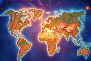
Geography Overview
- Geography encompasses the study of the physical world, human inhabitants, their interactions, and underlying patterns and systems.
- Maps are key tools in geography, utilizing legends to explain symbols and a scale bar for measuring distance.
Map Types
- Thematic Map: Displays specific topics or conditions in various locations.
- Physical Map: Illustrates land elevations and ocean depths using distinct colors.
- Political Map: Outlines countries, states, provinces, and cities.
- Climate Map: Represents the long-term weather patterns of regions.
Directional Concepts
- Cardinal Directions: North, South, East, and West.
- Intermediate Directions: Northwest, Southwest, Northeast, and Southeast.
- Compass Rose: Symbol indicating direction on maps.
Earth and Its Features
- Hemispheres: Earth divided into two halves, referred to as northern and southern hemispheres.
- Desert: A large area receiving minimal rainfall.
- Plain: A vast, flat expanse of land.
- Plateau: High land area with relatively uniform elevation.
Landforms
- Isthmus: Narrow land connecting two larger areas.
- Canyon: Deep, narrow valley with steep sides.
- Valley: Low land between hills or mountains.
- Gulf: Ocean or sea segment enclosed by a curved coastline.
- Sea: Large saltwater body nearly or partially surrounded by land.
- Bay: Coastal water body partially encircled by land, linked to a larger water body.
- Peninsula: Land mostly surrounded by water, attached to a larger landmass via an isthmus.
- Archipelago: A collection of islands.
Geographic Coordinates
- Latitude (Parallels): Horizontal lines measuring distance north or south of the Equator; ranges from 90°N (North Pole) to 90°S (South Pole).
- Longitude (Meridians): Vertical lines measuring distance east or west of the Prime Meridian; ranges from 0° to 180° in both directions.
- Prime Meridian: 0° longitude, dividing the Earth into western and eastern hemispheres.
- Equator: 0° latitude, separating the northern and southern hemispheres.
- Tropic of Capricorn: Approximately 23.5°S latitude.
- Tropic of Cancer: Approximately 23.5°N latitude.
Continents and Oceans
- Continents: Large landmasses categorized into seven major regions: North America, South America, Europe, Asia, Africa, Antarctica, Australia.
- Oceans: Five main oceans—Atlantic, Pacific, Indian, Southern, Arctic.
Notable Geographic Facts
- Mississippi River: Empties into the Gulf of Mexico.
- Largest Ocean: Pacific Ocean.
- Longest Mountain Range: Andes Mountains in South America.
- Largest Freshwater Lake: Lake Superior in North America.
- Lowest Point: Dead Sea located in Asia.
- Largest Lake: Caspian Sea, straddling Asia and Europe.
- Deepest Lake: Lake Baikal in Asia.
- Highest Mountain: Mount Everest in Asia.
- Greatest Ocean Depth: Mariana Trench in the Pacific Ocean.
- Longest River: Nile River flowing through Africa.
- Longest Reef System: Great Barrier Reef located in Australia.
- Largest Desert: Sahara Desert in Africa.
- Largest Rainforest: Amazon Basin in South America.
- Coldest Place on Earth: Vostok Station in Antarctica.
Studying That Suits You
Use AI to generate personalized quizzes and flashcards to suit your learning preferences.