Podcast
Questions and Answers
What are some of the characteristics shown on maps by Earth scientists?
What are some of the characteristics shown on maps by Earth scientists?
Types of rocks, difference in air pressure, varying depths of groundwater.
What do topographic maps show?
What do topographic maps show?
Surface features of the earth.
What is mean sea level?
What is mean sea level?
The point midway between the highest and lowest levels of the ocean.
What would be the advantage of a topographic map of an island over a typical map projection?
What would be the advantage of a topographic map of an island over a typical map projection?
What do contour lines show?
What do contour lines show?
What is the contour interval?
What is the contour interval?
What is relief when referring to maps?
What is relief when referring to maps?
What is an index contour?
What is an index contour?
How are exact elevations marked?
How are exact elevations marked?
What do contour lines spaced widely apart indicate?
What do contour lines spaced widely apart indicate?
What do contour lines spaced closely together indicate?
What do contour lines spaced closely together indicate?
Describe the contour line that indicates a valley.
Describe the contour line that indicates a valley.
How are hilltops indicated on a topographic map?
How are hilltops indicated on a topographic map?
What are depression contours?
What are depression contours?
What are geologic maps designed to show?
What are geologic maps designed to show?
What is a geologic unit?
What is a geologic unit?
Describe the set of letters that geologists assign to each rock unit.
Describe the set of letters that geologists assign to each rock unit.
Describe the three main parts of a soil survey.
Describe the three main parts of a soil survey.
What are strike and dip symbols?
What are strike and dip symbols?
Where will the V in the contour line point if a stream or river flows through the valley?
Where will the V in the contour line point if a stream or river flows through the valley?
How is the width of a valley represented on a contour map?
How is the width of a valley represented on a contour map?
What types of things may be plotted on a weather map?
What types of things may be plotted on a weather map?
What can be recorded about groundwater by using maps?
What can be recorded about groundwater by using maps?
Describe the two main types of contacts.
Describe the two main types of contacts.
What is the contour interval like on a map where the relief is high?
What is the contour interval like on a map where the relief is high?
Explain how elevation is shown on a topographic map.
Explain how elevation is shown on a topographic map.
Define contour interval.
Define contour interval.
Summarize how you can use information on a topographic map to compare the steepness of slopes.
Summarize how you can use information on a topographic map to compare the steepness of slopes.
Describe how geologic units of similar ages are shown on a geologic map.
Describe how geologic units of similar ages are shown on a geologic map.
Identify the three main parts of a soil survey.
Identify the three main parts of a soil survey.
Identify two primary uses for soil maps.
Identify two primary uses for soil maps.
Identify three types of maps other than topographic maps, geologic maps, and soil maps.
Identify three types of maps other than topographic maps, geologic maps, and soil maps.
How can you use lines on a topographic map to identify the direction of river flow?
How can you use lines on a topographic map to identify the direction of river flow?
Study Notes
Types of Maps Overview
- Earth scientists utilize maps to represent various characteristics of the Earth including types of rocks, air pressure differences, and groundwater depths.
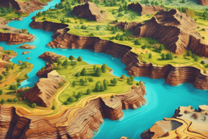
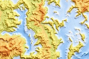
- Topographic maps display surface features and elevation, crucial for understanding land forms.
Elevation and Topographic Map Features
- Mean sea level is the baseline for measuring elevation, defined as the midpoint between maximum and minimum ocean levels.
- Topographic maps offer advantages, such as showing the size, shape, and elevation of geographic features like islands.
- Contour lines represent elevation changes, with the spacing between them indicating the steepness of slopes.
Understanding Contour Lines
- A contour interval refers to the elevation difference between adjacent contour lines; it varies with the area’s relief.
- Relief is defined as the elevation difference between the highest and lowest points in a mapped area.
- Index contours enhance map readability, typically marked with a heavier line, indicating every fifth line of elevation change.
- Closely spaced contour lines signify steep slopes, while widely spaced lines suggest level terrain.
Identifying Landforms and Features
- Valleys are depicted with contour lines that bend into a V shape, while hilltops are shown as closed loops.
- Depression contours, marked by short lines perpendicular to the loop, indicate sunken features in the terrain.
Geologic and Soil Mapping
- Geologic maps outline the distribution of geological features, using colors and letters to represent different rock units.
- The letters used denote the unit's age and type of rock, aiding in geological analysis.
- Soil surveys consist of text, maps, and tables, providing comprehensive information about soil characteristics.
Additional Mapping Concepts
- Strike and dip symbols illustrate the direction and angle at which geological beds tilt.
- When a stream flows through a contour valley, the V in the contour lines points upstream.
- The width of a valley is indicated by contour line spacing: lines spaced farther apart suggest a wider valley.
Weather and Groundwater Mapping
- Weather maps plot critical elements like air pressure, fronts, and precipitation, serving as essential tools in meteorology.
- Groundwater maps provide valuable data regarding mineral content, flow direction, well drilling, and water purity.
Other Types and Uses of Maps
- Beyond topographic, geologic, and soil maps, other important map types include weather maps, satellite maps, and water flow maps.
- Soil maps are primarily used in agriculture and land management, guiding efficient land use and crop production.
Analyzing Steepness and Flow Directions
- The steepness of slopes on topographic maps can be assessed by the proximity of contour lines; closer lines indicate steeper slopes.
- The direction of river flow is deduced by the orientation of V-shaped contours; the pointed end always points upstream.
Studying That Suits You
Use AI to generate personalized quizzes and flashcards to suit your learning preferences.
Description
Explore the fundamental concepts of different types of maps with these flashcards from Geography Chapter 3. This quiz will help you understand characteristics represented on maps, including topographic features and geology factors. Test your knowledge and enhance your learning experience.