Podcast
Questions and Answers
What is the primary purpose of location-based services (LBS) and geotagging?
What is the primary purpose of location-based services (LBS) and geotagging?
- To create immersive 3D models of the Earth's surface
- To facilitate citizen science projects
- To deliver personalized content and services based on location data (correct)
- To visualize complex phenomena like climate change
How does geotagging enhance digital content?
How does geotagging enhance digital content?
- By creating virtual reality experiences for users
- By visualizing climate change data through interactive maps
- By attaching location data to photographs and social media posts (correct)
- By gamifying the exploration of geographical tools
In what way do citizen science projects contribute to geographic data collection?
In what way do citizen science projects contribute to geographic data collection?
- By developing immersive 3D models of cities
- By crowdsourcing information that would be hard for scientists to gather (correct)
- By utilizing data visualization techniques for mapping
- By creating gamified challenges for users to learn geography
How can gamification enhance geographical learning?
How can gamification enhance geographical learning?
What role do data visualization techniques play in understanding geographic concepts?
What role do data visualization techniques play in understanding geographic concepts?
Flashcards are hidden until you start studying
Study Notes
Geographical Tools: Exploring the World with Maps and More
Geography is a field that relies on precise representation and analysis of our planet's features and human interactions. Geographical tools are the instruments and methods that help us visualize and understand the intricate patterns and changes that shape our world. Let's delve into some of the most essential and innovative geographical tools.
Maps
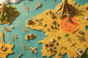
Maps have been the cornerstone of geography since ancient times. They come in various forms, including topographic maps that show elevation, physical features, and land cover; thematic maps that illustrate specific aspects such as population density or economic activity; and cartograms that represent geographic data in a more abstract way to emphasize particular aspects.
GIS (Geographic Information Systems)
GIS is a powerful tool that allows us to organize, analyze, and visualize geographic data. Combining maps, databases, and spatial analysis, GIS enables us to create maps and data models that reveal patterns, trends, and relationships that might not be apparent through traditional methods. GIS is widely used in fields such as urban planning, environmental research, and disaster management.
Remote Sensing
This technology involves acquiring data about the Earth's surface from a distance, typically using satellite imagery or aerial photographs. Remote sensing can provide valuable insights into environmental changes, natural resources, and land use patterns.
Location-Based Services (LBS) and Geotagging
LBS and geotagging refer to the use of location data in mobile devices and other technologies to deliver personalized content and services, such as finding the nearest restaurant or tracking a package's delivery route. Geotagging, in particular, allows users to attach location data to their digital content, such as photographs or social media posts, making it easier to explore and share the world around us.
3D Modeling and Virtual Reality (VR)
As technology advances, 3D modeling and VR are becoming increasingly popular in geography education and research. These tools allow us to create immersive and interactive representations of the Earth's surface, including terrain, buildings, and vegetation. VR can be particularly useful in understanding and visualizing complex phenomena, such as climate change and urbanization.
Citizen Science
Citizen science projects bring together the public and scientists to collect, analyze, and interpret geographic data. These projects leverage the power of crowdsourcing to gather information that would otherwise be difficult or impossible for scientists to obtain. Examples include projects like iNaturalist, where users share observations of plants and animals, and OpenStreetMap, which allows users to create and maintain a free, open-source map of the world.
Gamification
Games like GeoGuessr, which challenge players to pinpoint their location based on Google Street View images, can be a fun and engaging way to learn about geography. Gamification can make geographical learning more accessible and enjoyable for people of all ages.
Data Visualization
In the age of big data, the ability to make sense of vast amounts of information is more important than ever. Data visualization techniques enable us to communicate complex geographic concepts and findings through visual representations such as charts, graphs, and infographics.
These geographical tools, along with the innovation and expertise of geographers, are driving our understanding of the world and helping us face the challenges of our time. So next time you're exploring a new city, using a mapping app, or studying an environmental issue, remember the power of geographical tools in helping us make sense of our world.
Studying That Suits You
Use AI to generate personalized quizzes and flashcards to suit your learning preferences.


