Podcast
Questions and Answers
What defines a geographic problem?
What defines a geographic problem?
- Issues that are purely theoretical in nature.
- Problems solely based on demographics.
- Problems that involve an aspect of location in their solutions or data. (correct)
- Problems that ignore spatial relationships.
Which of the following is NOT a method for categorizing geographic problems?
Which of the following is NOT a method for categorizing geographic problems?
- Time-scale or priority.
- Scale or geographic detail.
- Intent or purpose.
- Temporal relevance. (correct)
What does spatial averaging by pixel primarily involve?
What does spatial averaging by pixel primarily involve?
- Setting all attribute values to zero within a pixel
- Assigning a constant value for all attributes within a pixel (correct)
- Using the modal value of attributes within a pixel
- Replacing values with the maximum attribute value within a pixel
What is the primary goal of using GIS according to the content?
What is the primary goal of using GIS according to the content?
Which of the following represents a micro-level geographic detail?
Which of the following represents a micro-level geographic detail?
Which geographic representation is best suited for a lake that never changes its extent?
Which geographic representation is best suited for a lake that never changes its extent?
Which of the following best describes operational time-scale in GIS?
Which of the following best describes operational time-scale in GIS?
In raster representation, which factor is primarily responsible for determining the information density?
In raster representation, which factor is primarily responsible for determining the information density?
What are the two primary methods of simplifying geographic data?
What are the two primary methods of simplifying geographic data?
How are fuzzy geographic objects, like wetland lakes, best represented?
How are fuzzy geographic objects, like wetland lakes, best represented?
What is the primary advantage of secant cylindrical transversal projection?
What is the primary advantage of secant cylindrical transversal projection?
In which category would 'global warming' be classified under the scale of geographic detail?
In which category would 'global warming' be classified under the scale of geographic detail?
What does the term 'central meridian' refer to in the context of secant cylindrical projection?
What does the term 'central meridian' refer to in the context of secant cylindrical projection?
Which of the following best describes the difference between raster and vector representation?
Which of the following best describes the difference between raster and vector representation?
Which attribute categorization would best represent a wetland lake's wetness gradients?
Which attribute categorization would best represent a wetland lake's wetness gradients?
What is the primary function of passive sensors in remote sensing?
What is the primary function of passive sensors in remote sensing?
Which of the following statements best describes a choropleth map?
Which of the following statements best describes a choropleth map?
What distinguishes active sensors from passive sensors in remote sensing?
What distinguishes active sensors from passive sensors in remote sensing?
In multivariate representation, how are different attributes typically visualized?
In multivariate representation, how are different attributes typically visualized?
What is an example of an active sensor used in remote sensing?
What is an example of an active sensor used in remote sensing?
Which of the following is true about cartograms?
Which of the following is true about cartograms?
What is a possible source of error when measuring length on a plane projection of the ellipsoidal Earth?
What is a possible source of error when measuring length on a plane projection of the ellipsoidal Earth?
What is SWEPOS in the context of GPS technology?
What is SWEPOS in the context of GPS technology?
Flashcards
Raster Representation Info Density
Raster Representation Info Density
Pixel size controls how much detail a geographic object has in a raster map.
Vector Representation Info Density
Vector Representation Info Density
The number of points used to draw a geographic object controls how much detail it has in a vector map.
Fuzzy Geographic Objects
Fuzzy Geographic Objects
Objects with unclear boundaries, like wetlands, whose extent may change over time.
Vector Representation for Static Lakes
Vector Representation for Static Lakes
Signup and view all the flashcards
Raster Representation of Wetland Lakes
Raster Representation of Wetland Lakes
Signup and view all the flashcards
Secant Cylindrical Transverse Projection
Secant Cylindrical Transverse Projection
Signup and view all the flashcards
Suitability for South-to-North Nations
Suitability for South-to-North Nations
Signup and view all the flashcards
Central Meridian
Central Meridian
Signup and view all the flashcards
Geographic Problem
Geographic Problem
Signup and view all the flashcards
Categorizing Geographic Problems
Categorizing Geographic Problems
Signup and view all the flashcards
Geographic Datum
Geographic Datum
Signup and view all the flashcards
Attribute Value
Attribute Value
Signup and view all the flashcards
Cyclic Attribute Scale
Cyclic Attribute Scale
Signup and view all the flashcards
GIS Data Simplification
GIS Data Simplification
Signup and view all the flashcards
Geographic Data Representation Methods
Geographic Data Representation Methods
Signup and view all the flashcards
Data Simplification Methods
Data Simplification Methods
Signup and view all the flashcards
Single-station RTK
Single-station RTK
Signup and view all the flashcards
Network RTK
Network RTK
Signup and view all the flashcards
SWEPOS
SWEPOS
Signup and view all the flashcards
Passive Remote Sensing
Passive Remote Sensing
Signup and view all the flashcards
Active Remote Sensing
Active Remote Sensing
Signup and view all the flashcards
Choropleth Map
Choropleth Map
Signup and view all the flashcards
Multivariate Representation
Multivariate Representation
Signup and view all the flashcards
Cartogram
Cartogram
Signup and view all the flashcards
Study Notes
Geographic Problems in GIS
- Geographic problems involve location, either in the information used to solve them or in the solutions themselves.
- There's a need to categorize geographic problems due to their diverse nature.
- Three methods for categorizing geographic problems are scale, intent, and time-scale.
Scale or Geographic Detail
- Micro level (e.g., crystalline structure coordinates)
- Local level (e.g., cities, forests, parks)
- Regional level (e.g., Baltic runoff, nationwide flu epidemic)
- Global level (e.g., global warming, bird flu pandemic)
Intent or Purpose
- Practical/urgent (e.g., money, emergency)
- Curiosity driven (e.g., continental drift, historic migration patterns)
Time-Scale
- Operational (e.g., smooth functioning of an organization)
- Tactical (e.g., forest harvesting plan)
- Strategic (e.g., organizational long-term direction)
Geographic Data (Datum)
- Most basic form of geographic data links a position (in space and time) to descriptive properties (attributes).
- Geographic attributes are classified according to their associated scale.
Representing Geographic Data
- Two primary methods used to simplify geographic reality for computer representation:
- Spatial averaging by pixel (tessellation)
- Using the fact that many attributes remain constant over large areas.
- Spatial averaging: attribute values within a square pixel are set to a constant value, often the average value.
Fuzzy Geographic Objects
- Many geographic objects are fuzzy, meaning their boundaries are not clearly defined and may change over time.
- Examples include deltas and wetlands.
- Representing fuzzy objects often requires different methods than representing clearly defined objects.
- A good example is the representation of wetlands using a gradient or index of wetness that can be defined with multiple categories.
Secant Cylindrical Transversal Projection
- A secant cylindrical projection is a map projection in which a cylinder intersects the Earth's surface along two meridians.
- This type of projection is well-suited to countries that are predominantly north-south oriented (like Sweden).
- The average projection error is smaller in secant projection than in tangential projection.
- "Central meridian" in projection refers to the reference meridian.
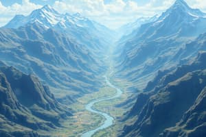
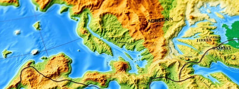
Terrain Map
- The terrain map represents landscape hydrology, land cover, buildings and infrastructure, topography, etc.
- The skeleton of a terrain map can sometimes be the hydrologic landscape elements, in particular in post glacial countries.
Remote Sensing Sensors
- Passive sensors utilize external energy sources (like sun's radiation) or blackbody radiation to detect the reflection of energy.
- Examples: infrared satellite-mounted sensors (like LANDSAT), conventional digital cameras in airplanes, producing highly resolved reference information.
- Active sensors emit their own energy signal to detect the reflected signal.
- Examples: RADAR sensors to depict elevation, SONAR to depict seafloor elevation.
Choropleth Maps
- Choropleth maps represent data through polygons in which each polygon holds a constant attribute value.
- Examples include population density, or election results.
Multivariate Representation
- A multivariate representation allows multiple attribute values to be carried by a single symbol.
- An example is a naval chart where arrows represent currents, showing speed by their color and direction by their orientation.
Measuring Distance on Ellipsoidal Earth
- Errors arise when measuring distances on a plane projection of an ellipsoid Earth due to several sources:
- Choice of distance metric: choosing between Pythagorean, and Great circle metric.
- Projection methods and map scale have a substantial effect on results.
- Error magnitude also depends of the degree of geographic generalization.
Studying That Suits You
Use AI to generate personalized quizzes and flashcards to suit your learning preferences.