Podcast
Questions and Answers
What does a small scale map typically represent compared to a large scale map?
What does a small scale map typically represent compared to a large scale map?
- More detailed information about a smaller area
- Maps that are three-dimensional
- Exact locations with high precision
- Less detail but covers a larger area (correct)
Which of the following components is NOT typically found on a map?
Which of the following components is NOT typically found on a map?
- Graphical illustrations of animals (correct)
- Title
- Scale
- Legend
Which statement accurately describes lines of longitude?
Which statement accurately describes lines of longitude?
- They are parallel and equidistant from each other.
- They run east to west across the globe.
- They indicate measurements in latitude degrees.
- They converge at the poles and are not equidistant. (correct)
What is meant by the term 'symbology' in map making?
What is meant by the term 'symbology' in map making?
What does the concept of 'projection' in cartography refer to?
What does the concept of 'projection' in cartography refer to?
What is a geographic coordinate system (GCS) primarily used for?
What is a geographic coordinate system (GCS) primarily used for?
What type of model does a 'datum' represent in geospatial analysis?
What type of model does a 'datum' represent in geospatial analysis?
Which aspect of a map provides context about its geographical representation?
Which aspect of a map provides context about its geographical representation?
What does GIS primarily enable users to do?
What does GIS primarily enable users to do?
Which of the following best describes a relational Database Management System?
Which of the following best describes a relational Database Management System?
What types of data are combined to describe geographical features in GIS?
What types of data are combined to describe geographical features in GIS?
How do GIS systems enhance the decision-making process within organizations?
How do GIS systems enhance the decision-making process within organizations?
What is a characteristic of a strong GIS software type?
What is a characteristic of a strong GIS software type?
What aspect does cartography primarily focus on within GIS?
What aspect does cartography primarily focus on within GIS?
What role do geometries play in a GIS?
What role do geometries play in a GIS?
What determines the properties of data such as projection and scale in GIS?
What determines the properties of data such as projection and scale in GIS?
What is the purpose of the 'on-the-fly' projection in ArcMap?
What is the purpose of the 'on-the-fly' projection in ArcMap?
Which coordinate system uses latitude and longitude as its units?
Which coordinate system uses latitude and longitude as its units?
What issue may arise if datasets do not line up in ArcMap?
What issue may arise if datasets do not line up in ArcMap?
What is the primary function of the 'project' tool in ArcToolbox?
What is the primary function of the 'project' tool in ArcToolbox?
What is the optimal number of classes for a choropleth map?
What is the optimal number of classes for a choropleth map?
What issue might occur if you change the coordinate system in catalog properties?
What issue might occur if you change the coordinate system in catalog properties?
Which type of mapping technique uses varying sizes of symbols to represent data?
Which type of mapping technique uses varying sizes of symbols to represent data?
Which projection type is characterized as the simplest and aligns easting and northing with latitude and longitude?
Which projection type is characterized as the simplest and aligns easting and northing with latitude and longitude?
What defines qualitative data in mapping?
What defines qualitative data in mapping?
In geodatabases, what is the unique identifier used for software?
In geodatabases, what is the unique identifier used for software?
What does the term 'datum' in GIS refer to?
What does the term 'datum' in GIS refer to?
Which of the following data types is characterized by having a meaningful zero?
Which of the following data types is characterized by having a meaningful zero?
In what situation is a manually projected coordinate system necessary?
In what situation is a manually projected coordinate system necessary?
What is the purpose of geocoding in mapping?
What is the purpose of geocoding in mapping?
Which of the following elements do NOT keep track of area and lengths in geodatabases?
Which of the following elements do NOT keep track of area and lengths in geodatabases?
What is an effective way to symbolize data in a dot-density map?
What is an effective way to symbolize data in a dot-density map?
What is the primary difference between vector and raster data models?
What is the primary difference between vector and raster data models?
Which of the following is NOT a type of vector file?
Which of the following is NOT a type of vector file?
In a vector data model, what does a polygon represent?
In a vector data model, what does a polygon represent?
What are attribute tables used for in data models?
What are attribute tables used for in data models?
What is a key advantage of using vector data models?
What is a key advantage of using vector data models?
Which of the following describes the 'feature class' within a geodatabase?
Which of the following describes the 'feature class' within a geodatabase?
What is the main disadvantage of vector data models compared to raster data models?
What is the main disadvantage of vector data models compared to raster data models?
What is the function of a feature dataset in a geodatabase?
What is the function of a feature dataset in a geodatabase?
What best describes the term 'topology' in the context of data models?
What best describes the term 'topology' in the context of data models?
What is a key characteristic of general reference maps?
What is a key characteristic of general reference maps?
What is the primary purpose of a map's legend?
What is the primary purpose of a map's legend?
Which statement best describes the scale of a map?
Which statement best describes the scale of a map?
Lines of latitude are characterized by which of the following features?
Lines of latitude are characterized by which of the following features?
In the context of map projections, what does distortion refer to?
In the context of map projections, what does distortion refer to?
What is the role of a datum in geographic coordinate systems?
What is the role of a datum in geographic coordinate systems?
Which component is essential for understanding the orientation of a map?
Which component is essential for understanding the orientation of a map?
What information do symbols in cartography primarily communicate?
What information do symbols in cartography primarily communicate?
What characteristic distinguishes large scale maps from small scale maps?
What characteristic distinguishes large scale maps from small scale maps?
What is the primary purpose of a choropleth map?
What is the primary purpose of a choropleth map?
Which of the following is a characteristic of ratio data?
Which of the following is a characteristic of ratio data?
What does the term 'geocoding' refer to in the context of mapping?
What does the term 'geocoding' refer to in the context of mapping?
Which method is most commonly used to represent quantitative data in thematic maps?
Which method is most commonly used to represent quantitative data in thematic maps?
In geodatabases, what unique identifier is primarily used?
In geodatabases, what unique identifier is primarily used?
What is a key limitation of using stand-alone tables for data in GIS?
What is a key limitation of using stand-alone tables for data in GIS?
Which visualization technique uses the density of a single symbol to represent data?
Which visualization technique uses the density of a single symbol to represent data?
Which of the following is crucial when creating field names in GIS?
Which of the following is crucial when creating field names in GIS?
What type of coordinate system uses easting and northing as its units?
What type of coordinate system uses easting and northing as its units?
What is the key function of 'on-the-fly' projection in ArcMap?
What is the key function of 'on-the-fly' projection in ArcMap?
Which scenario requires the use of the 'project' tool in ArcToolbox?
Which scenario requires the use of the 'project' tool in ArcToolbox?
What issue is likely to occur if data sets do not align in ArcMap?
What issue is likely to occur if data sets do not align in ArcMap?
What defines the spatial referencing in GIS?
What defines the spatial referencing in GIS?
Which projection type is characterized by presenting Earth's surface on a cylinder?
Which projection type is characterized by presenting Earth's surface on a cylinder?
What happens when you change a coordinate system in catalog properties?
What happens when you change a coordinate system in catalog properties?
Which of the following describes the Plate Carree projection?
Which of the following describes the Plate Carree projection?
What is the primary purpose of a Geographic Information System (GIS)?
What is the primary purpose of a Geographic Information System (GIS)?
Which of the following best describes the role of a Relational Database Management System (RDBMS) within GIS?
Which of the following best describes the role of a Relational Database Management System (RDBMS) within GIS?
What are the two types of data combined to describe geographical features in GIS?
What are the two types of data combined to describe geographical features in GIS?
What does the term 'cartography' primarily relate to within GIS?
What does the term 'cartography' primarily relate to within GIS?
What is a significant feature of a weak type of GIS software, such as a Geobrowser?
What is a significant feature of a weak type of GIS software, such as a Geobrowser?
How does GIS generally enhance decision-making processes within organizations?
How does GIS generally enhance decision-making processes within organizations?
Which aspect of GIS is primarily concerned with the management of multiple data layers or themes?
Which aspect of GIS is primarily concerned with the management of multiple data layers or themes?
What crucial aspect must be considered when deciding on data properties in GIS?
What crucial aspect must be considered when deciding on data properties in GIS?
What do vector data models primarily use to represent geographical features?
What do vector data models primarily use to represent geographical features?
Which component is generally included in attribute tables to describe geographical data?
Which component is generally included in attribute tables to describe geographical data?
What is a key advantage of using the vector data model over raster data models?
What is a key advantage of using the vector data model over raster data models?
In vector data models, what does a 'line' represent?
In vector data models, what does a 'line' represent?
Which statement best describes a shapefile in vector data storage?
Which statement best describes a shapefile in vector data storage?
What is the primary function of a feature dataset in a geodatabase?
What is the primary function of a feature dataset in a geodatabase?
Which of the following best describes the disadvantage of vector data models when compared to raster models?
Which of the following best describes the disadvantage of vector data models when compared to raster models?
What is generally NOT considered a part of the vector data model?
What is generally NOT considered a part of the vector data model?
How does a geodatabase enhance the capabilities of vector data management?
How does a geodatabase enhance the capabilities of vector data management?
Which aspect does NOT define the limitations of data models?
Which aspect does NOT define the limitations of data models?
Flashcards
Geographic Information System (GIS)
Geographic Information System (GIS)
A computer-based system for capturing, modeling, storing, retrieving, sharing, and manipulating geographic data.
Five M's in GIS
Five M's in GIS
Five key concepts in GIS: Cartography, Prediction using spatial data, Location, spatial changes, and processes about these.
Database Management System (DBMS)
Database Management System (DBMS)
Software used to manage multiple databases, enabling querying, updating, reporting, and administration.
Relational DBMS
Relational DBMS
Signup and view all the flashcards
GIS Software
GIS Software
Signup and view all the flashcards
GIS Data Layers
GIS Data Layers
Signup and view all the flashcards
Spatial Data
Spatial Data
Signup and view all the flashcards
Attribute Data
Attribute Data
Signup and view all the flashcards
Cartography
Cartography
Signup and view all the flashcards
Map
Map
Signup and view all the flashcards
Map Components
Map Components
Signup and view all the flashcards
Map Scale
Map Scale
Signup and view all the flashcards
Map Projection
Map Projection
Signup and view all the flashcards
Geographic Coordinate System (GCS)
Geographic Coordinate System (GCS)
Signup and view all the flashcards
Latitude
Latitude
Signup and view all the flashcards
Longitude
Longitude
Signup and view all the flashcards
Projected Coordinate System
Projected Coordinate System
Signup and view all the flashcards
On-the-fly projection
On-the-fly projection
Signup and view all the flashcards
Datum
Datum
Signup and view all the flashcards
Plate Carree Projection
Plate Carree Projection
Signup and view all the flashcards
Universal Transverse Mercator (UTM)
Universal Transverse Mercator (UTM)
Signup and view all the flashcards
Spatial Referencing
Spatial Referencing
Signup and view all the flashcards
Coordinate Systems in GIS
Coordinate Systems in GIS
Signup and view all the flashcards
Vector Data Model
Vector Data Model
Signup and view all the flashcards
Raster Data Model
Raster Data Model
Signup and view all the flashcards
Data Model
Data Model
Signup and view all the flashcards
Attribute Table
Attribute Table
Signup and view all the flashcards
Point
Point
Signup and view all the flashcards
Line
Line
Signup and view all the flashcards
Polygon
Polygon
Signup and view all the flashcards
Shapefile
Shapefile
Signup and view all the flashcards
Geodatabase
Geodatabase
Signup and view all the flashcards
Feature Dataset
Feature Dataset
Signup and view all the flashcards
Thematic Map
Thematic Map
Signup and view all the flashcards
Choropleth Map
Choropleth Map
Signup and view all the flashcards
Dot-density Map
Dot-density Map
Signup and view all the flashcards
Proportional Symbol Map
Proportional Symbol Map
Signup and view all the flashcards
Qualitative Data
Qualitative Data
Signup and view all the flashcards
Quantitative Data
Quantitative Data
Signup and view all the flashcards
Geocoding
Geocoding
Signup and view all the flashcards
What is a GIS?
What is a GIS?
Signup and view all the flashcards
What are GIS systems?
What are GIS systems?
Signup and view all the flashcards
What are the components of a map?
What are the components of a map?
Signup and view all the flashcards
What is map scale?
What is map scale?
Signup and view all the flashcards
What is map projection?
What is map projection?
Signup and view all the flashcards
What is a Geographic Coordinate System (GCS)?
What is a Geographic Coordinate System (GCS)?
Signup and view all the flashcards
What is a datum?
What is a datum?
Signup and view all the flashcards
What is latitude?
What is latitude?
Signup and view all the flashcards
What is longitude?
What is longitude?
Signup and view all the flashcards
Data Types: Qualitative vs. Quantitative
Data Types: Qualitative vs. Quantitative
Signup and view all the flashcards
Projection
Projection
Signup and view all the flashcards
Coordinate System
Coordinate System
Signup and view all the flashcards
General Reference Map
General Reference Map
Signup and view all the flashcards
Study Notes
Geographic Information Systems (GIS)
- GIS is a computer-based system enabling capture, modeling, storage, retrieval, sharing, and manipulation of geographic data.
- Key elements include cartography, prediction, location, and change analysis.
- GIS utilizes Database Management Systems (DBMS) to manage multiple databases, facilitating queries, updates, and reporting.
- Relational DBMS allows linking data based on common identifiers (e.g., parcel numbers, year built).
- GIS systems consist of hardware and software programs to collect, store, process data, and produce geographic information.
- GIS combines digital geographic data (geometries with attributes) for analysis and mapping.
- GIS software comes in various types (e.g., desktop, web-based, Geobrowser - weak, web-based - medium, desktop - strong).
- Organizations use GIS to analyze many layers/themes of geographic information.
GIS Representation Basics
- Incorporating geography into computer applications involves creating a relational DBMS (Database Management System).
- GIS data combines spatial and attribute data, crucial for describing features (geometries) and their properties.
- Data properties, projection, scale, accuracy, and resolution are crucial mapping factors, affecting how the data is represented and analyzed.
- Cartography, the study of maps, considers both the science and art of map creation, including the study of maps as scientific documents and works of art.
Mapping Concepts
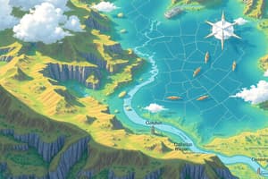
- A map is a geographical representation of locations, objects, themes, and relationships on Earth (in a flat format).
- Maps are often abstractions or generalized representations of reality.
- Essential map elements include title, legend, scale, neatline, and explanatory text.
- Global coordinates use latitude, longitude, degrees, minutes, and decimals to locate positions on the Earth.
- Latitude lines are parallel and almost equidistant; longitude lines converge.
Projections in GIS
- Projections transform 3D Earth data to a 2D map display, often leading to distortion.
- Different projections (e.g., Mercator) maintain different data properties like shapes, areas, and distances, which must be considered when choosing a projection for specific applications.
- Coordinate systems (Geographic and Projected) are crucial for aligning map data, which can be achieved through on-the-fly projections in software like ArcMap.
- GIS software (like ArcMap) includes tools to perform on-the-fly projections and coordinate system conversions, and potentially adjust projections within the project file.
Data Models
- GIS data models organize data into vectors (points, lines, and polygons) or rasters (grids or matrices).
- Vector data models represent discrete features using points, lines, and polygons, storing attributes in tables (e.g., Shapefile, Geodatabase).
- Raster data models represent continuous data using grids or matrices; attributes are stored in the cells or a separate table, depending on the dataset.
- Attributes (data about features) are stored in tables associated with vector data, often using techniques such as Object ID (OID), and Feature IDs (FID), particularly within geodatabases.
- Attribute tables organize data into rows and columns (records and fields).
Thematic Maps
- Thematic maps focus on a specific theme or data.
- Common techniques include choropleth maps (using color to represent data), dot density maps, and proportional symbol maps, each with varying degrees of complexity in representing the data.
Database Models & Data Management
- Tables and vector data files often use separate files for attributes and location data, using FID (Feature ID) and OID (Object ID), but geodatabases often combine this data in a single file for better management.
- Geodatabases combine spatial data and attributes in a single file format for optimized management of geographic data, allowing for better organization and more robust data management features, including checks and relationships for errors (e.g., area, lengths); often used with newer datasets.
- Coordinate systems & data projections are essential to ensure accurate spatial alignment of map data layers.
GIS Field Types
- Field types in a GIS database define the data formats stored in attribute tables (e.g., integer, decimal, text, date, etc.), influencing how different data types can be analyzed and visualized.
Studying That Suits You
Use AI to generate personalized quizzes and flashcards to suit your learning preferences.