Podcast
Questions and Answers
What are the three main segments of the GPS system?
What are the three main segments of the GPS system?
- Space Segment (correct)
- Network Segment
- Control Segment (correct)
- User Segment (correct)
What does GPS stand for?
What does GPS stand for?
Global Positioning System
The GPS satellites are controlled and operated by the US Air Force.
The GPS satellites are controlled and operated by the US Air Force.
False (B)
GPS satellites fly in medium Earth orbit (MEO) at an altitude of approximately ____ km.
GPS satellites fly in medium Earth orbit (MEO) at an altitude of approximately ____ km.
Which type of data do GPS satellites constantly transmit?
Which type of data do GPS satellites constantly transmit?
What type of clocks are used on GPS satellites for accurate timing?
What type of clocks are used on GPS satellites for accurate timing?
The current GPS constellation is only made up of newer satellites.
The current GPS constellation is only made up of newer satellites.
How many operational GPS satellites are maintained 95% of the time?
How many operational GPS satellites are maintained 95% of the time?
The altitude of GPS satellites is approximately ____ km.
The altitude of GPS satellites is approximately ____ km.
What role does the Master Control Station (MCS) play in the GPS control segment?
What role does the Master Control Station (MCS) play in the GPS control segment?
What is the purpose of the User Segment in the GPS system?
What is the purpose of the User Segment in the GPS system?
GPS satellites are powered primarily by ____ panels.
GPS satellites are powered primarily by ____ panels.
Flashcards are hidden until you start studying
Study Notes
GPS Overview
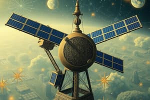
- Global Positioning System (GPS), also known as NAVSTAR, is vital for positioning and timing.
- Comprises three main segments: Space Segment, Control Segment, and User Segment.
GNSS Principle
- Requires satellites, their positions, signals, receivers, and observation equations.
- Propagation errors and measurement noise are considered to estimate position, velocity, and time.
GPS Functionality
- GPS calculates distances from ground stations to receivers using radio signal travel time.
- Accuracy improves as more satellites become visible to the receiver.
- Performance declines in dense environments like forests or buildings.
GPS Segments
- Space Segment: Features a constellation of satellites in Medium Earth Orbit (MEO) at approximately 20,200 km.
- Control Segment: Monitors and operates the GPS system, ensuring accuracy and health of satellites.
- User Segment: Encompasses various GPS receivers and navigation software used by civilians and military.
Satellite Operations
- Operated by the U.S. Department of Defense, ensuring at least 24 operational satellites are available 95% of the time.
- A constellation of 31 satellites facilitates coverage, with 6 satellites visible from any location.
Satellite Characteristics
- Each satellite has an orbital period of 11.5 hours and is arranged in six evenly spaced planes inclined at 55 degrees to the equator.
- Powered by solar panels with backup from nickel-cadmium batteries.
- Each satellite contains four atomic clocks to ensure precise timing.
GPS Constellation Expansion
- In June 2011, the Air Force expanded the GPS constellation to include 27 active slots, enhancing global coverage.
Space Segment Functions
- Maintains accurate time using rubidium and cesium clocks, broadcasting time and position data.
- Utilizes three carrier frequencies (L1, L2, L5) and pseudo-random noise codes for signal transmission.
- Receives and stores satellite data uploaded by the Control Segment.
Satellite Generations
- Mix of older and newer satellites with various generations like Block IIA, IIR, and future GPS III featuring improvements.
Control Segment Structure
- Comprises a global network of ground facilities to monitor orbits, satellite health, and time maintenance.
- Includes a Master Control Station (MCS) in Colorado that uploads navigation messages and ensures satellite accuracy.
Monitoring and Ground Antennas
- Monitor Stations: Track satellite performance and relay atmospheric data to the MCS.
- Ground Antennas: Facilitate communication with satellites, supporting navigation data updates and telemetry.
User Segment Applications
- Used by military for navigation, reconnaissance, and missile guidance.
- Civilian applications include navigation, surveying, mapping, geophysics, remote sensing, and time frequency transfer.
Studying That Suits You
Use AI to generate personalized quizzes and flashcards to suit your learning preferences.