Podcast
Questions and Answers
What is the primary function of the satellites in a satellite positioning system?
What is the primary function of the satellites in a satellite positioning system?
- To communicate directly with users
- To monitor other satellite movements
- To serve as reference or control stations for positioning (correct)
- To correct clock biases in receivers
How many satellites does the GPS constellation consist of?
How many satellites does the GPS constellation consist of?
- 36 satellites
- 32 satellites (correct)
- 30 satellites
- 24 satellites
Which process is used to determine the coordinates of an unknown position using ranges from satellites?
Which process is used to determine the coordinates of an unknown position using ranges from satellites?
- Multilateration (correct)
- Trilateration (correct)
- Resection
- Triangulation
What role do atomic clocks play in satellite positioning systems?
What role do atomic clocks play in satellite positioning systems?
What is included in the Control segment of a satellite positioning system?
What is included in the Control segment of a satellite positioning system?
What determines the operational coverage of GPS satellites?
What determines the operational coverage of GPS satellites?
What does the unique Psuedo Random Noise (PRN) number identify?
What does the unique Psuedo Random Noise (PRN) number identify?
Which of the following best describes the User segment in satellite positioning systems?
Which of the following best describes the User segment in satellite positioning systems?
What principle does the TRANSIT system primarily operate on?
What principle does the TRANSIT system primarily operate on?
What determines the observed Doppler shifts in satellite signals?
What determines the observed Doppler shifts in satellite signals?
When was public access to the TRANSIT system granted?
When was public access to the TRANSIT system granted?
Which system was developed by the U.S. Department of the Navy in the 1970s?
Which system was developed by the U.S. Department of the Navy in the 1970s?
Which of the following terms describes modern receivers that can receive signals from multiple systems?
Which of the following terms describes modern receivers that can receive signals from multiple systems?
What distinguishes GNSS receivers from GPS receivers?
What distinguishes GNSS receivers from GPS receivers?
Which satellite navigation system is associated with the former Soviet Union?
Which satellite navigation system is associated with the former Soviet Union?
What is the primary function of satellite positioning systems?
What is the primary function of satellite positioning systems?
What does PPK stand for in GNSS processing?
What does PPK stand for in GNSS processing?
What communication method allows base and rovers to receive corrections in real-time?
What communication method allows base and rovers to receive corrections in real-time?
What benefit do real-time networks (RTN) provide for GNSS data collection?
What benefit do real-time networks (RTN) provide for GNSS data collection?
What protocol is commonly used to deliver instantaneous correction data to the rover in network RTK systems?
What protocol is commonly used to deliver instantaneous correction data to the rover in network RTK systems?
Why are proprietary data formats less favorable in GNSS systems?
Why are proprietary data formats less favorable in GNSS systems?
Which map projection is best suited for minimizing distortions over a curved surface?
Which map projection is best suited for minimizing distortions over a curved surface?
What challenge is presented by surveying measurements over large areas?
What challenge is presented by surveying measurements over large areas?
Which of the following is true regarding RTCM format?
Which of the following is true regarding RTCM format?
What is the primary advantage of using multiple receivers in differential GNSS?
What is the primary advantage of using multiple receivers in differential GNSS?
In static GNSS surveying, what role does the base receiver typically serve?
In static GNSS surveying, what role does the base receiver typically serve?
Which statement correctly describes kinematic GNSS surveying?
Which statement correctly describes kinematic GNSS surveying?
What is the typical outcome of using a longer observation period in static GNSS surveying?
What is the typical outcome of using a longer observation period in static GNSS surveying?
How do tropospheric and ionospheric effects impact differential GNSS?
How do tropospheric and ionospheric effects impact differential GNSS?
What does the term 'baseline vectors' refer to in GNSS surveying?
What does the term 'baseline vectors' refer to in GNSS surveying?
What is the purpose of least squares adjustment in GNSS data processing?
What is the purpose of least squares adjustment in GNSS data processing?
What is generally required for a rover receiver to effectively collect data during kinematic surveying?
What is generally required for a rover receiver to effectively collect data during kinematic surveying?
What does the term ρ represent in the pseudorange equation?
What does the term ρ represent in the pseudorange equation?
Which of the following components is NOT part of the pseudorange equation as outlined?
Which of the following components is NOT part of the pseudorange equation as outlined?
What is the primary purpose of satellite clock bias corrections in the pseudorange equation?
What is the primary purpose of satellite clock bias corrections in the pseudorange equation?
How can receiver clock bias, dT, be determined according to the discussed methodology?
How can receiver clock bias, dT, be determined according to the discussed methodology?
What is the primary impact of ionospheric effects on GNSS signals?
What is the primary impact of ionospheric effects on GNSS signals?
What is the significance of the relativistic effect in the context of satellite clock biases?
What is the significance of the relativistic effect in the context of satellite clock biases?
Which factor is considered the largest contributor to the error budget in GNSS measurements?
Which factor is considered the largest contributor to the error budget in GNSS measurements?
In the context of the pseudorange equation, which term accounts for atmospheric signal distortions?
In the context of the pseudorange equation, which term accounts for atmospheric signal distortions?
What is the significance of carrier phase measurements in satellite communication?
What is the significance of carrier phase measurements in satellite communication?
How is the wavelength ($ ext{λ}$) calculated based on signal frequency ($ ext{f}$)?
How is the wavelength ($ ext{λ}$) calculated based on signal frequency ($ ext{f}$)?
For the L1 carrier frequency of 1575.42 MHz, what is the approximate wavelength?
For the L1 carrier frequency of 1575.42 MHz, what is the approximate wavelength?
What is referred to as Integer Ambiguity in carrier phase measurements?
What is referred to as Integer Ambiguity in carrier phase measurements?
What happens when the receiver loses count of the integer cycles in carrier phase measurement?
What happens when the receiver loses count of the integer cycles in carrier phase measurement?
How does the EDF receiver utilize phase measurements?
How does the EDF receiver utilize phase measurements?
Which frequency corresponds to a wavelength of approximately 24 cm?
Which frequency corresponds to a wavelength of approximately 24 cm?
What defines the precision of carrier phase measurements compared to code pseudorange measurements?
What defines the precision of carrier phase measurements compared to code pseudorange measurements?
Flashcards
Global Navigation Satellite Systems (GNSS)
Global Navigation Satellite Systems (GNSS)
A collective term for various satellite positioning systems, including GPS, GLONASS, Galileo, QZSS, and BeiDou, used to determine precise locations.
TRANSIT system
TRANSIT system
An early US satellite navigation system utilizing the Doppler effect for positioning.
Doppler Effect
Doppler Effect
The apparent change in frequency of a wave emitted by a moving source, as observed by a stationary receiver.
GPS (NAVSTAR GPS)
GPS (NAVSTAR GPS)
Signup and view all the flashcards
Satellite Positioning Systems
Satellite Positioning Systems
Signup and view all the flashcards
GNSS Receiver
GNSS Receiver
Signup and view all the flashcards
GLONASS
GLONASS
Signup and view all the flashcards
Satellite Positioning Principle
Satellite Positioning Principle
Signup and view all the flashcards
Multilateration
Multilateration
Signup and view all the flashcards
Trilateration
Trilateration
Signup and view all the flashcards
GPS Space Segment
GPS Space Segment
Signup and view all the flashcards
GPS Control Segment
GPS Control Segment
Signup and view all the flashcards
GPS User Segment
GPS User Segment
Signup and view all the flashcards
Atomic Clocks (satellites)
Atomic Clocks (satellites)
Signup and view all the flashcards
PRN (Satellite Vehicle Number)
PRN (Satellite Vehicle Number)
Signup and view all the flashcards
Pseudorange
Pseudorange
Signup and view all the flashcards
Satellite Clock Error (dt)
Satellite Clock Error (dt)
Signup and view all the flashcards
Receiver Clock Error (dT)
Receiver Clock Error (dT)
Signup and view all the flashcards
Ionospheric Effects (dion)
Ionospheric Effects (dion)
Signup and view all the flashcards
Tropospheric Effects (dtrop)
Tropospheric Effects (dtrop)
Signup and view all the flashcards
Multipath Error (εmp)
Multipath Error (εmp)
Signup and view all the flashcards
Other Error Terms (εp)
Other Error Terms (εp)
Signup and view all the flashcards
Why are multiple satellites needed to determine location?
Why are multiple satellites needed to determine location?
Signup and view all the flashcards
Carrier Phase Measurement
Carrier Phase Measurement
Signup and view all the flashcards
Wavelength
Wavelength
Signup and view all the flashcards
Carrier Phase Measurement Precision
Carrier Phase Measurement Precision
Signup and view all the flashcards
Integer Ambiguity
Integer Ambiguity
Signup and view all the flashcards
Cycle Slip
Cycle Slip
Signup and view all the flashcards
EDM (Electronic Distance Measurement)
EDM (Electronic Distance Measurement)
Signup and view all the flashcards
How is EDM similar to GNSS?
How is EDM similar to GNSS?
Signup and view all the flashcards
Why is Integer Ambiguity a problem?
Why is Integer Ambiguity a problem?
Signup and view all the flashcards
Differential GNSS (DGNSS)
Differential GNSS (DGNSS)
Signup and view all the flashcards
Baseline Measurement
Baseline Measurement
Signup and view all the flashcards
Static GNSS Surveying
Static GNSS Surveying
Signup and view all the flashcards
Rover Receiver
Rover Receiver
Signup and view all the flashcards
Kinematic GNSS Surveying
Kinematic GNSS Surveying
Signup and view all the flashcards
Trajectory
Trajectory
Signup and view all the flashcards
Why is a long observation period important in Static GNSS Surveying?
Why is a long observation period important in Static GNSS Surveying?
Signup and view all the flashcards
PPK
PPK
Signup and view all the flashcards
RTK
RTK
Signup and view all the flashcards
RTN
RTN
Signup and view all the flashcards
NTRIP
NTRIP
Signup and view all the flashcards
RTCM
RTCM
Signup and view all the flashcards
Map Projection
Map Projection
Signup and view all the flashcards
Conical, Cylindrical, or Azimuthal
Conical, Cylindrical, or Azimuthal
Signup and view all the flashcards
Geodetic Considerations
Geodetic Considerations
Signup and view all the flashcards
Study Notes
Global Navigation Satellite Systems (GNSS)
- Satellite positioning systems began in 1958 with the Navy Navigation Satellite System (NNSS, or TRANSIT).
- TRANSIT worked using the Doppler Effect.
- The Doppler Effect is an apparent shift in frequency when a wave source is moving relative to an observer.
- The system measured Doppler shifts from satellites to ground stations to determine the receiving station's position.
- NNSS was decommissioned in 1980.
- Global Positioning System (GPS) was developed by the US Navy in the 1970's.
- GPS, along with other systems like GLONASS, QzSS, Galileo, and BeiDou comprise the broader category of GNSS.
- GNSS receivers can process signals from multiple systems.
- GPS receivers accept only GPS signals.
Satellite Positioning Systems
- The systems use signal information and precise timing to calculate receiver positions.
- Satellites act as reference stations.
- The distance from satellites to the receiver is calculated using Multilateration/Trilateration.
- Trilateration uses 3 ranges (distances).
- Multilateration uses 4 or more ranges.
- This process is similar to resection in conventional surveying, using angles and distances from reference stations to determine an unknown position.
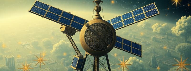
GPS System Components
- Space Segment: CONTAINS 32 satellites (24 active, 8 in reserve) in medium Earth orbit (~20,200 km) in six orbital planes to produce 24-hour coverage.
- Control Segment: Consists of monitoring stations around the world. These stations track satellite signals, positions, and other data for use by master control stations. Data is used to make precise predictions of future satellite orbits and clock errors.
- User Segment: Contains the receivers used to measure the signals from the satellites to determine the receiver's position. Atomic clocks and signals are also used to determine precise time.
- Satellites use precise atomic clocks for precise timing.
- Individual satellites are identified by a unique Pseudo Random Noise (PRN) number.
GNSS Signals
- Satellite signals are broadcast in the microwave portion of the electromagnetic spectrum.
- These signals are passive, meaning receivers only receive them.
- Various codes are used to encode information (such as data and timing) onto carrier waves broadcast from satellites.
Time
- The time elapsed between when a signal is transmitted and received by a receiver allows for calculating range measurements using the speed of light.
- Time keeping accuracy on satellite signals is key. GPS signals have a resolution of 1.5 seconds.
- Time for GPS is expressed as a week number and a time of week count (TOW).
GPS Signals
- GPS satellites use three carrier phase frequencies.
- L1 (1575.42 MHz), L2 (1227.60 MHz), L5 (1176.45 MHz).
- Two codes are also used, a civilian code and a military code.
- Military P(Y) code is replaced with M codes.
GLONASS Signals
- Similar to GPS but uses an L1 and L2 signal.
- Uses different access (FDMA) to differentiate between satellites compared to the GPS protocol (CDMA).
Galileo Signals
- 30 in-orbit satellites, at an altitude of approximately,~23,200 km.
- Three orbital planes with 120° separation between them
- Three signals: E1 (1575.42 MHz), E5 (1191.795 MHz), and E6 (1278.75 MHz). E5 is broken into two separate signals (E5a and E5b)
BeiDou-3 Signals
- Uses three bands: B1, B2, and B3
- Signals are modulated with several codes for military and civilian purposes.
Codes
- Used to communicate timing and navigation information to receivers.
- Includes: Precision Code (P-Code), Coarse Acquisition Code (C/A code), and Navigation Code.
Selective Availability (SA)
- Intentional degradation of public GPS signals for national security.
- Discontinued in 2000.
Modulated Carrier Waves
- GNSS signals are carrier waves which are modulated to carry information.
- Three modulation methods are used: amplitude, frequency, and phase modulation.
- Phase modulation is particularly important in determining distance measurements.
Integer Ambiguity
- Resolution of the exact number of cycles of a carrier wave is required to calculate precise distances.
Point Positioning
- Requires determining simultaneous ranges from at least four signals to find a receiver’s position (X,Y,Z).
Relative Positioning (with Base Station)
- Methods that calculate baseline vectors between multiple receivers to increase precision.
- Common techniques include static and kinematic (real-time) methods.
Coordinate Systems in GNSS
- Map projections are used to transform locations on curves surfaces (like the Earth) onto flat projection planes ensuring accurate representation.
- Various projections exist (conical, cylindrical, azimuthal, etc.).
- Coordinate systems such as 3D Cartesian and Geodetic are used to relate locations on Earth to a coordinate system. Coordinate systems have reference ellipsoids and use latitude, longitude and elevation.
Polar Motion
- Earth's rotation is not perfectly uniform, resulting in periodic wobbly motions.
- Instantaneous polar position (CTP) is tracked continuously.
Time Systems
- Time systems in GNSS take into account Earth irregularities to ensure accuracy. Important systems include UTC, local solar time, and sidereal time.
Angular Velocity
- Earth's rotational velocity is not uniform (and is crucial for satellite corrections).
Studying That Suits You
Use AI to generate personalized quizzes and flashcards to suit your learning preferences.
Related Documents
Description
This quiz explores the fundamental concepts of satellite positioning systems, including GPS and GNSS. Test your knowledge on the roles of satellites, atomic clocks, and segments involved in these systems. Ideal for students and enthusiasts looking to understand satellite navigation technology.