Podcast
Questions and Answers
What role does vegetation play in the environment?
What role does vegetation play in the environment?
- Generating hydroelectricity
- Increasing urbanization
- Creating GIS software
- Supporting life through water cycles (correct)
Which technology allows geographers to analyze spatial information?
Which technology allows geographers to analyze spatial information?
- Google Earth (correct)
- YouTube
What is the primary focus of human geography?
What is the primary focus of human geography?
- Creating cultural landscapes
- Studying the spatial patterns of human activities (correct)
- Understanding the behavior of animals
- Analyzing ocean currents
What does urbanization refer to?
What does urbanization refer to?
How does GIS technology help in disaster response planning?
How does GIS technology help in disaster response planning?
What does physical geography mainly focus on?
What does physical geography mainly focus on?
What does climate refer to?
What does climate refer to?
How do landforms influence human existence?
How do landforms influence human existence?
How does soil availability affect human activities?
How does soil availability affect human activities?
Which geological processes contribute to the formation of landforms?
Which geological processes contribute to the formation of landforms?
Study Notes
Unraveling the World's Diversity: Exploring Geography
Geography isn't just about learning names and locations on a map. It's a field that dives deep into the complex interplay of physical and human landscapes, shaping our understanding of the world and our place within it. As you embark on this journey to explore geography, we'll shed light on what makes our planet so fascinating and interconnected.
Physical Geography
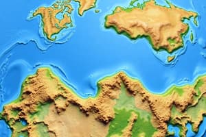
Physical geography examines the natural features of our planet, such as landforms, climate, soil, water, and vegetation. From the majestic Himalayas to the vast Amazon rainforest, these features influence human existence and ecosystems in countless ways.
-
Landforms: Landforms like mountains, valleys, and plains are the result of geological processes like erosion, weathering, and plate tectonics. They affect local climates and influence human settlement and transportation routes.
-
Climate: Climate refers to the average weather conditions over long periods. It's influenced by factors like latitude, altitude, and ocean currents. Climate is crucial for understanding vegetation, wildlife, and water availability.
-
Soil: Soil is the result of weathering and decomposition of rocks. It supports plant life and agriculture. Soils vary in texture, nutrient content, and water-retention capacity, shaping human land use and agricultural practices.
-
Water: Water bodies like oceans, lakes, rivers, and glaciers influence weather patterns, support life, and impact transportation. They also provide a source of drinking water, irrigation, and hydroelectricity.
-
Vegetation: Vegetation includes plants, trees, and forests. It plays a vital role in the water cycle, carbon sequestration, and supporting wildlife habitats. Vegetation also influences the local climate through evapotranspiration and albedo effects.
Human Geography
Human geography focuses on the spatial patterns and processes of human activities and interactions with the environment. From urbanization to cultural landscapes, human geography offers a unique perspective on our world.
-
Urbanization: Urbanization refers to the expansion of cities, towns, and suburbs, leading to the concentration of population and economic activity. It affects land use, transportation, and lifestyle.
-
Cultural landscapes: Cultural landscapes are the result of human interaction with the natural environment. Examples include ancient cities, heritage sites, and agricultural lands. These landscapes reflect local cultures and traditions.
-
Spatial patterns: Spatial patterns refer to the distribution of human activities and settlements across the landscape. Examples include cities, suburbs, rural landscapes, and wilderness areas. Understanding these patterns aids in predicting future changes in land use and human populations.
-
Regional development: Regional development focuses on understanding the economic, social, and environmental challenges faced by various regions of the world. Examples include urbanization, rural development, and industrialization.
Geographic Information Systems (GIS)
GIS technology allows geographers to analyze, visualize, and interpret spatial information. GIS technology is used in various fields, including agriculture, urban planning, natural resource management, and public health.
-
GIS software: GIS software allows users to create maps, analyze spatial data, and generate models. Examples include ArcGIS, QGIS, and Google Earth.
-
Remote sensing: Remote sensing involves the acquisition of spatial data from satellite and aerial platforms. This data can be used to analyze land use, vegetation, and environmental changes.
-
Geospatial analysis: Geospatial analysis involves the use of GIS software and remote sensing data to examine spatial patterns and processes. Examples include land use change modeling, habitat mapping, and disaster response planning.
As you delve deeper into the world of geography, you'll discover that it's a dynamic and ever-evolving field that connects science, history, and culture. Geography not only informs our understanding of the world but also equips us with the tools to address some of the most pressing challenges of our time, such as climate change, urbanization, and environmental conservation. So put on your thinking cap, grab a map, and let's explore the wonders of our planet. National Geographic Society. (n.d.). What is geography? Accessed from https://www.nationalgeographic.org/encyclopedia/geography/ National Research Council. (2009). Geography for Life: National Geography Standards for K-12. National Academies Press. United Nations Educational, Scientific, and Cultural Organization. (n.d.). What is geography? Accessed from https://en.unesco.org/themes/geography-education United States Geological Survey. (n.d.). Geography. Accessed from https://www.usgs.gov/faqs/what-geography Environmental Systems Research Institute Inc. (n.d.). What is GIS? Accessed from https://www.esri.com/en-us/arcgis/products/arcgis-desktop/overview Association of American Geographers. (n.d.). What is Geography? Accessed from https://www.aag.org/about/what-is-geography
Studying That Suits You
Use AI to generate personalized quizzes and flashcards to suit your learning preferences.
Description
Embark on a journey to explore the complex interplay of physical and human landscapes that shape our understanding of the world. From landforms and climate to urbanization and GIS technology, discover the fascinating interconnectedness of our planet.