Podcast
Questions and Answers
Which of the following characteristics is least likely to be found in a Tundra biome?
Which of the following characteristics is least likely to be found in a Tundra biome?
- High biodiversity (correct)
- Cold climate
- Treeless landscape
- Presence of permafrost
What is the primary factor that determines the distribution of global biomes?
What is the primary factor that determines the distribution of global biomes?
- Latitude, altitude, and climate (correct)
- Proximity to mountain barriers
- Distance from the sea
- Ocean currents
Which Australian biome is characterized by grasslands with scattered trees and seasonal rainfall?
Which Australian biome is characterized by grasslands with scattered trees and seasonal rainfall?
- Desert
- Savanna (correct)
- Temperate Forest
- Tropical Rainforest
How do mountain barriers primarily affect local climate and biome distribution?
How do mountain barriers primarily affect local climate and biome distribution?
Which biome is characterized by high biodiversity, warm temperatures, and high rainfall?
Which biome is characterized by high biodiversity, warm temperatures, and high rainfall?
In the context of topographic maps, what do contour lines represent?
In the context of topographic maps, what do contour lines represent?
If a map has a scale of 1:50,000, what does this indicate?
If a map has a scale of 1:50,000, what does this indicate?
What is the purpose of a climate graph?
What is the purpose of a climate graph?
What is the most accurate definition of 'relief' in the context of topographic maps?
What is the most accurate definition of 'relief' in the context of topographic maps?
Which type of forest is characterized by moderate temperatures, high rainfall, and coniferous trees?
Which type of forest is characterized by moderate temperatures, high rainfall, and coniferous trees?
Which of the following forest types is known for its short growing seasons?
Which of the following forest types is known for its short growing seasons?
What does the 'O' stand for in 'BOLTSS'?
What does the 'O' stand for in 'BOLTSS'?
If two points on a topographic map are close together, what does this indicate about the slope?
If two points on a topographic map are close together, what does this indicate about the slope?
What is the definition of 'bearing' in the context of mapping and navigation?
What is the definition of 'bearing' in the context of mapping and navigation?
What is indicated by the Y-axis on a climate graph?
What is indicated by the Y-axis on a climate graph?
Which of the following biomes is characterized by deciduous trees, moderate climate, and distinct seasons?
Which of the following biomes is characterized by deciduous trees, moderate climate, and distinct seasons?
What is the purpose of dividing maps into quadrants?
What is the purpose of dividing maps into quadrants?
In Australia, which of the following regions is most likely to be a desert biome?
In Australia, which of the following regions is most likely to be a desert biome?
Understanding the elevation of landforms and how they are represented on maps contributes to which aspect of topographic map reading?
Understanding the elevation of landforms and how they are represented on maps contributes to which aspect of topographic map reading?
What is the formula to calculate Gradient?
What is the formula to calculate Gradient?
Flashcards
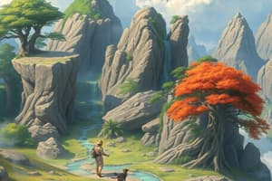
What is a Biome?
What is a Biome?
A major life zone characterized by climate, animal, and plant life.
Tropical Rainforest
Tropical Rainforest
High biodiversity, warm temperatures, and high rainfall.
Desert Biome
Desert Biome
Low precipitation, extreme temperatures, and sparse vegetation.
Savanna Biome
Savanna Biome
Signup and view all the flashcards
Temperate Forest
Temperate Forest
Signup and view all the flashcards
Taiga (Boreal Forest)
Taiga (Boreal Forest)
Signup and view all the flashcards
Tundra Biome
Tundra Biome
Signup and view all the flashcards
Latitude and Climate
Latitude and Climate
Signup and view all the flashcards
Mountain Barriers
Mountain Barriers
Signup and view all the flashcards
Climate Graphs
Climate Graphs
Signup and view all the flashcards
What does the X-axis represent in climate graphs?
What does the X-axis represent in climate graphs?
Signup and view all the flashcards
What does the Y-axis represent in climate graphs?
What does the Y-axis represent in climate graphs?
Signup and view all the flashcards
Legend Interpretation
Legend Interpretation
Signup and view all the flashcards
What is Latitude?
What is Latitude?
Signup and view all the flashcards
What is Longitude?
What is Longitude?
Signup and view all the flashcards
Map Scale
Map Scale
Signup and view all the flashcards
Bearing (in maps)
Bearing (in maps)
Signup and view all the flashcards
Contour Lines
Contour Lines
Signup and view all the flashcards
What is land use?
What is land use?
Signup and view all the flashcards
Gradient
Gradient
Signup and view all the flashcards
Study Notes
- Biomes are major life zones characterized by their vegetation, climate, and animal life
Key characteristics of major Biomes
- Tropical Rainforest: High biodiversity, warm temperatures, high rainfall
- Desert: Low precipitation, extreme temperatures, and sparse vegetation
- Savanna: Grasslands with scattered trees and seasonal rainfall
- Temperate Forest: Deciduous trees, moderate climate, and distinct seasons
- Taiga (Boreal Forest): Coniferous trees, cold climate, and longer winters
- Tundra: Cold, treeless, permafrost, and low biodiversity
Distribution of Global Biomes
- Biomes are distributed based on latitude, altitude, and climate
- Major biomes exist in specific geographic regions, like rainforests near the equator
Australia's Biomes
- Savanna: Found in Northern regions, characterized by dry grasslands
- Desert: Central Australia, defined by arid conditions
- Temperate Forest: Southern regions, with more rainfall and diverse flora
Factors Affecting Biomes
- Latitude and Climate: Influence temperature and precipitation patterns
- Mountain Barriers: Influence rainfall (orographic effect) and temperature
- Altitude (Elevation): Higher elevations have cooler temperatures and different vegetation
- Ocean Currents: Affect coastal climates and temperatures
- Distance from the Sea: Influences humidity and temperature variations
Different Types of Forests
- Tropical Rainforest: Known to be dense with high biodiversity, warm, and wet conditions
- Temperate Rainforest: Includes moderate temperatures, high rainfall, and coniferous trees
- Boreal Forest: Cold climates, coniferous trees, and short growing seasons
Rainforests and their features
- Have high humidity and temperatures
- Rich in biodiversity, home to numerous species
- Important for carbon storage and oxygen production
Climate graphs
- Climate Graphs: Display temperature and precipitation over time
- Key Elements:
- X-axis represents months
- Y-axis represents temperature (°C) and precipitation (mm)
- Interpretation of trends and anomalies is essential
Topographic map skills
- BOLTSS:
- B: Border
- O: Orientation (compass rose)
- L: Legend
- T: Title
- S: Scale
- S: Source
- Understanding cardinal directions (N, S, E, W) and their bearings is crucial
Distance
- Measuring distances using the map scale is necessary
Scale
- Ratio of distance on the map to actual distance on the ground
Bearing
- Direction in degrees from a reference point (usually north)
Area and Grid References
- Identifying locations using grid coordinates is essential
Contour Lines
- Lines connect points of equal elevation, indicating terrain relief
Height and Relief
- Understanding the elevation of landforms is important
- Relief refers to the variation in elevation across an area
- Maps may use shading or coloring to represent elevation and relief visually
- Determine the difference in height between two points in an area, either the highest minus the lowest point
Slope Aspect
- Direction a slope faces, affecting sunlight and moisture, from the highest point to the lowest point at a site
Quadrants
- Maps are divided into four sections for easier navigation
- Each quadrant can be identified using grid references
Legend Interpretation
- Understanding symbols for human (roads, buildings) and physical features (rivers, mountains)
Land Use
- Understanding how different areas are utilized (urban, agricultural, recreational)
- Analyses of the impact of land use on the environment and society need consideration
Gradient
- How steep something is from one point to another
- How calculate: Rise divided by run= gradient. Simplify fraction after and convert into ratio
- To simplify the fraction, divide top and bottom by the top number
- Run: Distance between each point
- Rise: Difference in height between each point
- Smaller the number the steeper the slope
World Mapping: Latitude and Longitude
- Latitude: Measures north/south parallel to the equator
- Longitude: Measures east/west parallel to the prime meridian
- Used for precise location identification and measured in degrees
Map/Graph Interpretation
- Skills include analyzing data, identifying trends, and understanding geographical relationships
Studying That Suits You
Use AI to generate personalized quizzes and flashcards to suit your learning preferences.