Podcast
Questions and Answers
Which geographic features separated ancient China from the rest of the world?
Which geographic features separated ancient China from the rest of the world?
- Oceans and seas
- Deserts and mountains (correct)
- Rivers and lakes
- Plains and plateaus
What is the highest mountain range in the world that borders southern China?
What is the highest mountain range in the world that borders southern China?
- The Andes Mountains
- The Himalayan Mountains (correct)
- The Alps
- The Rocky Mountains
Which desert is located in the eastern part of Outer China?
Which desert is located in the eastern part of Outer China?
- The Sahara Desert
- The Mojave Desert
- The Atacama Desert
- The Gobi Desert (correct)
What is the name of the depression located north of the Taklamakan Desert?
What is the name of the depression located north of the Taklamakan Desert?
Which plain is located to the east of the Gobi Desert?
Which plain is located to the east of the Gobi Desert?
What is the main section of China where most of ancient Chinese history took place?
What is the main section of China where most of ancient Chinese history took place?
Which group of people lived in the Gobi Desert and were enemies of the Chinese?
Which group of people lived in the Gobi Desert and were enemies of the Chinese?
Which two main areas make up Inner China?
Which two main areas make up Inner China?
Which river is sometimes called the 'cradle of the Chinese civilization'?
Which river is sometimes called the 'cradle of the Chinese civilization'?
Which river is located in southern China and is ideal for growing rice?
Which river is located in southern China and is ideal for growing rice?
What is the nickname for the Huang He River?
What is the nickname for the Huang He River?
Which rivers helped the Chinese civilization survive and expand?
Which rivers helped the Chinese civilization survive and expand?
What kept the Chinese separate from the rest of the ancient world for a long time?
What kept the Chinese separate from the rest of the ancient world for a long time?
What did the first Chinese people do for food?
What did the first Chinese people do for food?
What is the current rank of China in terms of country size?
What is the current rank of China in terms of country size?
Flashcards are hidden until you start studying
Study Notes
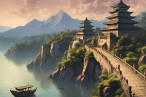
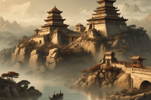
Geographic Features of Ancient China
- The Himalayas, Gobi Desert, and Taklamakan Desert served as natural barriers, isolating ancient China from other civilizations.
Highest Mountain Range
- The Himalayas, the world’s highest mountain range, borders southern China.
Eastern Desert
- The Gobi Desert is situated in the eastern part of Outer China.
Depression North of Taklamakan Desert
- The Tarim Basin is the depression located north of the Taklamakan Desert.
Plain East of Gobi Desert
- The North China Plain lies to the east of the Gobi Desert.
Main Historical Section
- The Huang He Valley is the primary region where most of ancient Chinese history unfolded.
People in the Gobi Desert
- The Mongols inhabited the Gobi Desert and were often adversaries of the Chinese.
Inner China Regions
- Inner China primarily consists of the North China Plain and the Yangtze River Basin.
Cradle of Chinese Civilization
- The Huang He River, also known as the Yellow River, is often referred to as the 'cradle of Chinese civilization.'
Southern Agriculture River
- The Yangtze River, located in southern China, provides ideal conditions for rice cultivation.
Nickname for Huang He River
- The Huang He River is nicknamed the Yellow River due to its color from silt deposits.
Rivers for Survival and Expansion
- The Yangtze and Huang He rivers were critical for the survival and expansion of Chinese civilization.
Isolation Factors
- Geographic features, including mountains and deserts, kept the Chinese civilization separate from the rest of the ancient world for prolonged periods.
Early Food Sources
- The first Chinese people engaged in agriculture and hunting to obtain food.
Current Size Rank of China
- China ranks as the fourth largest country in the world by total area.
Studying That Suits You
Use AI to generate personalized quizzes and flashcards to suit your learning preferences.