Podcast
Questions and Answers
What lies just southeast of the Himalayan Mountains?
What lies just southeast of the Himalayan Mountains?
- The Yellow Sea
- The Gobi Desert
- The Plateau of Tibet (correct)
- The Tibetan Tundra
Where is China's main tropical rainforest located?
Where is China's main tropical rainforest located?
- Tibetan Plateau
- Hainan Province (correct)
- Kunlun Mountains
- Yunnan Province
What is the largest desert in east Asia?
What is the largest desert in east Asia?
- The Himalayan Desert
- The Tibetan Desert
- The Yellow Desert
- The Gobi Desert (correct)
Why did Ancient China initially develop independently?
Why did Ancient China initially develop independently?
What is the staple food for the Chinese culture?
What is the staple food for the Chinese culture?
What are the two rivers along which Ancient China developed?
What are the two rivers along which Ancient China developed?
Which mountain range in China serves as a natural boundary between India and the Tibetan Plateau?
Which mountain range in China serves as a natural boundary between India and the Tibetan Plateau?
What were the major advantages of natural barriers in Ancient China's development?
What were the major advantages of natural barriers in Ancient China's development?
Which of the following was NOT one of the distinct regions of Ancient China based on the text?
Which of the following was NOT one of the distinct regions of Ancient China based on the text?
What is the highest peak in the Himalayan Mountains, which are significant in China's geography?
What is the highest peak in the Himalayan Mountains, which are significant in China's geography?
Flashcards
Plateau of Tibet
Plateau of Tibet
Located southeast of the Himalayan Mountains, extending north to the Kunlun Mountains.
Hainan Province
Hainan Province
China's southernmost and smallest province, featuring a tropical rainforest and diverse plant and animal life.
Yunnan Province
Yunnan Province
Located on the southwest tip of China, known for its Xishuangbanna tropical rainforest with diverse plant and animal life.
East China, South China, and Yellow Seas
East China, South China, and Yellow Seas
Signup and view all the flashcards
Gobi Desert
Gobi Desert
Signup and view all the flashcards
Tibetan Tundra
Tibetan Tundra
Signup and view all the flashcards
Ancient China's Isolation
Ancient China's Isolation
Signup and view all the flashcards
Benefits of Natural Barriers
Benefits of Natural Barriers
Signup and view all the flashcards
Rivers of Ancient China
Rivers of Ancient China
Signup and view all the flashcards
Impact of China's Natural Barriers
Impact of China's Natural Barriers
Signup and view all the flashcards
Study Notes
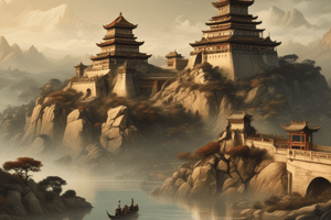
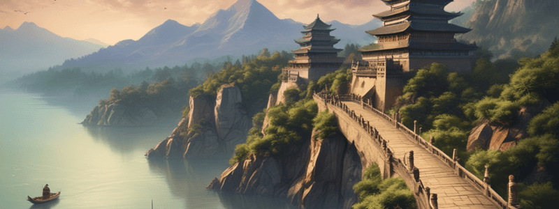
Geography of China
- The Plateau of Tibet lies southeast of the Himalayan Mountains and extends north to the Kunlun Mountains.
- Hainan Province is the southernmost province and the smallest in China, with a tropical rainforest, rich in diverse plant and animal life.
- Yunnan Province, located on the southwest tip of China, is home to the Xishuangbanna tropical rainforest, also rich in diverse plant and animal life.
Seas in China
- The East China Sea, South China Sea, and Yellow Sea border the east coast of China and extend into the Pacific Ocean.
- The East Sea is north of Taiwan and on the very east coast of China.
- The South Sea is south of Taiwan along the southeast coast of China.
- The Yellow Sea lies along the eastern coast of China between China and the Korean Peninsula.
Desert and Tundra
- The Gobi Desert is the largest desert in east Asia, spanning roughly 1,000 miles across central Asia.
- The Gobi Desert can be divided into five sub-regions: the Eastern Gobi Desert steppe, the Alashan plateau, the Gobi Lakes Valley desert steppe, Dzungarian Basin semi-desert, and the Tian Shan range.
- The Tibetan Tundra is located in the Tibetan plateau and has the coldest temperatures, limiting the use of its land severely.
Ancient China
- Ancient China was isolated due to China's physical geography, with surrounding desert, mountains, and seas creating natural barriers that protected the Ancient Chinese civilization from outside invaders.
- The natural barriers allowed Ancient China to develop independently without any outside influences.
- Ancient China developed along The Yellow River and Yangtze River, which are still protected today by natural barriers.
Impact of Geography on Development
- China's natural barriers had both advantages (protection from outsiders) and disadvantages (difficulty in trade with other early civilizations).
- The natural barriers created four distinct regions in Ancient China: mountains, jungles, deserts, and tundra.
Studying That Suits You
Use AI to generate personalized quizzes and flashcards to suit your learning preferences.