Podcast
Questions and Answers
How do clouds influence Earth's temperature?
How do clouds influence Earth's temperature?
- Clouds only reflect sunlight, leading to a cooling effect.
- Clouds trap heat at night and reflect sunlight during the day. (correct)
- Clouds only trap heat, leading to a warming effect.
- Clouds have no significant impact on Earth's temperature.
High-pressure zones, common in desert regions, tend to promote cloud cover and cooling due to rising air.
High-pressure zones, common in desert regions, tend to promote cloud cover and cooling due to rising air.
False (B)
What is the primary cause of seasonal changes on Earth?
What is the primary cause of seasonal changes on Earth?
Earth's axial tilt
Areas covered in ________ have a high albedo, reflecting a large amount of sunlight.
Areas covered in ________ have a high albedo, reflecting a large amount of sunlight.
Match the isotherm behavior with the geographic area:
Match the isotherm behavior with the geographic area:
Which factor is MOST responsible for the uneven distribution of solar energy across the Earth's surface?
Which factor is MOST responsible for the uneven distribution of solar energy across the Earth's surface?
The Torrid Zone is characterized by consistently moderate temperatures due to its distance from the equator.
The Torrid Zone is characterized by consistently moderate temperatures due to its distance from the equator.
What happens to isotherms during summer in the Northern Hemisphere?
What happens to isotherms during summer in the Northern Hemisphere?
Isotherms shift more dramatically over oceans compared to land due to the high heat capacity of water.
Isotherms shift more dramatically over oceans compared to land due to the high heat capacity of water.
Explain how the distribution of land and water masses affects temperature variations, and name the phenomenon.
Explain how the distribution of land and water masses affects temperature variations, and name the phenomenon.
Temperature generally ______ with increasing altitude at an average rate of 6.5°C per 1000m. This is called the Lapse Rate.
Temperature generally ______ with increasing altitude at an average rate of 6.5°C per 1000m. This is called the Lapse Rate.
What is the primary function of isotherms on a map?
What is the primary function of isotherms on a map?
Match each heat zone with its latitudinal location:
Match each heat zone with its latitudinal location:
What is the effect of warm ocean currents on isotherms?
What is the effect of warm ocean currents on isotherms?
In the Southern Hemisphere, isotherms are generally more _________ than in the Northern Hemisphere due to a greater proportion of ocean coverage.
In the Southern Hemisphere, isotherms are generally more _________ than in the Northern Hemisphere due to a greater proportion of ocean coverage.
Which of the following best describes the primary characteristic of the Temperate Zone?
Which of the following best describes the primary characteristic of the Temperate Zone?
Warm ocean currents generally decrease the temperature of nearby coastal landmasses.
Warm ocean currents generally decrease the temperature of nearby coastal landmasses.
How do winds contribute to the distribution of temperature on Earth?
How do winds contribute to the distribution of temperature on Earth?
Which of the following regions is LEAST likely to experience extreme temperature variations?
Which of the following regions is LEAST likely to experience extreme temperature variations?
The Frigid Zones are characterized by receiving very slanting or no sunlight during ______, leading to extremely cold temperatures.
The Frigid Zones are characterized by receiving very slanting or no sunlight during ______, leading to extremely cold temperatures.
Flashcards
Heat on Earth
Heat on Earth
Energy derived mainly from solar radiation, geothermal heat, and human activities.
Torrid Zone
Torrid Zone
The hottest heat zone, located between the Tropic of Cancer and Capricorn (23.5° N/S), receiving direct sunlight.
Temperate Zones
Temperate Zones
A heat zone located between the tropics and polar circles (23.5° – 66.5° N/S) with moderate temperatures and four distinct seasons.
Frigid Zones
Frigid Zones
Signup and view all the flashcards
Latitude's Effect on Temperature
Latitude's Effect on Temperature
Signup and view all the flashcards
Altitude's Effect on Temperature
Altitude's Effect on Temperature
Signup and view all the flashcards
Land and Water Distribution
Land and Water Distribution
Signup and view all the flashcards
Ocean Currents
Ocean Currents
Signup and view all the flashcards
Winds effect on Temperature
Winds effect on Temperature
Signup and view all the flashcards
Temperature Variation on Earth
Temperature Variation on Earth
Signup and view all the flashcards
High-Pressure Zones
High-Pressure Zones
Signup and view all the flashcards
Low-Pressure Zones
Low-Pressure Zones
Signup and view all the flashcards
Albedo
Albedo
Signup and view all the flashcards
Earth's Tilt Impact
Earth's Tilt Impact
Signup and view all the flashcards
Summer Solstice (June 21)
Summer Solstice (June 21)
Signup and view all the flashcards
Isotherms
Isotherms
Signup and view all the flashcards
Isotherms & Latitude
Isotherms & Latitude
Signup and view all the flashcards
Isotherm Bending
Isotherm Bending
Signup and view all the flashcards
Isotherm Spacing
Isotherm Spacing
Signup and view all the flashcards
Ocean Currents Shift Isotherms
Ocean Currents Shift Isotherms
Signup and view all the flashcards
Study Notes
- Earth's temperature varies due to solar radiation, atmospheric conditions, and geographical factors.
- The sun is the primary source of heat for Earth.
Heat and Heat Zones
- Heat on Earth mainly comes from solar radiation, with minor contributions from geothermal heat and human activities.
- The amount of heat a place receives depends on latitude, altitude, land-water contrast, and atmospheric conditions
Heat Zones
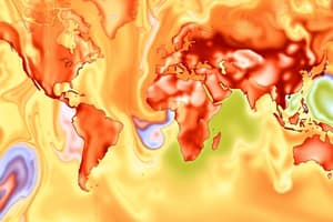
- Earth is divided into three major heat zones based on solar radiation intensity at different latitudes.
Torrid Zone (Tropical Zone) [0° – 23.5° N/S]
- Located between the Tropic of Cancer (23.5° N) and Tropic of Capricorn (23.5° S).
- Receives direct sunlight throughout the year
- It is the hottest zone on Earth.
- Examples include the Amazon Basin, Sahara Desert, South Asia, and Central Africa.
Temperate Zones [23.5° – 66.5° N/S]
- Located between the Tropics and the Polar Circles.
- Receives slanting rays of the Sun, resulting in moderate temperatures.
- Experiences four distinct seasons: summer, winter, spring, and autumn.
- Examples include the USA, Europe, China, and Argentina.
Frigid Zones (Polar Zones) [66.5° – 90° N/S]
- Located beyond the Arctic Circle (66.5° N) and Antarctic Circle (66.5° S).
- Receives minimal or no sunlight during winter.
- Extremely cold throughout the year, with permafrost in some areas.
- Examples include Greenland, Antarctica, Siberia, and Canada.
Factors Affecting Temperature Distribution
- Several factors influence temperature distribution on Earth.
Latitude
- Areas near the Equator receive direct sunlight, making them warmer.
- As latitude increases, sunlight becomes more slanting, reducing heat intensity.
Altitude (Elevation)
- Temperature decreases with altitude at a rate of 6.5°C per 1000m.
- Higher altitudes are colder because of thinner air and lower heat retention.
Land and Water Distribution
- Land heats and cools quickly, causing inland areas to experience extreme temperatures.
- Oceans heat and cool slowly, moderating coastal climates through maritime influence.
Ocean Currents
- Warm currents, such as the Gulf Stream, raise temperatures of nearby land.
- Cold currents, such as the Labrador Current, lower the temperatures of coastal regions.
Winds and Pressure Systems
- Winds transfer heat; warm winds increase temperature, while cold winds reduce it.
- High-pressure zones trap heat, while low-pressure zones promote cloud cover and cooling.
Cloud Cover and Albedo
- Clouds trap heat at night, causing a warming effect, but reflect sunlight during the day, causing a cooling effect.
- Snow-covered areas have high albedo, reflecting most sunlight and staying cold.
Seasonal Changes
- Earth’s tilt (23.5°) causes seasons by changing the angle of sunlight received at different latitudes.
- During the Summer Solstice (June 21), the Northern Hemisphere receives maximum heat.
- During the Winter Solstice (December 21), the Northern Hemisphere receives the least heat.
Isotherms
- Isotherms are imaginary lines on a map that connect places with the same temperature at a given time.
- Used to study global temperature distribution.
General Characteristics of Isotherms
- Isotherms run roughly parallel to latitude lines since temperature varies mainly by latitude.
- Over oceans, isotherms remain stable due to water's high heat capacity.
- Isotherms bend over land due to rapid heating/cooling effects.
- Closer spacing indicates rapid temperature change in deserts and polar regions.
- In oceans and equatorial areas, isotherms are more spaced out due to stable temperatures.
- Warm currents shift isotherms poleward.
- Cold currents shift isotherms equatorward.
Shifting of Isotherms
- Isotherms shift seasonally.
Summer Shifts
- During summer (June-July in the Northern Hemisphere, December-January in the Southern Hemisphere), isotherms shift poleward.
- Continental regions experience higher temperature rises than oceans.
Winter Shifts
- During winter (December-January in the Northern Hemisphere, June-July in the Southern Hemisphere), isotherms shift equatorward.
- Oceans retain heat longer, causing milder coastal winters.
Key Observations in Isotherm Shifting
- Over land, isotherms shift more due to quick heating and cooling.
- Over oceans, isotherms shift less because of water’s heat retention.
- In the Southern Hemisphere, isotherms are more stable because oceans dominate.
- Near the poles, seasonal shifts are strongest due to extreme temperature variations.
Studying That Suits You
Use AI to generate personalized quizzes and flashcards to suit your learning preferences.