Podcast
Questions and Answers
Explain how the tilt of Earth's axis, combined with its rotation, results in the seasons we experience.
Explain how the tilt of Earth's axis, combined with its rotation, results in the seasons we experience.
The tilt causes different hemispheres to receive more direct sunlight at different times of the year. Coupled with Earth's rotation, this uneven distribution of sunlight leads to seasonal changes.
Describe the relationship between Earth's rotation and the Coriolis effect, and provide an example of its impact on weather patterns.
Describe the relationship between Earth's rotation and the Coriolis effect, and provide an example of its impact on weather patterns.
Earth's rotation causes the Coriolis effect, which deflects moving objects. This deflection influences the direction of wind patterns, and the flow of ocean currents.
How does the speed of Earth's rotation vary with latitude, and what is the primary reason for this variation?
How does the speed of Earth's rotation vary with latitude, and what is the primary reason for this variation?
The speed of rotation is fastest at the Equator and decreases toward the poles, this is because the circumference is largest at the Equator.
Explain how the international time zone system is directly related to Earth's rotation. Include the longitudinal width of a standard time zone.
Explain how the international time zone system is directly related to Earth's rotation. Include the longitudinal width of a standard time zone.
Describe how Earth's rotation influences daily human activities, providing at least two specific examples.
Describe how Earth's rotation influences daily human activities, providing at least two specific examples.
Explain how the flattening of Earth at the poles and bulging at the Equator are related to its rotation.
Explain how the flattening of Earth at the poles and bulging at the Equator are related to its rotation.
How might a change in the rate of Earth's rotation affect global navigation systems like GPS? Explain briefly.
How might a change in the rate of Earth's rotation affect global navigation systems like GPS? Explain briefly.
Describe how the cycle of day and night, caused by Earth's rotation, affects energy consumption patterns in urban areas.
Describe how the cycle of day and night, caused by Earth's rotation, affects energy consumption patterns in urban areas.
Explain how Earth's rotation and its relation to time zones impact international business activities and communications.
Explain how Earth's rotation and its relation to time zones impact international business activities and communications.
How does the study of Earth's rotation help in understanding long-term climate patterns and changes?
How does the study of Earth's rotation help in understanding long-term climate patterns and changes?
Flashcards
Geography
Geography
The study of the Earth's surface, including its physical features, human populations, and the interactions between them.
Rotation
Rotation
The spinning of the Earth on its axis.
Physical geography
Physical geography
Focuses on the natural environment, including landforms, climate, vegetation, soils, and water bodies.
Human geography
Human geography
Signup and view all the flashcards
Geographic coordinate system
Geographic coordinate system
Signup and view all the flashcards
Latitude
Latitude
Signup and view all the flashcards
Longitude
Longitude
Signup and view all the flashcards
Earth's axis
Earth's axis
Signup and view all the flashcards
Coriolis effect
Coriolis effect
Signup and view all the flashcards
Day and night
Day and night
Signup and view all the flashcards
Study Notes
- Geography and rotation are fundamental concepts in understanding Earth's characteristics and its place in the solar system.
- Geography is the study of the Earth's surface, including its physical features, human populations, and the interactions between them.
- Rotation refers to the spinning of the Earth on its axis.
Earth's Geography
- Physical geography focuses on the natural environment.
- It studies landforms, climate, vegetation, soils, and water bodies.
- Human geography examines the spatial distribution of human activities and their impact on the Earth.
- It covers topics like population, culture, economics, and urbanization.
- Geography also involves the study of the interactions between humans and the environment.
- This includes topics such as resource management, pollution, and conservation.
Geographic Coordinate System
- A geographic coordinate system is used to locate points on the Earth's surface.
- Latitude measures the angular distance north or south of the Equator.
- Latitude lines are called parallels.
- The Equator is 0° latitude, and the North and South Poles are 90° N and 90° S, respectively.
- Longitude measures the angular distance east or west of the Prime Meridian.
- Longitude lines are called meridians.
- The Prime Meridian is 0° longitude and passes through Greenwich, England.
- Longitude ranges from 0° to 180° east and west.
Earth's Rotation
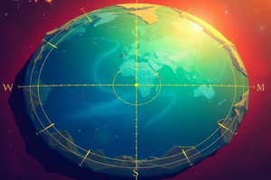
- Earth rotates on its axis, an imaginary line passing through the North and South Poles.
- The Earth's axis is tilted at an angle of approximately 23.5° relative to its orbital plane around the Sun.
- This tilt is responsible for the seasons.
- Earth rotates from west to east, which is why the Sun appears to rise in the east and set in the west.
- One complete rotation takes approximately 24 hours, which defines a day.
- The speed of rotation varies with latitude.
- It is fastest at the Equator (about 1,670 km/h) and decreases towards the poles.
Effects of Earth's Rotation
- The most obvious effect of Earth's rotation is the cycle of day and night.
- As Earth rotates, different parts of the planet are exposed to sunlight, creating day, while the opposite side experiences night.
- Rotation causes the Coriolis effect.
- The Coriolis effect deflects moving objects (like air and ocean currents) to the right in the Northern Hemisphere and to the left in the Southern Hemisphere.
- This effect influences weather patterns and ocean currents.
- Rotation also contributes to the flattening of Earth at the poles and bulging at the Equator.
- The centrifugal force caused by rotation is stronger at the Equator than at the poles.
- The rotation of the Earth is used to define time zones.
- The Earth is divided into 24 time zones, each approximately 15° of longitude wide, corresponding to one hour of Earth's rotation.
Relationship between Geography and Rotation
- Earth’s rotation influences geographic phenomena such as weather patterns, ocean currents, and the distribution of climate zones.
- The Coriolis effect, resulting from Earth's rotation, plays a key role in shaping regional climates and ecosystems, which are studied in geography.
- The cycle of day and night, caused by rotation, affects human activities, agriculture, and energy consumption, all of which are geographic considerations.
- Time zones, based on Earth’s rotation, are fundamental for coordinating global economic activities and communication, reflecting the interconnectedness studied in geography.
- The Earth’s shape and tilt, influenced by rotation, determine the distribution of solar energy, leading to various climate zones and biomes across different geographic regions.
Studying That Suits You
Use AI to generate personalized quizzes and flashcards to suit your learning preferences.