Podcast
Questions and Answers
Which river is known for its badland topography called the Chambal ravines?
Which river is known for its badland topography called the Chambal ravines?
- Kosi
- Ghaghara
- Sarda
- Chambal (correct)
Where does the Chambal river ultimately flow into?
Where does the Chambal river ultimately flow into?
- Ganges
- Yamuna (correct)
- Brahmaputra
- Sutlej
Which river originates from the Milam glacier and is known as Goriganga?
Which river originates from the Milam glacier and is known as Goriganga?
- Mahananda
- Damodar
- Sarda (correct)
- Ramganga
Which river is referred to as the 'sorrow of Bengal'?
Which river is referred to as the 'sorrow of Bengal'?
What is the main tributary of the Damodar river?
What is the main tributary of the Damodar river?
The Kosi river is considered an antecedent river; where does its main stream, Arun, originate?
The Kosi river is considered an antecedent river; where does its main stream, Arun, originate?
Which river changes its course to the southwest after crossing the Shiwalik hills?
Which river changes its course to the southwest after crossing the Shiwalik hills?
Which river joins the Ganga as its last left bank tributary in West Bengal?
Which river joins the Ganga as its last left bank tributary in West Bengal?
What significant river is believed to have traversed the entire longitudinal extent of the Himalaya during the Miocene period?
What significant river is believed to have traversed the entire longitudinal extent of the Himalaya during the Miocene period?
What caused the dismemberment of the Indo-Brahma river into three main drainage systems?
What caused the dismemberment of the Indo-Brahma river into three main drainage systems?
Which river system is the largest river basin in the world and originates from the Kailash Mountain range?
Which river system is the largest river basin in the world and originates from the Kailash Mountain range?
Which factor was responsible for diverting the Ganga and Brahmaputra systems to flow towards the Bay of Bengal?
Which factor was responsible for diverting the Ganga and Brahmaputra systems to flow towards the Bay of Bengal?
How long is the Indus River in India?
How long is the Indus River in India?
What is the primary reason for the remarkable continuity of the Shiwalik?
What is the primary reason for the remarkable continuity of the Shiwalik?
What is the name of the river before it emerges in India as the Brahmaputra?
What is the name of the river before it emerges in India as the Brahmaputra?
Which river is known as 'Singi Khamban' in Tibet?
Which river is known as 'Singi Khamban' in Tibet?
Which of the following is a major left bank tributary of the Brahmaputra?
Which of the following is a major left bank tributary of the Brahmaputra?
Which terrain does the Indus river cut across to form a spectacular gorge?
Which terrain does the Indus river cut across to form a spectacular gorge?
Where does the Brahmaputra enter Bangladesh?
Where does the Brahmaputra enter Bangladesh?
What significant characteristic of the Brahmaputra is often attributed to its tributaries?
What significant characteristic of the Brahmaputra is often attributed to its tributaries?
Which river system is primarily associated with the northern part of the Peninsular drainage?
Which river system is primarily associated with the northern part of the Peninsular drainage?
How do most major Peninsular rivers generally flow?
How do most major Peninsular rivers generally flow?
Which of these rivers is characteristic of the Peninsular drainage system's age?
Which of these rivers is characteristic of the Peninsular drainage system's age?
What best describes the flow characteristics of Peninsular rivers?
What best describes the flow characteristics of Peninsular rivers?
Which of the following tributaries joins the right bank of the Indus?
Which of the following tributaries joins the right bank of the Indus?
What is the total length the Chenab flows before entering Pakistan?
What is the total length the Chenab flows before entering Pakistan?
From which mountain pass does the Ravi originate?
From which mountain pass does the Ravi originate?
Which river is also known as Chandrabhaga?
Which river is also known as Chandrabhaga?
Where does the Jhelum river rise from?
Where does the Jhelum river rise from?
Which tributary of the Indus flows through the Punjab plains before joining the Satluj?
Which tributary of the Indus flows through the Punjab plains before joining the Satluj?
What altitude does the Satluj originate at in Tibet?
What altitude does the Satluj originate at in Tibet?
What is the significance of the Ganga in India?
What is the significance of the Ganga in India?
What percentage of the Kaveri basin is located in Karnataka?
What percentage of the Kaveri basin is located in Karnataka?
How high does the Narmada originate from the Amarkantak plateau?
How high does the Narmada originate from the Amarkantak plateau?
What is a significant tributary of the Kaveri river?
What is a significant tributary of the Kaveri river?
What is the length of the estuary formed by the Narmada river at its mouth?
What is the length of the estuary formed by the Narmada river at its mouth?
What major project has been constructed on the Narmada river?
What major project has been constructed on the Narmada river?
What is one reason for the pollution of rivers?
What is one reason for the pollution of rivers?
What is one approach that can help manage river water disputes?
What is one approach that can help manage river water disputes?
What aspect of river management may be influenced by uneven terrain?
What aspect of river management may be influenced by uneven terrain?
What is the length of the Ganga river?
What is the length of the Ganga river?
Which tributary of the Alaknanda meets it at Karna Prayag?
Which tributary of the Alaknanda meets it at Karna Prayag?
At which location does the Alaknanda meet the Bhagirathi?
At which location does the Alaknanda meet the Bhagirathi?
Which state does NOT share the Ganga river?
Which state does NOT share the Ganga river?
What is one of the main objectives of the Namami Gange Programme?
What is one of the main objectives of the Namami Gange Programme?
Which is the longest tributary of the Ganga?
Which is the longest tributary of the Ganga?
Where does the Ganga enter the plains?
Where does the Ganga enter the plains?
Which is a right bank tributary of the Ganga?
Which is a right bank tributary of the Ganga?
Flashcards
Indus River
Indus River
The Indus River is the longest and most important river in Pakistan. It originates in the Tibetan Plateau and flows through Pakistan before emptying into the Arabian Sea.
Panjnad
Panjnad
The Panjnad is the name given to the five rivers of Punjab: the Satluj, the Beas, the Ravi, the Chenab, and the Jhelum. These rivers merge before joining the Indus.
Jhelum River
Jhelum River
The Jhelum River is an important tributary of the Indus. It originates in Kashmir and flows through Srinagar and the Wular Lake before entering Pakistan.
Chenab River
Chenab River
Signup and view all the flashcards
Ravi River
Ravi River
Signup and view all the flashcards
Beas River
Beas River
Signup and view all the flashcards
Satluj River
Satluj River
Signup and view all the flashcards
Ganga River
Ganga River
Signup and view all the flashcards
Shiwalik River
Shiwalik River
Signup and view all the flashcards
Miocene Period
Miocene Period
Signup and view all the flashcards
Dismemberment of the Shiwalik River
Dismemberment of the Shiwalik River
Signup and view all the flashcards
Pleistocene Upheaval
Pleistocene Upheaval
Signup and view all the flashcards
Potwar Plateau (Delhi Ridge)
Potwar Plateau (Delhi Ridge)
Signup and view all the flashcards
Downthrusting of the Malda Gap
Downthrusting of the Malda Gap
Signup and view all the flashcards
Indus River System
Indus River System
Signup and view all the flashcards
Bokhar Chu
Bokhar Chu
Signup and view all the flashcards
What is the Ganga River?
What is the Ganga River?
Signup and view all the flashcards
Where does the Ganges originate?
Where does the Ganges originate?
Signup and view all the flashcards
What states does the Ganges flow through?
What states does the Ganges flow through?
Signup and view all the flashcards
What is the Yamuna River?
What is the Yamuna River?
Signup and view all the flashcards
What are some tributaries of the Yamuna River?
What are some tributaries of the Yamuna River?
Signup and view all the flashcards
What is the Yamuna River's role in irrigation?
What is the Yamuna River's role in irrigation?
Signup and view all the flashcards
Explain the "Namami Gange Programme"
Explain the "Namami Gange Programme"
Signup and view all the flashcards
What is the Son River?
What is the Son River?
Signup and view all the flashcards
What is the Chambal River known for?
What is the Chambal River known for?
Signup and view all the flashcards
Which river joins the Ganga near Patna?
Which river joins the Ganga near Patna?
Signup and view all the flashcards
What river joins the Ganga at Chhapra?
What river joins the Ganga at Chhapra?
Signup and view all the flashcards
What river joins the Ganga in West Bengal, originating in Tibet?
What river joins the Ganga in West Bengal, originating in Tibet?
Signup and view all the flashcards
What river is called Goriganga in the Himalayas, Kali in Nepal, and joins the Ghaghara?
What river is called Goriganga in the Himalayas, Kali in Nepal, and joins the Ghaghara?
Signup and view all the flashcards
What river joins the Ganga near Kannauj, originating in the Garhwal hills?
What river joins the Ganga near Kannauj, originating in the Garhwal hills?
Signup and view all the flashcards
Which river joins the Ganga west of Patna?
Which river joins the Ganga west of Patna?
Signup and view all the flashcards
What river is known as the 'sorrow of Bengal' but tamed by the Damodar Valley Corporation?
What river is known as the 'sorrow of Bengal' but tamed by the Damodar Valley Corporation?
Signup and view all the flashcards
Namami Devi Narmade
Namami Devi Narmade
Signup and view all the flashcards
River Linking
River Linking
Signup and view all the flashcards
Uneven Terrain
Uneven Terrain
Signup and view all the flashcards
Water Lifting
Water Lifting
Signup and view all the flashcards
Surplus Water
Surplus Water
Signup and view all the flashcards
The Brahmaputra's Origin
The Brahmaputra's Origin
Signup and view all the flashcards
The Brahmaputra in Tibet
The Brahmaputra in Tibet
Signup and view all the flashcards
River Water Pollution
River Water Pollution
Signup and view all the flashcards
River Silt Load
River Silt Load
Signup and view all the flashcards
The Brahmaputra's Emergence
The Brahmaputra's Emergence
Signup and view all the flashcards
Uneven Seasonal Flow
Uneven Seasonal Flow
Signup and view all the flashcards
The Brahmaputra in Arunachal Pradesh
The Brahmaputra in Arunachal Pradesh
Signup and view all the flashcards
The Brahmaputra in Assam
The Brahmaputra in Assam
Signup and view all the flashcards
What is an Antecedent River?
What is an Antecedent River?
Signup and view all the flashcards
The Brahmaputra's Journey to the Bay of Bengal
The Brahmaputra's Journey to the Bay of Bengal
Signup and view all the flashcards
Why the Brahmaputra Floods
Why the Brahmaputra Floods
Signup and view all the flashcards
Study Notes
Drainage Systems
- Drainage is the flow of water through defined channels, preventing large-scale flooding.
- Drainage systems are networks of channels.
- Drainage patterns vary based on geological time period, rock type, topography, slope, water quantity, and flow periodicity.
- Drainage patterns can be dendritic (tree-like), radial (flowing outwards from a hill), trellis (primary tributaries parallel, secondary tributaries at right angles), or centripetal (flowing inwards to a central point).
- A catchment area is the area drained by a river and its tributaries.
- A drainage basin is the area drained by a river and its tributaries, with a defined boundary.
- Watersheds are the boundaries between drainage basins. Watersheds are smaller than river basins. Changes in one part of a basin or watershed affect the entire area.
- Drainage basins are used for micro, meso, or macro planning.
- Drainage systems in India are categorized by discharge (orientations towards the sea, Arabian Sea or Bay of Bengal), basin size (major, medium, minor)
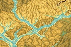
Himalayan Drainage
- The Himalayan drainage system is a complex network formed through geological processes that includes the Ganga, Indus, and Brahmaputra river systems.
- These rivers flow through gorges, V-shaped valleys, rapids, and waterfalls in mountainous regions.
- They transition to wide valleys and extensive floodplains in the plains, forming depositional features (like deltas).
- The Himalayas are the source for many of the rivers. A long geological history is the cause.
- Rivers have varied patterns based on different geological origins.
- The rivers' journey shapes the landscape.
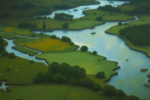
Peninsular Drainage
- Peninsular drainage is older than Himalayan drainage.
- The Western Ghats act as a water divide. Rivers generally flow eastward to the Bay of Bengal or to smaller rivers flowing to the Arabian Sea.
- Rivers in the Peninsular system have a fixed course with less meandering than Himalayan rivers.
- The Narmada and Tapi are exceptions that flow westward due to rift valley characteristics.
- The rivers of Peninsular India originate primarily from the Western Ghats and the Eastern Ghats and are known for their relatively stable courses and moderate seasonal variations in flow. They are characterized by fixed courses and less meandering, compared to Himalayan rivers.
Studying That Suits You
Use AI to generate personalized quizzes and flashcards to suit your learning preferences.