Podcast
Questions and Answers
What is the largest freshwater lake in Japan?
What is the largest freshwater lake in Japan?
- Lake Ashi
- Lake Toya
- Lake Chuzenji
- Lake Biwa (correct)
What is the most populous island in Japan?
What is the most populous island in Japan?
- Hokkaido
- Kyushu
- Shikoku
- Honshu (correct)
What is the name of the megalopolis that includes the Greater Tokyo Area and Keihanshin megapoles?
What is the name of the megalopolis that includes the Greater Tokyo Area and Keihanshin megapoles?
- Kanto Plain
- Nobi Plain
- Osaka Plain
- Taiheiyō Belt (correct)
Which region of Japan comprises only one prefecture?
Which region of Japan comprises only one prefecture?
What percentage of Japan's total area is reclaimed land?
What percentage of Japan's total area is reclaimed land?
What is the name of the incipient subduction zone consisting of thrust faults on the eastern margin of the Sea of Japan?
What is the name of the incipient subduction zone consisting of thrust faults on the eastern margin of the Sea of Japan?
What is the percentage of energy produced from nuclear power in Japan as of 2011?
What is the percentage of energy produced from nuclear power in Japan as of 2011?
What is the name of the group of islands located to the south and east of the main islands of the Japanese archipelago and are all administered by Tokyo Metropolis?
What is the name of the group of islands located to the south and east of the main islands of the Japanese archipelago and are all administered by Tokyo Metropolis?
What is the name of the largest of the three major basins in the Sea of Japan?
What is the name of the largest of the three major basins in the Sea of Japan?
Flashcards
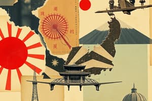
Japan's Archipelago
Japan's Archipelago
Japan is a group of over 14,000 islands, with 5 main ones: Hokkaido, Honshu, Kyushu, Shikoku, and Okinawa.
Ring of Fire Location
Ring of Fire Location
Japan is located in the northwestern Pacific Ring of Fire, making it prone to earthquakes, tsunamis, and volcanoes.
Japan's Main Islands
Japan's Main Islands
Hokkaido, Honshu, Kyushu, Shikoku, and Okinawa are the five major islands forming the Japanese archipelago.
Japan's Mountainous Terrain
Japan's Mountainous Terrain
Signup and view all the flashcards
Japan's Coastal Regions
Japan's Coastal Regions
Signup and view all the flashcards
Japan's Economic Plains
Japan's Economic Plains
Signup and view all the flashcards
Japan's Land Area
Japan's Land Area
Signup and view all the flashcards
Japan's River System
Japan's River System
Signup and view all the flashcards
Japan's Exclusive Economic Zone
Japan's Exclusive Economic Zone
Signup and view all the flashcards
Study Notes
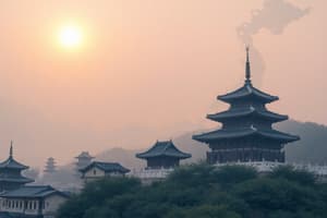
Geographical Features of Japan
- Japan is an archipelagic country consisting of over 14,000 islands, with the five main islands being Hokkaido, Honshu, Kyushu, Shikoku, and Okinawa.
- The terrain is mostly mountainous, with 66% forested areas and population clustered in urban areas along the coast, plains, and valleys.
- Japan is located in the northwestern Ring of Fire and is affected by frequent earthquakes, tsunamis, and stratovolcanoes, with three oceanic trenches to the east.
- Japan has a diverse flora and fauna, with some rare endemic species, especially in the Ogasawara Islands.
- The country has a long coastline of 29,751 km and the 8th largest Exclusive Economic Zone of 4,470,000 km2 in the world, making it rich in marine life and mineral resources.
- Japan has a population of 126 million living on 377,973.89 km2 of land, making it the second most populous island country and the 11th most populous country in the world.
- Japan has eight regions, with each region containing several prefectures, except the Hokkaido region, which comprises only Hokkaido Prefecture.
- Japan is mountainous, with a mountain range running through each of the main islands, and 73% of its area is mountainous, with scattered plains and intermontane basins covering only about 27%.
- Japan is home to 108 active volcanoes and has a long chain of mountains that runs down the middle of the archipelago, dividing it into two halves.
- The Kantō Plain, Osaka Plain, and Nōbi Plain are the most important economic, political, and cultural areas of Japan located in central Honshū, with the largest population centers and agricultural production.
- Hokkaido has multiple plains, making it the most agriculturally rich prefecture in Japan, with nearly one fourth of Japan's arable land and 22% of Japan's forests.
- Japan's rivers are steep and swift, and few are suitable for navigation except in their lower reaches, with most being less than 300 km in length, providing hydroelectric power.Geography of Japan
Rivers: The longest river in Japan is the Shinano River, which is 367 km long.
Lakes: Lake Biwa is the largest freshwater lake in Japan, covering an area of 670.3 km². It is estimated to be 13 million years old and has a diverse ecosystem with over 1,000 species and subspecies.
Coasts: The Pacific coastline south of Tokyo has many natural harbors, while the coastlines north of Tokyo, Hokkaido, and the Sea of Japan have few natural harbors. Japan has 765 km of tidal flats.
Land reclamation: Approximately 0.5% of Japan's total area is reclaimed land, with most projects occurring after World War II. Land reclamation projects were done in coastal areas for maritime and industrial factories, and artificial islands were created, such as Chubu Centrair International Airport in Ise Bay and Kansai International Airport in the middle of Osaka Bay.
Oceanography: Japan has a sea territory of 4,470,000 km², with one of the largest ocean territories with a combination of all depths from shallow to very deep sea. The eastern margin of the Sea of Japan is an incipient subduction zone consisting of thrust faults.
Geology: The Japanese archipelago is the result of subducting tectonic plates over several hundred million years. The Pacific Plate and Philippine Sea Plate are subduction plates. Japan has distributed volcanic series where the volcanic rocks change from tholeiite—calc-alkaline—alkaline with increasing distance from the trench.
Growing archipelago: Japan's landmass continues to grow gradually because of perpetual tectonic plate movements, earthquakes, stratovolcanoes, and land reclamation.
Sea of Japan: During the Pleistocene, the Japanese islands may have occasionally been connected to the Eurasian Continent via the Korea Strait and the Korean Peninsula or Sakhalin. The Sea of Japan was considered to be a frozen inner lake.
History: The onset of formation of the Japan Arc was in the Early Miocene (23 million years ago). The Sea of Japan started to open during the Early Miocene period.Geography and Energy in Japan
Geography:
- Japanese archipelago had a taiga biome and Hokkaido, Sakhalin, and the Kuril islands had mammoth steppe biome.
- The Sea of Japan has a surface area of 978,000 km2, a mean depth of 1,752 m and a maximum depth of 3,742 m.
- There are three major basins: the Yamato Basin in the southeast, the Japan Basin in the north and the Tsushima Basin in the southwest.
- Japan has 34 National Parks and 56 Quasi-National Parks designated and managed for protection and sustainable usage by the Ministry of the Environment under the Natural Parks Law.
- The Three Views of Japan are traditionally the pine-clad islands of Matsushima, the pine-clad sandbar of Amanohashidate, and Itsukushima Shrine.
- Japan's varied geographical features divide it into six principal climatic zones.
Energy:
-
As of 2011, 46.1% of energy in Japan was produced from petroleum, 21.3% from coal, 21.4% from natural gas, 4.0% from nuclear power and 3.3% from hydropower.
-
Following the 2011 Tōhoku earthquake and tsunami disaster in 2011, the nuclear reactors were shut down.
-
Japan has the third largest geothermal reserves in the world.
-
Japan's government pledged to increase renewable energy sources from 15% to 22–24% including wind and solar by 2030.
-
Geothermal energy is being heavily focused on as a source of power following the Fukushima disaster.
-
Japan has the exclusive economic zone with estimated large quantities of mineral resources such as methane clathrate, natural gas, metallic minerals, and rare-earth mineral reserves.Geography of Japan
-
Aleutian Low causes cold air to flow southeastward across Japan, bringing freezing temperatures and heavy snowfalls to central mountain ranges facing the Sea of Japan and clear skies to areas fronting on the Pacific.
-
Warmest winter temperatures are found in the Nanpō and Bonin Islands, while the coolest summer temperatures are found on the northeastern coast of Hokkaidō in Kushiro and Nemuro Subprefectures.
-
Sunshine is generally modest in quantity, ranging from about six hours per day in the Inland Sea coast to four hours per day on the Sea of Japan coast of Hokkaidō.
-
The highest recorded temperature in Japan was 41.1 °C (106.0 °F) on 23 July 2018, while the lowest was −41.0 °C (−41.8 °F) in Asahikawa on 25 January 1902.
-
Japan has a population of 126.3 million in 2019, with 90.7% of the total population living in cities.
-
Honshū is the largest island of Japan and the second most populous island in the world, with the Greater Tokyo Area on Honshu being the largest metropolitan area in the world.
-
Kyushu has the second highest population density of 307.13 persons/km2 (2016), while Shikoku has the third highest population density of 204.55 persons/km2.
-
Hokkaido is the second largest island of Japan and has the lowest population density with just 64.5 persons/km2 (2016).
-
Okinawa Prefecture has the smallest population of 1,301,462 (2014) and the highest population density of 1083.6 persons/km2.
-
Nanpō Islands are the groups of islands located to the south and east of the main islands of the Japanese archipelago and are all administered by Tokyo Metropolis.
-
The Taiheiyō Belt is a megalopolis that includes the Greater Tokyo Area and Keihanshin megapoles and has a total population of approximately 81,859,345 (2016).
-
Japan is substantially prone to earthquakes, tsunami, and volcanoes because of its location along the Pacific Ring of Fire.
-
Japan has 108 active volcanoes and is a world leader in research on causes and prediction of earthquakes.
Studying That Suits You
Use AI to generate personalized quizzes and flashcards to suit your learning preferences.