Podcast
Questions and Answers
What primarily determines the strength of atmospheric circulation that affects desert formation?
What primarily determines the strength of atmospheric circulation that affects desert formation?
- The average position of the Sun relative to the Earth (correct)
- Topography of the land
- Ocean currents
- The Earth's rotation
Which latitudinal range is most commonly associated with the formation of many deserts?
Which latitudinal range is most commonly associated with the formation of many deserts?
- 45° to 60°
- 30° to 45°
- 15° to 30° (correct)
- 0° to 15°
What phenomenon is responsible for creating a rain shadow desert?
What phenomenon is responsible for creating a rain shadow desert?
- Destruction of vegetation
- Ocean currents directing heat away from land
- Sinking humid air
- Prevailing winds lifting moisture-laden air over mountains (correct)
Which type of desert is characterized by very low average annual precipitation despite being covered in ice?
Which type of desert is characterized by very low average annual precipitation despite being covered in ice?
Why do deserts have extreme temperature fluctuations between day and night?
Why do deserts have extreme temperature fluctuations between day and night?
What primarily causes the high-pressure belts at approximately 30° north and south of the equator?
What primarily causes the high-pressure belts at approximately 30° north and south of the equator?
How does the Coriolis effect influence atmospheric and oceanic currents?
How does the Coriolis effect influence atmospheric and oceanic currents?
What factor contributes to the creation of desert conditions between 15° and 30° latitude?
What factor contributes to the creation of desert conditions between 15° and 30° latitude?
What is the significance of the trade winds in terms of historical navigation?
What is the significance of the trade winds in terms of historical navigation?
Which phenomenon does NOT contribute to the extreme dryness of the Atacama Desert?
Which phenomenon does NOT contribute to the extreme dryness of the Atacama Desert?
Flashcards
Desert Definition
Desert Definition
A desert is a region with low precipitation, characterized by aridity.
Desert Temperature Extremes
Desert Temperature Extremes
Deserts experience extreme temperatures due to lack of moisture (humidity and clouds) leading to more solar radiation absorption and heat emission.
Desert Latitudinal Location
Desert Latitudinal Location
Many deserts are found between 15° and 30° latitude in both hemispheres due to sinking air currents.
Trade Winds
Trade Winds
Signup and view all the flashcards
Rain Shadow Desert
Rain Shadow Desert
Signup and view all the flashcards
Polar Desert
Polar Desert
Signup and view all the flashcards
Earth's Driest Desert
Earth's Driest Desert
Signup and view all the flashcards
Atmospheric Circulation Driver
Atmospheric Circulation Driver
Signup and view all the flashcards
Latitude
Latitude
Signup and view all the flashcards
Angle of Incidence
Angle of Incidence
Signup and view all the flashcards
Tropical Zones
Tropical Zones
Signup and view all the flashcards
Hadley Cell
Hadley Cell
Signup and view all the flashcards
Horse Latitudes
Horse Latitudes
Signup and view all the flashcards
Trade Winds
Trade Winds
Signup and view all the flashcards
Westerlies
Westerlies
Signup and view all the flashcards
Rain Shadow Desert
Rain Shadow Desert
Signup and view all the flashcards
Coriolis Effect
Coriolis Effect
Signup and view all the flashcards
Polar Cells
Polar Cells
Signup and view all the flashcards
Study Notes
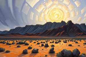
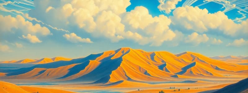
Desert Formation and Characteristics
- Approximately 30% of Earth's land surface is desert, characterized by low precipitation.
- Deserts' extreme temperatures result from low atmospheric moisture and lack of cloud cover, leading to greater solar absorption and heat emission.
- Desert location is not random; many are between 15° and 30° latitude due to atmospheric circulation patterns.
- Trade winds, created by sinking air at 30° N and S of the equator, contribute to deserts like the Sahara and Outback.
- Rain shadow deserts form when prevailing winds are forced over mountain ranges. Moisture condenses and precipitates on the windward side, leaving the leeward side dry.
- Polar deserts, in the Arctic and Antarctic, arise from sinking cold, dry air.
Atmospheric Circulation and Deserts
- Solar energy drives atmospheric and oceanic circulation, unevenly distributed across latitudes.
- High solar energy receipt occurs close to the equator, low energy at the poles.
- Latitude is the measure of an Earth circle parallel to the equator. Angle of incidence is the angle of sunlight on Earth's surface.
- Three atmospheric cells (Hadley, Ferrel, Polar) drive large-scale air circulation. The Hadley cell rises near the equator, cools, and releases moisture, then descends at around 30˚ N and S of the equator.
- The descending air creates the horse latitudes, regions with high pressure and low precipitation.
- Other desert formations can result from rain shadow effects.
- The Atacama Desert, the driest non-polar desert, is located in a rain shadow on the western side of the Andes Mountains.
- Polar cells form, producing cold, dry conditions at the poles.
Coriolis Effect and Wind Patterns
- Earth's rotation causes the Coriolis effect, deflecting air and water movements.
- Deflection is to the right in the Northern Hemisphere and to the left in the Southern Hemisphere.
- This effect influences prevailing winds (Trade Winds and Westerlies) and larger scale air circulations (e.g., Hadley Cell).
- The effect causes ocean currents to spiral and create the patterns of the zones of dry air in connection with the atmospheric cells of both hemispheres.
Desert Weathering and Erosion
- Weathering in deserts is slower than in other climates due to low water availability.
- Chemical weathering is also slower due to lack of liquid water. Mechanical weathering, like ice wedging, is also lessened.
- Desert varnish is a unique weathering product, a dark brown layer of minerals on desert rock surfaces.
- Wind is a key erosion agent in deserts, carrying sediment in dust storms (haboobs) and creating loess deposits.
- Saltation, the bouncing movement of sand grains, results in well-rounded and frosted surfaces and wind abrasion of bedrock (yardangs and ventifacts).
- Sliding stones are a remarkable example of wind's erosive power; supported on thin layers of ice or water, these stones are moved across surfaces by the force of the wind.
Desert Landforms and Processes
- Alluvial fans are fan-shaped landforms created by streams emerging from mountains, spreading out and depositing sediment.
- Bajadas are aprons of alluvium along mountain fronts, formed by merging alluvial fans.
- Inselbergs are residual mountains buried by their own erosion debris.
- Playas are dry lake beds in enclosed basins, often very flat.
- Ephemeral, or intermittent streams, contain water only after rainfall, capable of creating flash floods.
- Flash floods are a significant risk in deserts due to the high volumes of water concentrated in a short period.
Sand and Dunes
- Ergs (sand seas) are regions of loose sand accumulated and sculpted by wind.
- Dunes are sculpted by wind and sand supply; their forms vary with wind direction and sand availability, including barchans (crescent-shaped), longitudinal (linear), parabolic, and star dunes.
- Cross-bedding is a characteristic feature of dunes, formed by layers of sand parallel to the wind’s direction.
- Ancient sand dunes in various locations worldwide, such as Utah, lead to deposits like the Navajo Sandstone, an example of cross bedding.
Basin and Range Region (Great Basin)
- The Great Basin is an interior drainage basin, meaning precipitation doesn't flow to the ocean.
- The Basin and Range region is a subregion, characterized by normal faults, creating horsts and grabens (block mountains).
- Landscapes transition from mountains, alluvial fans, bajadas, to subdued inselbergs across regions like the Mojave Desert.
- Desertification is the transformation of arable land into desert, often caused by unsustainable agricultural practices, overgrazing, unsustainable water use and global climate change.
- Examples include severe droughts that transform once productive agricultural areas into barren land.
Studying That Suits You
Use AI to generate personalized quizzes and flashcards to suit your learning preferences.