Podcast
Questions and Answers
What is the purpose of a map?
What is the purpose of a map?
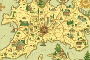
A map is a visual representation of an area, typically showing geographical features, political boundaries, and infrastructure. Its purpose is to provide a way to navigate and understand the layout of a specific location.
What are the different types of maps?
What are the different types of maps?
There are various types of maps, including physical maps that show natural features, political maps that display governmental boundaries, topographic maps that illustrate elevation and terrain, and thematic maps that focus on specific themes or topics.
How are maps created?
How are maps created?
Maps are created through a process of cartography, which involves gathering geographic data, using specialized software and tools to design the map, and then printing or digitally publishing the final result for use by individuals or organizations.
Flashcards are hidden until you start studying
Study Notes
Purpose of a Map
- A map is a visual representation of an area or place, used to convey geographical information and help navigate from one place to another
- Maps provide a spatial understanding of an area, allowing users to understand relationships between different locations
Types of Maps
- Political Maps: show boundaries between countries, states, and cities, and are often used for educational or administrative purposes
- Physical Maps: display natural features such as mountains, valleys, and rivers, and are often used to show geographical features
- Topographic Maps: display relief and elevation of an area, using contours and shading to show variations in terrain
- Thematic Maps: display specific data or information, such as climate, population density, or economic data, and are often used for research or analysis
Map Creation
- Traditional Method: involves creating a map by hand, using surveys, observations, and measurements to collect data
- Modern Method: involves using aerial photography, satellite imagery, and geographic information systems (GIS) to collect and analyze data
- Digital Maps: are created using computer software, allowing for easy updates and revisions, and are often used for online applications
Studying That Suits You
Use AI to generate personalized quizzes and flashcards to suit your learning preferences.


