Podcast
Questions and Answers
A beach experiencing light wave activity typically exhibits which of the following characteristics?
A beach experiencing light wave activity typically exhibits which of the following characteristics?
- A wide sandy berm and a steep beach face. (correct)
- Presence of longshore bars and stormy weather conditions.
- Dominance of backwash and sediment movement away from shore.
- A narrow beach and a flattened beach face.
During periods of heavy wave activity, what changes are most likely to occur on a beach?
During periods of heavy wave activity, what changes are most likely to occur on a beach?
- Longshore bars disappear due to the increased wave energy.
- The berm widens as sand is deposited, creating a steeper beach face.
- Swash dominates, leading to a net movement of sand up the beach face.
- Sediment is moved away from the shore, resulting in a narrower beach and a flattened beach face. (correct)
Which of the following is the primary process responsible for the creation of a spit?
Which of the following is the primary process responsible for the creation of a spit?
- Longshore drift depositing sediment in a linear ridge extending from land into deeper water. (correct)
- Volcanic activity creating new land formations.
- Tectonic uplift along the coast.
- The accumulation of coral reef material over time.
What key factor distinguishes a tombolo from other depositional coast features such as spits or bay barriers?
What key factor distinguishes a tombolo from other depositional coast features such as spits or bay barriers?
Which scenario would be most conducive to the formation of barrier islands?
Which scenario would be most conducive to the formation of barrier islands?
What is a crucial role of the dunes on a barrier island?
What is a crucial role of the dunes on a barrier island?
What condition would cause a delta shoreline to smooth out over time?
What condition would cause a delta shoreline to smooth out over time?
What is a primary consequence of beach starvation within a beach compartment?
What is a primary consequence of beach starvation within a beach compartment?
What evidence would support the classification of a shoreline as an emerging shoreline?
What evidence would support the classification of a shoreline as an emerging shoreline?
Which geologic process is most likely to cause localized folding, faulting, and tilting, leading to changes in sea level?
Which geologic process is most likely to cause localized folding, faulting, and tilting, leading to changes in sea level?
What is the primary cause of eustatic sea level changes?
What is the primary cause of eustatic sea level changes?
How do groins impact sediment distribution along a coastline?
How do groins impact sediment distribution along a coastline?
What is the main purpose of building jetties?
What is the main purpose of building jetties?
What is a significant environmental consequence often associated with the construction of breakwaters?
What is a significant environmental consequence often associated with the construction of breakwaters?
Why do seawalls often require continual repair and maintenance?
Why do seawalls often require continual repair and maintenance?
What is the primary goal of beach replenishment as an alternative to hard stabilization?
What is the primary goal of beach replenishment as an alternative to hard stabilization?
What oceanographic feature influences the direction of coastal geostrophic currents, particularly in the Northern Hemisphere?
What oceanographic feature influences the direction of coastal geostrophic currents, particularly in the Northern Hemisphere?
What is a halocline?
What is a halocline?
What geological process primarily accounts for the origin of coastal plain estuaries?
What geological process primarily accounts for the origin of coastal plain estuaries?
What is the primary characteristic of a fjord estuary?
What is the primary characteristic of a fjord estuary?
Which condition characterizes a vertically mixed estuary?
Which condition characterizes a vertically mixed estuary?
What is a key feature of a salt wedge estuary?
What is a key feature of a salt wedge estuary?
How can increased nutrient input from sewage and agriculture affect estuaries?
How can increased nutrient input from sewage and agriculture affect estuaries?
Which environmental issue is particularly associated with the Columbia River Estuary due to its historical use as a conduit for the logging industry?
Which environmental issue is particularly associated with the Columbia River Estuary due to its historical use as a conduit for the logging industry?
What factor contributes to the hypersaline conditions observed in lagoons such as Laguna Madre along the Texas coast?
What factor contributes to the hypersaline conditions observed in lagoons such as Laguna Madre along the Texas coast?
How does the water circulation pattern in the Mediterranean Sea differ from that of typical estuaries?
How does the water circulation pattern in the Mediterranean Sea differ from that of typical estuaries?
What is a key characteristic of coastal wetlands that contributes to their low oxygen levels in sediments?
What is a key characteristic of coastal wetlands that contributes to their low oxygen levels in sediments?
Which type of coastal wetland is typically found in tropical regions below 30 degrees latitude?
Which type of coastal wetland is typically found in tropical regions below 30 degrees latitude?
What is a significant ecological benefit provided by coastal wetlands?
What is a significant ecological benefit provided by coastal wetlands?
What environmental challenge is predicted to exacerbate the loss of coastal wetlands in the future?
What environmental challenge is predicted to exacerbate the loss of coastal wetlands in the future?
What is the primary function of distributaries in a delta environment?
What is the primary function of distributaries in a delta environment?
How does the presence of an underwater sill influence water flow and characteristics in the Mediterranean Sea?
How does the presence of an underwater sill influence water flow and characteristics in the Mediterranean Sea?
What is the role of the pycnocline in the Chesapeake Bay?
What is the role of the pycnocline in the Chesapeake Bay?
Which of the following human activities has contributed most significantly to the loss of coastal wetlands in the U.S.?
Which of the following human activities has contributed most significantly to the loss of coastal wetlands in the U.S.?
How does the removal of sediment by damming rivers affect the long-term stability of deltas downstream?
How does the removal of sediment by damming rivers affect the long-term stability of deltas downstream?
What is the primary reason for the unique circulation pattern observed in the Mediterranean Sea, in contrast to typical estuaries?
What is the primary reason for the unique circulation pattern observed in the Mediterranean Sea, in contrast to typical estuaries?
Which feature of barrier islands is most crucial in protecting mainland areas from the direct impact of storm waves?
Which feature of barrier islands is most crucial in protecting mainland areas from the direct impact of storm waves?
Flashcards
Beach
Beach
The active area of a coastline affected by waves, from the low tide breaker line to the far end of the berm.
Shore
Shore
The zone between the low tide line and the highest land area affected by storm waves.
Coast
Coast
Extends inland as far as ocean-related features are found.
Coastline
Coastline
Signup and view all the flashcards
Backshore
Backshore
Signup and view all the flashcards
Foreshore
Foreshore
Signup and view all the flashcards
Shoreline
Shoreline
Signup and view all the flashcards
Nearshore
Nearshore
Signup and view all the flashcards
Offshore
Offshore
Signup and view all the flashcards
Berm
Berm
Signup and view all the flashcards
Beach face
Beach face
Signup and view all the flashcards
Wave-cut bench
Wave-cut bench
Signup and view all the flashcards
Longshore bars
Longshore bars
Signup and view all the flashcards
Longshore trough
Longshore trough
Signup and view all the flashcards
Swash
Swash
Signup and view all the flashcards
Backwash
Backwash
Signup and view all the flashcards
Longshore current
Longshore current
Signup and view all the flashcards
Longshore Drift
Longshore Drift
Signup and view all the flashcards
Erosional Shores
Erosional Shores
Signup and view all the flashcards
Depositional Shores
Depositional Shores
Signup and view all the flashcards
Spit
Spit
Signup and view all the flashcards
Bay barrier (baymouth bar)
Bay barrier (baymouth bar)
Signup and view all the flashcards
Tombolo
Tombolo
Signup and view all the flashcards
Barrier Islands
Barrier Islands
Signup and view all the flashcards
Ocean Beach
Ocean Beach
Signup and view all the flashcards
Dune
Dune
Signup and view all the flashcards
Barrier flat
Barrier flat
Signup and view all the flashcards
Salt Marshes
Salt Marshes
Signup and view all the flashcards
Deltas
Deltas
Signup and view all the flashcards
Beach starvation
Beach starvation
Signup and view all the flashcards
Marine Terraces
Marine Terraces
Signup and view all the flashcards
Drowned Beaches
Drowned Beaches
Signup and view all the flashcards
Eustatic sea level changes
Eustatic sea level changes
Signup and view all the flashcards
Hard Stabilization
Hard Stabilization
Signup and view all the flashcards
Groins
Groins
Signup and view all the flashcards
Jetties
Jetties
Signup and view all the flashcards
Breakwaters
Breakwaters
Signup and view all the flashcards
Seawalls
Seawalls
Signup and view all the flashcards
Beach replenishment/nourishment
Beach replenishment/nourishment
Signup and view all the flashcards
Estuary
Estuary
Signup and view all the flashcards
Study Notes
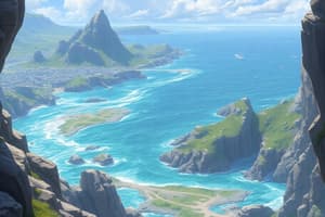
- The beach encompasses the active coastal area affected by waves, from the low tide breaker line to the berm's edge
Coastal Region Definitions
- Shore: The zone between the low tide line and the highest land area affected by storm waves.
- Coast: The area extending inland as far as ocean-related features are found.
- Coastline: The boundary between the shore and coast,marking the limit of the highest storm wave impact.
- Backshore: The part of the shore above the high tide shoreline, covered during storms.
- Foreshore: The intertidal zone exposed at low tide and submerged at high tide.
- Shoreline: The migrating water's edge.
- Nearshore: Extends from the low tide shoreline to the low tide breaker line, always submerged, and impacted by waves.
- Offshore: The zone seaward of the low tide breakers.
Beach Features
- Berm: A dry, gently sloping, elevated beach margin at the foot of coastal cliffs or dunes.
- Beach face: A wet, sloping surface from the berm to the shoreline, also known as the low tide terrace.
- Wave-cut bench: A flat, wave-eroded surface along which beach sediment moves.
- Longshore bars: Sand bars parallel to the coast that may cause waves to break.
- Longshore trough: Separates the longshore bar from the beach face.
Beach Composition
- Beaches have material from locally available sources and is always in transit along the shoreline.
- Sediment composition ranges from coarse boulders to fine mud.
- Boulders from cliffs, sand and mud from rivers, or biologic matter on tropical beaches.
Sand Movement
- Swash moves water up the beach, depositing sand, while backwash drains water back, eroding sand.
- Longshore currents transport sand along the beach, parallel to the shoreline.
Beach Types
- Summertime Beach: Wide, sandy berm, steep beach face, with swash dominating and no longshore bars.
- Wintertime Beach: Narrower beach, flattened beach face, sediment moves offshore, backwash dominates, and longshore bars are present.
Longshore Currents and Drift
- Longshore currents move in a zigzag pattern at speeds up to 4 km/hour.
- Longshore drift transports sediment in the surf zone, with millions of tons moved yearly.
Shore Types
- Erosional Shores: Have well-developed cliffs and uplifted coasts, like the U.S. Pacific coast.
- Depositional Shores: Gradually subsiding and feature barrier islands and sand deposits, common in the Gulf Coast and U.S. Southeast Atlantic coast.
Features of Erosional Shores
- Headlands absorb wave energy, carving out wave-cut cliffs and sea caves.
- Sea arches form when sea caves erode through headlands.
- Sea stacks are the remnants of eroded sea arches.
- Marine terraces are generated by the uplift of wave-cut benches.
- Erosion rates increase with wave exposure, smaller tidal ranges, and weaker bedrock.
Features of Depositional Shores
- Wave action distributes sediment along the continental margin.
- Spit: A linear ridge of sediment connecting to the mainland and hooking into a bay.
- Bay barrier: Seals off a lagoon from the ocean, originating as a spit across a bay mouth.
- Tombolo: Connects an island or sea stack to the mainland, forming in the wave energy shadow.
Barrier Islands
- Long offshore deposits of sand parallel to the coast, protecting the mainland from high wave activity.
- Over 2000 worldwide, with almost 300 along the Atlantic and Gulf coasts of the U.S.
- They're separated from the mainland by a lagoon.
- Islands feature an ocean beach, dunes, a barrier flat, and salt marshes.
- They migrate landward over time due to rising sea levels.
Deltas
- Triangular sediment deposits at river mouths, fertile but prone to flooding.
- Distributaries are branching channels that carry sediment, creating a "bird's foot" pattern.
- Delta shorelines smooth when erosion exceeds deposition, as seen in the Nile River Delta after the Aswan Dam's construction.
Beach Compartments
- Include rivers which supply sediment, the beach itself, and offshore submarine canyons.
- Beach compartments experience beach starvation when human activities block the sand supply. For example, Southern California has 4: Santa Barbara, Santa Monica, San Pedro, and Oceanside.
Shoreline Changes
- Emerging Shorelines: Rising above sea level, with marine terraces and stranded beach deposits, seen on the U.S. Pacific Coast.
- Submerging Shorelines: Sinking below sea level, with drowned beaches, submerged dunes, and drowned river valleys (estuaries), common on the U.S. Atlantic Coast.
Sea Level Changes
- Local geologic processes: raise or lower Earth’s crust.
- Isostatic adjustments: rebound of crust after ice removal.
- Worldwide changes in sea level: alter seawater volume or ocean basin size.
- Eustatic changes result from forming/melting glaciers or thermal expansion/contraction of seawater.
- During ice ages, sea level was at least 120 meters lower.
- Complete melting of remaining ice would raise sea level by 70 meters.
Hard Stabilization
- Structures built to control coastal erosion often have unwanted outcomes.
- Groins: Perpendicular to the beach, trapping sand upcoast and causing erosion downcoast.
- Jetties: Built in pairs to protect harbor entrances.
- Breakwaters: Parallel to shore, protecting harbors but can cause erosion.
- Seawalls: Armor the coastline but can reflect wave energy and erode beaches.
Alternatives to Hard Stabilization
- Construction restrictions: Limit building near shorelines.
- Relocation: move structures from eroding areas.
- Beach replenishment: Add sand to beaches, an expensive and continuous process.
Coastal Water Characteristics
- Salinity: freshwater runoff doesn't mix well.
- Halocline: Represents salinity variations with depth.
- Temperature: Restricted mixing.
- Isothermal: Uniform temperature.
- Thermocline: Represents temperature variations with depth.
Coastal Geostrophic Currents
- Generated by wind and runoff and deflected by the Coriolis effect (to the right in the Northern Hemisphere).
- N. Hemisphere: curve northward on western coasts and southward on eastern coasts.
Estuaries
- Partially enclosed coastal water bodies where freshwater mixes with salty ocean water. Like River mouths, Bays, Inlets, Gulfs, and Sounds.
- They formed from sea level rise after glacier retreat.
Estuary Types
- Coastal plain estuary: Forms as sea level rises and floods existing river valleys (Chesapeake Bay).
- Fjord estuary: Forms as sea level rises and floods existing glaciated valleys (Alaska, Canada, New Zealand, Chile, and Norway).
Estuary Types Cont.
- Bar-built estuary: Shallow, separated from ocean by sand bars (U.S. Gulf and East coasts).
- Tectonic estuary: Forms due to faulting, San Francisco Bay
Water Mixing in Estuaries
- Vertically mixed: Shallow, salinity uniform from top to bottom.
- Slightly stratified: Salinity increases from head to mouth, with two water layers.
- Highly stratified: Deep, with a strong salinity gradient.
- Salt wedge: Salty water wedges under river water.
Estuaries and Human Impact
- Threatened by human populations.
- Estuaries serve as breeding grounds and nurseries.
- Activities like the Columbia River logging industry and Chesapeake Bay nutrient pollution damage the water.
Lagoons
- Shallow water bodies landward of islands with restricted circulation; form in bar-built estuaries.
- The 3 distinct zones include freshwater, transitional, and saltwater.
- E.g. Laguna Madre, along the Texas coast.
Marginal Seas
- Large, semi-isolated water bodies that result from tectonic events.(Mediterranean, Caribbean)
Mediterranean Sea
- Remnant of the ancient Tethys Sea. Narrow strait of Gibraltar connects it to the Atlantic.
- Underwater sill separates major basins, restricting flow.
- The circulation is opposite most estuaries, driven by Middle East heat and evaporation.
Coastal Wetlands
- Ecosystems with a high water table.
- Occur along coastal waters, including estuaries, lagoons, and marginal seas.
- Include swamps, tidal flats, coastal marshes, and bayous, highly biologically productive, with low oxygen in sediments.
Types of Coastal Wetlands
- Salt marshes: Between 30 and 65 degrees latitude, support salt-tolerant grasses.
- Mangroves: Tropics below 30 degrees latitude, salt-tolerant trees with oxygen-depleted sediments.
Wetland Characteristics
- Home to diverse plants and animals, serving as nurseries for fish.
- Soak up nutrients, remove pollutants, protect shorelines, dissipate wave energy, and absorb floodwater.
Wetland Loss
- More than half of U.S. wetlands have vanished due to development.
- Establishment of the EPA's Office of Wetlands Protection in 1986 has slowed losses.
- Future sea level rise is predicted to exacerbate losses.
Studying That Suits You
Use AI to generate personalized quizzes and flashcards to suit your learning preferences.