Podcast
Questions and Answers
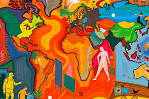
What is globalization?
What is globalization?
- The expansion of processes to a global scale (correct)
- A type of map projection
- The study of human adaptations
- An increase in cultural traits
Give an example of globalization.
Give an example of globalization.
McDonald's expansion into a global company.
What is a perceptual region?
What is a perceptual region?
A region that only exists as a conceptualization.
Provide an example of a perceptual region.
Provide an example of a perceptual region.
What is a Geographic Information System (GIS)?
What is a Geographic Information System (GIS)?
How is GIS usually formatted for the user's convenience?
How is GIS usually formatted for the user's convenience?
What does Time Space Compression refer to?
What does Time Space Compression refer to?
What is a Global Positioning System (GPS)?
What is a Global Positioning System (GPS)?
What things typically use GPS?
What things typically use GPS?
What is Distance Decay?
What is Distance Decay?
Provide an example of Distance Decay.
Provide an example of Distance Decay.
What is Expansion Diffusion?
What is Expansion Diffusion?
What three types of diffusion fit under the 'Expansion' category?
What three types of diffusion fit under the 'Expansion' category?
What is Contagious Diffusion?
What is Contagious Diffusion?
Give an example of Contagious Diffusion.
Give an example of Contagious Diffusion.
What is a Thematic Map?
What is a Thematic Map?
Is this an example of a Thematic Map: A map showing rainfall distribution?
Is this an example of a Thematic Map: A map showing rainfall distribution?
What is Movement in geography?
What is Movement in geography?
Provide an example in history of Movement.
Provide an example in history of Movement.
What is a Cultural Landscape?
What is a Cultural Landscape?
Give an example of a Cultural Landscape.
Give an example of a Cultural Landscape.
What is a Sequence Occupant?
What is a Sequence Occupant?
Provide an example of Sequence Occupant.
Provide an example of Sequence Occupant.
What is the Fraction of Distance?
What is the Fraction of Distance?
Give an example of Fraction of Distance.
Give an example of Fraction of Distance.
What is Latitude?
What is Latitude?
What is the name of the parallel at 0 degrees?
What is the name of the parallel at 0 degrees?
What is Relocation Diffusion?
What is Relocation Diffusion?
Provide an example of Relocation Diffusion.
Provide an example of Relocation Diffusion.
What is Possibilism?
What is Possibilism?
Provide a prime example of Possibilism.
Provide a prime example of Possibilism.
What is the 0-degree longitude called?
What is the 0-degree longitude called?
What city does the Prime Meridian cross through?
What city does the Prime Meridian cross through?
What is a Cartogram Map?
What is a Cartogram Map?
Which map appears distorted due to size alterations?
Which map appears distorted due to size alterations?
What is Relative Location?
What is Relative Location?
Provide an example of Relative Location.
Provide an example of Relative Location.
What is the International Date Line?
What is the International Date Line?
What is Cultural Ecology?
What is Cultural Ecology?
Give an example of adaptation in Cultural Ecology.
Give an example of adaptation in Cultural Ecology.
What is a Choropleth Map?
What is a Choropleth Map?
When may a Choropleth Map be used?
When may a Choropleth Map be used?
What is Time Space Convergence?
What is Time Space Convergence?
What is a Hearth?
What is a Hearth?
Where is the hearth of Christianity?
Where is the hearth of Christianity?
What is Independent Invention?
What is Independent Invention?
Give an example of Independent Invention.
Give an example of Independent Invention.
What is the Mercator Projection?
What is the Mercator Projection?
What are the 5 Themes of Geography?
What are the 5 Themes of Geography?
What is Location in geography?
What is Location in geography?
What is Human Environment?
What is Human Environment?
What is Region in geography?
What is Region in geography?
Define Place in geography.
Define Place in geography.
What is a Reference Map?
What is a Reference Map?
What is a Graduated Symbol Map?
What is a Graduated Symbol Map?
What is Diffusion?
What is Diffusion?
What is Hierarchical Diffusion?
What is Hierarchical Diffusion?
Give an example of Hierarchical Diffusion.
Give an example of Hierarchical Diffusion.
What is an Isoline Map?
What is an Isoline Map?
What is Political Ecology?
What is Political Ecology?
What is Landscape Analysis?
What is Landscape Analysis?
What is Distribution?
What is Distribution?
What is Distortion?
What is Distortion?
What is Spatial Perspective?
What is Spatial Perspective?
What is a Functional Region?
What is a Functional Region?
Give an example of a Functional Region.
Give an example of a Functional Region.
What is Site in geography?
What is Site in geography?
Provide an example of Site.
Provide an example of Site.
What is Situation in geography?
What is Situation in geography?
Give an example of Situation.
Give an example of Situation.
What is Longitude?
What is Longitude?
What is Distance in geography?
What is Distance in geography?
What is Environmental Determinism?
What is Environmental Determinism?
What viewpoint states that civilizations thrive based on their environment?
What viewpoint states that civilizations thrive based on their environment?
What is a Formal Region?
What is a Formal Region?
What is Remote Sensing?
What is Remote Sensing?
What is Scale in geography?
What is Scale in geography?
What does Spatial refer to?
What does Spatial refer to?
What are World Regions?
What are World Regions?
What is the North Pole?
What is the North Pole?
What is the South Pole?
What is the South Pole?
What are Map Projections?
What are Map Projections?
What is Azimuthal/Polar Projection?
What is Azimuthal/Polar Projection?
What is Robinson Projection?
What is Robinson Projection?
What is Geospatial Data?
What is Geospatial Data?
What is Absolute Direction?
What is Absolute Direction?
What is Relative Direction?
What is Relative Direction?
What is a Vernacular Region?
What is a Vernacular Region?
What is Stimulus Diffusion?
What is Stimulus Diffusion?
Give a common example of Stimulus Diffusion.
Give a common example of Stimulus Diffusion.
What is Geographic Perspective?
What is Geographic Perspective?
What is Absolute Location?
What is Absolute Location?
Flashcards
Globalization
Globalization
Economic, political, and cultural processes expanding globally, impacting state boundaries. Example: McDonald's influencing various cultures.
Perceptual Region
Perceptual Region
Conceptual regions that exist in thought rather than physical boundaries. Example: "The South" in the United States.
Geographic Information System (GIS)
Geographic Information System (GIS)
Computer hardware and software for collecting and analyzing spatial data. GIS data often organized in layers for user convenience.
Time Space Compression
Time Space Compression
Signup and view all the flashcards
Global Positioning System (GPS)
Global Positioning System (GPS)
Signup and view all the flashcards
Distance Decay
Distance Decay
Signup and view all the flashcards
Expansion Diffusion
Expansion Diffusion
Signup and view all the flashcards
Contagious Diffusion
Contagious Diffusion
Signup and view all the flashcards
Thematic Map
Thematic Map
Signup and view all the flashcards
Movement
Movement
Signup and view all the flashcards
Cultural Landscape
Cultural Landscape
Signup and view all the flashcards
Sequence Occupant
Sequence Occupant
Signup and view all the flashcards
Fraction of Distance
Fraction of Distance
Signup and view all the flashcards
Latitude (Parallels)
Latitude (Parallels)
Signup and view all the flashcards
Relocation Diffusion
Relocation Diffusion
Signup and view all the flashcards
Possibilism
Possibilism
Signup and view all the flashcards
Prime Meridian
Prime Meridian
Signup and view all the flashcards
Cartogram Map
Cartogram Map
Signup and view all the flashcards
Relative Location
Relative Location
Signup and view all the flashcards
International Date Line
International Date Line
Signup and view all the flashcards
Cultural Ecology
Cultural Ecology
Signup and view all the flashcards
Choropleth Map
Choropleth Map
Signup and view all the flashcards
Time Space Convergence
Time Space Convergence
Signup and view all the flashcards
Hearth
Hearth
Signup and view all the flashcards
Independent Invention
Independent Invention
Signup and view all the flashcards
Mercator Projection
Mercator Projection
Signup and view all the flashcards
5 Themes of Geography
5 Themes of Geography
Signup and view all the flashcards
Site
Site
Signup and view all the flashcards
Situation
Situation
Signup and view all the flashcards
Longitude
Longitude
Signup and view all the flashcards
Environmental Determinism
Environmental Determinism
Signup and view all the flashcards
Formal Region
Formal Region
Signup and view all the flashcards
Remote Sensing
Remote Sensing
Signup and view all the flashcards
Scale
Scale
Signup and view all the flashcards
World Regions
World Regions
Signup and view all the flashcards
Map Projections
Map Projections
Signup and view all the flashcards
Geospatial Data
Geospatial Data
Signup and view all the flashcards
Absolute Direction
Absolute Direction
Signup and view all the flashcards
Relative Direction
Relative Direction
Signup and view all the flashcards
Vernacular Region
Vernacular Region
Signup and view all the flashcards
Stimulus Diffusion
Stimulus Diffusion
Signup and view all the flashcards
Geographic Perspective
Geographic Perspective
Signup and view all the flashcards
Absolute Location
Absolute Location
Signup and view all the flashcards
Study Notes
Globalization
- Economic, political, and cultural processes expanding globally, impacting state boundaries.
- Example: McDonald's as a global company influencing various cultures.
Perceptual Region
- Conceptual regions that exist in thought rather than physical boundaries.
- Example: "The South" in the United States.
Geographic Information System (GIS)
- Computer hardware and software for collecting and analyzing spatial data.
- GIS data is often organized in layers for user convenience.
Time Space Compression
- Reflects the social and physical effects of rapid convergence of time and space, as associated with David Harvey.
Global Positioning System (GPS)
- Satellite-based system used to determine exact locations on Earth.
- Commonly found in modern cars, phones, computers, and various vehicles.
Distance Decay
- Interaction decreases as distance increases.
- Example: Closer relationships between France and Germany compared to France and China.
Expansion Diffusion
- Spread of innovation or ideas resulting in a growing number of influenced populations.
- Types include contagious, hierarchical, and stimulus diffusion.
Contagious Diffusion
- Spreading of ideas or innovations through localized populations similarly to disease spread.
- Example: General illness outbreaks (excluding HIV/AIDS).
Thematic Map
- Maps that illustrate stories and highlight specific attributes or movement of geographical phenomena.
Movement
- Theme of geography detailing the mobility of people, goods, and ideas across Earth.
- Historical example: Migration of people across the Bering Land Bridge.
Cultural Landscape
- Geographic areas associated with historic events or activities.
- Example: Gettysburg battlefield.
Sequence Occupant
- Concept that successive societies leave cultural imprints, contributing to a cumulative landscape.
- Example: Alexandria, Egypt with Egyptian, Greek, and Roman influences.
Fraction of Distance
- Increased time and cost associated with greater distances.
- Example: Higher cost to fly from Atlanta to Paris versus Atlanta to Boston.
Latitude (Parallels)
- Imaginary lines running east-west, measuring distance north or south of the equator.
Relocation Diffusion
- Process where innovations spread as carrier agents relocate to new areas, notably seen in colonization.
- Example: Spread of Spanish language and culture in Latin America.
Possibilism
- Geographic viewpoint emphasizing human decision-making as critical for cultural development.
Prime Meridian
- Longitude line at 0 degrees, passing through Greenwich, England.
Cartogram Map
- Map type that distorts land area and distance based on thematic variables, creating a unique visual representation.
Relative Location
- The situation of a place relative to others.
- Example: France's location on the northwest border of Spain.
International Date Line
- Divides today and tomorrow, mainly following the 180-degree meridian in the Bering Strait.
Cultural Ecology
- Study of how humans adapt to social and physical environments.
- Example: Inuit using every part of seals and whales due to scarcity in the Arctic.
Choropleth Map
- Map using color or shading to depict values within predefined areas.
- Used for comparing regional attributes like GDP.
Time Space Convergence
- Accelerated movement of goods and ideas in the 20th century due to advancements in transport and communication.
Hearth
- Geographic origin of an idea or cultural trait, notably Jerusalem for Christianity.
Independent Invention
- Similar traits arising in multiple cultural hearths independently.
- Example: Independent emergence of farming across ancient civilizations.
Mercator Projection
- Distorts polar areas but is utilized for navigation due to straight lines representing constant compass directions.
5 Themes of Geography
- Location, human-environment interaction, region, place, and movement are central themes identified by GENIP.
Site
- Internal physical attributes of a place, such as its exact location and setting.
- Example: Specific latitude and longitude coordinates of a house.
Situation
- External attributes of a place, regarding its relative location to other places.
- Example: Atlanta's positioning relative to Savannah.
Longitude
- Lines circling the Earth, measuring angular distances from the Prime Meridian.
Environmental Determinism
- Theory that the natural environment influences human development, including cultural aspects.
Formal Region
- Areas with a degree of homogeneity in one or more phenomena.
Remote Sensing
- Data collection method using instruments distanced from the area of study.
Scale
- Representation level of real-world phenomena in reduced forms.
World Regions
- Areas characterized by common traits, such as Western Europe.
Map Projections
- Techniques for representing Earth's surface on a flat plane.
Geospatial Data
- Information represented in numeric values within a geographic coordinate system, crucial for mapping.
Absolute Direction
- Universal compass directions (North, South, etc.).
Relative Direction
- Direction based on perception, such as left or right.
Vernacular Region
- Synonymous with perceptual region, reflecting people's perceptions.
Stimulus Diffusion
- Cultural adaptations arising from the introduction of traits from other places.
- Example: Indian adaptation of the Maharaja Mac burger.
Geographic Perspective
- Understanding topics by examining spatial features and relationships.
Absolute Location
- Specific location of an item defined by latitude and longitude.
Studying That Suits You
Use AI to generate personalized quizzes and flashcards to suit your learning preferences.