Podcast
Questions and Answers
Considering the multifaceted challenges in visualizing and representing pervasive socio-economic disparities, which methodological approach would MOST effectively integrate quantitative poverty statistics with qualitative narratives to foster a nuanced understanding of the 'Geography of Poverty' project's implications?
Considering the multifaceted challenges in visualizing and representing pervasive socio-economic disparities, which methodological approach would MOST effectively integrate quantitative poverty statistics with qualitative narratives to foster a nuanced understanding of the 'Geography of Poverty' project's implications?
- Utilizing geographic information systems (GIS) to map poverty indicators, subsequently overlaying these maps with census data to identify spatial clusters amenable to targeted interventions.
- Developing a mixed-methods framework that iteratively combines spatial statistical analysis with in-depth case studies and photovoice techniques, ensuring both representativeness and contextual richness. (correct)
- Employing purely econometric models to establish causal relationships between geographical location and poverty rates, thus minimizing subjective interpretations.
- Focusing exclusively on ethnographic studies within designated 'poverty areas' to capture lived experiences, thereby prioritizing individual voices over statistical aggregates.
In the context of the 'Geography of Poverty' project's aim to document economic divisions in the United States, what critical epistemological challenge arises when attempting to represent the lived experiences of marginalized communities through photography and data visualization?
In the context of the 'Geography of Poverty' project's aim to document economic divisions in the United States, what critical epistemological challenge arises when attempting to represent the lived experiences of marginalized communities through photography and data visualization?
- The inherent limitations of quantitative data in capturing the subjective dimensions of poverty, necessitating a reliance on purely qualitative research methods.
- The methodological difficulty of obtaining representative samples from geographically dispersed and socially isolated populations, leading to biased or incomplete datasets.
- The ethical imperative to prioritize the anonymity of individuals living in 'poverty areas,' even if it compromises the project's ability to convey the scope and depth of the issue.
- The potential for visual representations and statistical analyses to perpetuate stereotypes or reinforce dominant narratives, thereby obscuring the complexities of individual circumstances. (correct)
Considering the 'Geography of Poverty' project's use of geotagged maps linking to Instagram, what potential ethical concern arises regarding the privacy and exploitation of vulnerable populations when merging real-time social media data with poverty statistics?
Considering the 'Geography of Poverty' project's use of geotagged maps linking to Instagram, what potential ethical concern arises regarding the privacy and exploitation of vulnerable populations when merging real-time social media data with poverty statistics?
- Social media platforms inherently provide users with control over their data, mitigating concerns about privacy violations and ensuring informed consent.
- Geotagging ensures accurate representation of poverty areas, thereby enhancing the project's credibility and minimizing potential misinterpretations.
- Real-time data integration allows for immediate feedback and participatory engagement from affected communities, fostering a sense of ownership and empowerment.
- The combination of personal narratives and geographic data could inadvertently expose individuals to risks such as harassment, surveillance, or economic exploitation, necessitating stringent anonymization protocols. (correct)
Given the historical context of the 'War on Poverty' and the persistent economic disparities documented by the 'Geography of Poverty' project, what systemic critique emerges regarding the efficacy of traditional anti-poverty interventions?
Given the historical context of the 'War on Poverty' and the persistent economic disparities documented by the 'Geography of Poverty' project, what systemic critique emerges regarding the efficacy of traditional anti-poverty interventions?
Analyzing the 'Geography of Poverty' project's impact on public discourse and policy-making, what critical consideration should be given to the potential for such visual and narrative representations to elicit empathy, while simultaneously reinforcing othering and perpetuating existing power dynamics in the portrayal of impoverished communities?
Analyzing the 'Geography of Poverty' project's impact on public discourse and policy-making, what critical consideration should be given to the potential for such visual and narrative representations to elicit empathy, while simultaneously reinforcing othering and perpetuating existing power dynamics in the portrayal of impoverished communities?
Given the 'Geography of Poverty' project's comprehensive documentation through photography, data, and narratives, to what extent does its methodology account for the dynamic interplay between individual agency, structural constraints, and geographical context in shaping the experiences of poverty?
Given the 'Geography of Poverty' project's comprehensive documentation through photography, data, and narratives, to what extent does its methodology account for the dynamic interplay between individual agency, structural constraints, and geographical context in shaping the experiences of poverty?
Evaluating the 'Geography of Poverty' project's multimedia approach, what critical methodological challenge arises in translating complex statistical data on poverty into accessible and engaging visual narratives for a broad audience, while avoiding oversimplification or misrepresentation?
Evaluating the 'Geography of Poverty' project's multimedia approach, what critical methodological challenge arises in translating complex statistical data on poverty into accessible and engaging visual narratives for a broad audience, while avoiding oversimplification or misrepresentation?
Considering the 'Geography of Poverty' project's impact on fostering social change, what critical sociological concept underlies the potential for its visual and narrative representations to mobilize collective action and challenge existing power structures that perpetuate poverty?
Considering the 'Geography of Poverty' project's impact on fostering social change, what critical sociological concept underlies the potential for its visual and narrative representations to mobilize collective action and challenge existing power structures that perpetuate poverty?
Given the chronicling of economic divisions by the 'Geography of Poverty' project, what represents the MOST significant challenge for sustainable, scalable, and structurally transformative poverty alleviation strategies?
Given the chronicling of economic divisions by the 'Geography of Poverty' project, what represents the MOST significant challenge for sustainable, scalable, and structurally transformative poverty alleviation strategies?
Considering the 'Geography of Poverty' efforts to 'humanize facts and numbers', which represent the MOST critical ethical consideration for photographers and journalists documenting communities experiencing economic hardship?
Considering the 'Geography of Poverty' efforts to 'humanize facts and numbers', which represent the MOST critical ethical consideration for photographers and journalists documenting communities experiencing economic hardship?
In the context of the 'Geography of Poverty' project's digital storytelling, which of the following platform design choices would MOST effectively promote critical engagement and challenge pre-existing biases among audiences regarding poverty and inequality?
In the context of the 'Geography of Poverty' project's digital storytelling, which of the following platform design choices would MOST effectively promote critical engagement and challenge pre-existing biases among audiences regarding poverty and inequality?
Given the 'Geography of Poverty' project's temporal scope, documenting poverty over several years, what key methodological innovation could enhance its longitudinal analysis of poverty dynamics and inform more effective policy interventions?
Given the 'Geography of Poverty' project's temporal scope, documenting poverty over several years, what key methodological innovation could enhance its longitudinal analysis of poverty dynamics and inform more effective policy interventions?
In light of the 'Geography of Poverty' highlighting economic disparities, what advanced geospatial statistical method would MOST rigorously assess the spatial clustering and spillover effects of poverty across different communities and regions?
In light of the 'Geography of Poverty' highlighting economic disparities, what advanced geospatial statistical method would MOST rigorously assess the spatial clustering and spillover effects of poverty across different communities and regions?
Considering the ethical dimensions inherent in representing marginalized communities, which theoretical framework would MOST comprehensively address the power dynamics and potential for re-traumatization when using photography and personal narratives to document the 'Geography of Poverty'?
Considering the ethical dimensions inherent in representing marginalized communities, which theoretical framework would MOST comprehensively address the power dynamics and potential for re-traumatization when using photography and personal narratives to document the 'Geography of Poverty'?
Reflecting on the 'Geography of Poverty', which paradigm would MOST effectively integrate insights from spatial econometrics, social network analysis, and behavioral economics to understand how geographical context, social interactions, and individual decision-making collectively shape poverty dynamics and inform targeted interventions?
Reflecting on the 'Geography of Poverty', which paradigm would MOST effectively integrate insights from spatial econometrics, social network analysis, and behavioral economics to understand how geographical context, social interactions, and individual decision-making collectively shape poverty dynamics and inform targeted interventions?
Flashcards
Geography of Poverty
Geography of Poverty
A project documenting poverty areas across 46 states in the U.S.
"Poverty areas"
"Poverty areas"
Areas with poverty rates exceeding 20%.
Immersive Microsite
Immersive Microsite
A digital platform created to showcase 'The Geography of Poverty' project.
Humanizing facts
Humanizing facts
Signup and view all the flashcards
Social Media Campaign
Social Media Campaign
Signup and view all the flashcards
Geography of Poverty Zine
Geography of Poverty Zine
Signup and view all the flashcards
Economic Divisions
Economic Divisions
Signup and view all the flashcards
Study Notes
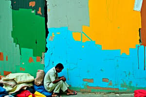
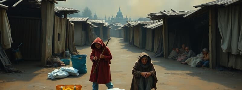
- Magnum photographer Matt Black traveled over 100,000 miles across 46 states to document "poverty areas."
- The project profiles marginalized people and communities in the U.S.
- It highlights unprecedented economic divisions affecting millions.
- Over 43 million people in the U.S. live under the poverty line.
- Income share of the top 1% has more than doubled since the 1970s.
- The richest 0.1% have tripled their share of national wealth
- Black documented communities with poverty rates exceeding 20%.
- The project was expanded nationwide in collaboration with MSNBC.com.
- A long-form microsite was created to showcase the project, launching in June 2015.
- The microsite featured photography, motion clips, data visualization, and geotagged maps.
- The audience could follow Black's journey in real-time via Instagram.
- Photography humanizes facts, and the map emphasizes the scale of the problem.
- Individual stories highlight a country-wide issue.
- The Executive Producer championed the project and secured support from MSNBC executives.
- A framework for the long-form project was established, including editorial premise, story structures, goals, and timelines.
- The Executive Producer worked with design and development teams on aesthetics and storytelling functionality.
- Additional funding was secured, and outside project partnerships were co-managed.
- Visual content was directed and edited.
- A social media campaign was created to build and sustain an audience.
- A special edition print zine was produced.
- The project's success is attributed to the collaborative effort of the whole team.
Studying That Suits You
Use AI to generate personalized quizzes and flashcards to suit your learning preferences.