Podcast
Questions and Answers
Which body of water is not found on the map of the African continent?
Which body of water is not found on the map of the African continent?
- Indian Ocean
- Red Sea
- Amazon River (correct)
- Mediterranean Sea
Identify the highest mountain range featured on the African map.
Identify the highest mountain range featured on the African map.
- Draak Mountains
- Tassili n'Ajjer
- Atlas (correct)
- Tibesti
Which plateau area is included on the African map?
Which plateau area is included on the African map?
- Great Plains
- Deccan Plateau
- Colorado Plateau
- Air Plateau (correct)
Which of the following deserts is represented on the African map?
Which of the following deserts is represented on the African map?
What is the scale of the map of the African continent?
What is the scale of the map of the African continent?
Flashcards are hidden until you start studying
Study Notes
Major Bodies of Water
- Mediterranean Sea: Located at the northern edge of Africa, crucial for trade and cultural exchange.
- Red Sea: Separates Africa from the Arabian Peninsula, a vital route for maritime traffic.
- Arabian Sea: Part of the Indian Ocean, significant for shipping and marine biodiversity.
- Indian Ocean: Largest body of water to the southeast of Africa, key for global shipping routes.
- Atlantic Ocean: Borders the western coast of Africa, rich in marine resources and fishery zones.
- Gulf of Guinea: Found in West Africa, important for oil production and fishing activities.
Mountain Areas
- Tibesti Mountains: A range in Chad, home to volcanic peaks and diverse wildlife.
- Ahaggar Mountains: Located in Algeria, known for ancient rock art and scenic landscapes.
- Tassili n'Ajjer: A plateau region in Algeria, famous for its prehistoric rock paintings and unique geological formations.
- Atlas Mountains: Stretch across Morocco, Algeria, and Tunisia, a vital source of water for the region.
- Ethiopian Highlands: Known as "The Roof of Africa," this region has the highest average elevation on the continent.
- Rwenzori Mountains: Bordering Uganda and the Democratic Republic of the Congo, known for their glacial peaks.
- East African Rift: A tectonic plate boundary that creates a valley system with diverse ecosystems.
- Drakensberg Mountains: A mountain range in South Africa, recognized for its dramatic cliffs and biodiversity.
Plateau Areas
- Air Plateau: Located in Niger, a region with significant archaeological sites.
- Azande Plateau: Found in the Central African Republic and South Sudan, known for its fertile soils.
- Cundia-Katanga Plateau: A mineral-rich area in the Democratic Republic of the Congo, essential for mining.
- Kaap Plateau: Found in South Africa, significant for its unique flora and fauna.
Other Areas
- Tenere: A vast desert region in Niger, characterized by sand dunes and minimal rainfall.
- Sahara Desert: The largest hot desert in the world, spanning multiple countries; a challenging environment.
- Congo Basin: A critical rainforest area, known for its biodiversity and role in carbon storage.
- Shaba Region: Located in the Democratic Republic of the Congo, recognized for its mineral wealth.
- Etosha Pan: A large salt pan in Namibia, attracts diverse wildlife during the rainy season.
- Kalahari Desert: A semi-arid sandy savanna that spans Botswana, Namibia, and South Africa, known for its unique ecosystems.
- Arabian Peninsula: Located at the northeast corner of the African continent, strategic location for trade.
- Somali Peninsula: A prominent protrusion in East Africa, includes diverse landscapes from mountains to coastal areas.
Map Features
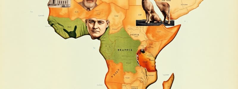
- Predominantly yellow and brown colors indicate landforms; blue represents water bodies.
- Scale of 1:34,000,000 enables measurement of distances across the African continent.
- The map is labeled in Czech, making it accessible to Czech-speaking audiences.
Studying That Suits You
Use AI to generate personalized quizzes and flashcards to suit your learning preferences.


