Podcast
Questions and Answers
What is a plateau?
What is a plateau?
A large, level area that rises above the surrounding land, has at least one side with a steep slope.
What is elevation?
What is elevation?
The height of land above sea level.
What is a rift?
What is a rift?
A deep crack in Earth's surface.
What is a tributary?
What is a tributary?
What does it mean if an area is fertile?
What does it mean if an area is fertile?
What does it mean to irrigate?
What does it mean to irrigate?
What is a drought?
What is a drought?
What is an oasis?
What is an oasis?
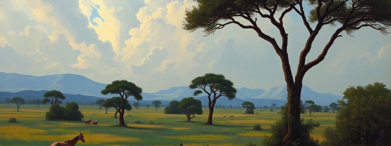
What is a savanna?
What is a savanna?
What is a nomad?
What is a nomad?
What is subsistence farming?
What is subsistence farming?
What is a cash crop?
What is a cash crop?
What is an economy?
What is an economy?
What does it mean to diversify?
What does it mean to diversify?
How does Africa measure up to other continents?
How does Africa measure up to other continents?
What are the regions of Africa?
What are the regions of Africa?
What are Africa's four major rivers?
What are Africa's four major rivers?
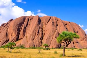
What are the main physical features of Africa?
What are the main physical features of Africa?
What is the most populated region of Africa and why?
What is the most populated region of Africa and why?
How does the Nile flow?
How does the Nile flow?
Describe farming in the Nile. How has it changed?
Describe farming in the Nile. How has it changed?
How are the crops that grow in the desert watered?
How are the crops that grow in the desert watered?
Why is Africa often called the 'plateau continent'?
Why is Africa often called the 'plateau continent'?
What is Africa's tallest mountain and in which region is it located?
What is Africa's tallest mountain and in which region is it located?
Near what landform are most of Africa's major lakes located?
Near what landform are most of Africa's major lakes located?
Why can't ships sail all the way from Africa's interior to the sea?
Why can't ships sail all the way from Africa's interior to the sea?
Why have people farmed the land along the Nile for thousands of years?
Why have people farmed the land along the Nile for thousands of years?
Name three factors that influence climate.
Name three factors that influence climate.
Give an example of how one of these factors can influence the climate of an area.
Give an example of how one of these factors can influence the climate of an area.
Flashcards are hidden until you start studying
Study Notes
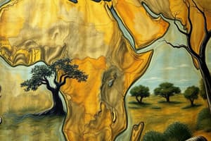
Physical Geography of Africa
- Plateaus are large, level areas above surrounding land, characterized by at least one steep slope.
- Elevation refers to the height of land above sea level, influencing climate and vegetation.
- A rift is a significant geological crack in Earth's surface, often leading to diverse landforms.
- Tributaries are smaller rivers or streams that flow into larger rivers, impacting water systems.
- Fertile land is rich in nutrients essential for robust plant growth.
- Irrigation involves supplying water to crops through various means like ditches or channels.
- Droughts are extended periods of minimal or absent rainfall, affecting agriculture and water supply.
- Oases are fertile spots in deserts, often featuring vegetation and water sources.
- Savannas consist of vast areas of tall grasses with sparse tree coverage, supporting diverse wildlife.
- Nomads are individuals who move frequently, lacking a permanent home, usually for resource availability.
- Subsistence farming focuses on growing just enough food for personal or family use.
- Cash crops are cultivated mainly for sale, differing from subsistence crops meant for direct consumption.
Africa's Geographical Context
- Africa is the second largest continent globally, playing a crucial role in biodiversity and climate.
- Four main regions of Africa: West Africa, North Africa, Southern and Central Africa, and East Africa.
- Major rivers include the Nile, Congo, Niger, and Zambezi, serving multiple purposes like transportation and irrigation.
Climate and Agriculture
- West Africa is the most populous region, benefiting from its fertile grasslands ideal for food production.
- The Nile River flows northward into the Mediterranean Sea, significantly influencing agriculture along its banks.
- Historical farming practices along the Nile revolved around its annual flooding, which enriched soils with silt; however, the construction of the Aswan High Dam has altered these traditional methods.
Major Landforms and Features
- Africa is referred to as the "plateau continent" due to its extensive raised areas with sharp drops to the sea.
- Mount Kilimanjaro, the tallest mountain in Africa, is located in East Africa and features diverse climates based on elevation.
- Most of Africa's major lakes are situated in or near the Great Rift Valley, a significant geological feature.
Navigation Challenges
- Ships cannot navigate directly from Africa's interior to the sea due to rivers being interrupted by waterfalls and rapids.
Farming and Climate Influences
- The rich silt deposited by Nile floods has supported agriculture for thousands of years, highlighting the river's importance.
- Three climate-influencing factors are distance from the Equator, elevation, and proximity to large water bodies or landforms. For example, at higher elevations like Mount Kilimanjaro, temperatures drop significantly, resulting in snow-capped peaks even in summer.
Studying That Suits You
Use AI to generate personalized quizzes and flashcards to suit your learning preferences.