Podcast
Play an AI-generated podcast conversation about this lesson
Download our mobile app to listen on the go
Get App
Questions and Answers
What percentage of the image should be ground when flying a low-level orbit?
What percentage of the image should be ground when flying a low-level orbit?
- 30%
- 40%
- 20% (correct)
- 10%
What is the minimum number of orbits required to ensure sufficient overlap between images?
What is the minimum number of orbits required to ensure sufficient overlap between images?
- 2
- 4
- 3 (correct)
- 1
What feature should be used to take a second-long photo during an orbit?
What feature should be used to take a second-long photo during an orbit?
- Time Shot (correct)
- Time Lapse
- Burst Mode
- Interval Shooting
Why is overlap crucial when creating a 3D model?
Why is overlap crucial when creating a 3D model?
Signup and view all the answers
What is the purpose of identifying emergency landing spots?
What is the purpose of identifying emergency landing spots?
Signup and view all the answers
Why should you avoid capturing highways in images?
Why should you avoid capturing highways in images?
Signup and view all the answers
What is the purpose of using radio etiquette during the mission?
What is the purpose of using radio etiquette during the mission?
Signup and view all the answers
At what altitude should the top orbit be established?
At what altitude should the top orbit be established?
Signup and view all the answers
Flashcards are hidden until you start studying
Study Notes
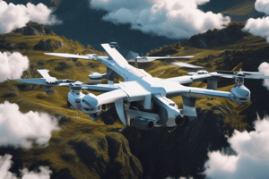
Flying Orbits and Aerial Imagery
- To fly a low-level orbit, tilt the camera down to avoid capturing the sky, and aim for 20% of the image to be ground.
- Start by flying around the whole building, then elevate 15 ft and tilt the camera down again, not exceeding 15°.
- Repeat this process to maintain a minimum of three orbits, ensuring at least three images capture the corner of the building.
Importance of Overlap
- The goal is to maintain a minimum of three orbits to ensure sufficient overlap between images.
- Overlap is crucial for creating a 3D model, especially when dealing with complex structures.
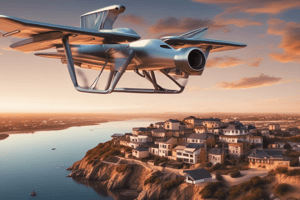
Using DJI Go and Point of Interest Mode
- Set the point of interest over the top of the building using DJI Go and Point of Interest mode.
- Set the radius to ensure the whole building is captured, and then hit "go" to start the orbit.
Time Shot Feature and Image Capture
- Use the Time Shot feature under Photos to take a second-long photo, and then click the photo button once to continue capturing images during the orbit.
- The drone will take multiple images during the orbit, which will be used to create a 3D model.
Emergency Landing Spots and Safety
- Identify primary and secondary emergency landing spots to ensure safety in case of an unexpected event.
- Be aware of obstacles such as power lines, roads, and trees, and plan accordingly.
Mocha and Altitude
- Set the mocha (Minimum Obstacle Clearance Altitude) at 20 ft above the highest point in the area, which is 70 ft in this case.
- Establish a top orbit at 80 ft AGL to ensure good imagery and clearance from obstacles.
Image Capture and Avoidance
- Avoid capturing the sky and highways in the images, as they can cause issues with the 3D model.
- Use techniques to remove motion blur from the images if necessary.
Radio Etiquette and Communication
- Use radio etiquette to ensure clear communication during the mission.
- Request a brief call back from the VO to confirm receipt of commands.
- Use a standardized format for radio calls, such as "Team 3 to VO Drone 1, 40 ft AGL, counterclockwise."
Flying Orbits and Aerial Imagery
- For low-level orbits, tilt the camera down to avoid capturing the sky, aiming for 20% of the image to be ground.
- Fly around the whole building, then elevate 15 ft and tilt the camera down again, not exceeding 15°.
- Repeat this process to maintain a minimum of three orbits, ensuring at least three images capture the corner of the building.
Importance of Overlap
- A minimum of three orbits is required to ensure sufficient overlap between images.
- Overlap is crucial for creating a 3D model, especially when dealing with complex structures.
Using DJI Go and Point of Interest Mode
- Use DJI Go and Point of Interest mode to set the point of interest over the top of the building.
- Set the radius to ensure the whole building is captured, then hit "go" to start the orbit.
Time Shot Feature and Image Capture
- Use the Time Shot feature under Photos to take a second-long photo, then click the photo button once to continue capturing images during the orbit.
- The drone will take multiple images during the orbit, which will be used to create a 3D model.
Emergency Landing Spots and Safety
- Identify primary and secondary emergency landing spots to ensure safety in case of an unexpected event.
- Be aware of obstacles such as power lines, roads, and trees, and plan accordingly.
Mocha and Altitude
- Set the mocha (Minimum Obstacle Clearance Altitude) at 20 ft above the highest point in the area.
- Establish a top orbit at 80 ft AGL to ensure good imagery and clearance from obstacles.
Image Capture and Avoidance
- Avoid capturing the sky and highways in the images, as they can cause issues with the 3D model.
- Use techniques to remove motion blur from the images if necessary.
Radio Etiquette and Communication
- Use radio etiquette to ensure clear communication during the mission.
- Request a brief call back from the VO to confirm receipt of commands.
- Use a standardized format for radio calls, such as "Team 3 to VO Drone 1, 40 ft AGL, counterclockwise."
Studying That Suits You
Use AI to generate personalized quizzes and flashcards to suit your learning preferences.