Podcast
Questions and Answers
ਭੂਗੋਲ ਦੇ ਅਧਾਰ 'ਤੇ, ਭਾਰਤ ਦੇ ਉੱਤਰੀ ਸੀਮਾ 'ਤੇ ਕਿਹੜਾ ਪਹਾੜੀ ਦੌਰ ਹੈ?
ਭੂਗੋਲ ਦੇ ਅਧਾਰ 'ਤੇ, ਭਾਰਤ ਦੇ ਉੱਤਰੀ ਸੀਮਾ 'ਤੇ ਕਿਹੜਾ ਪਹਾੜੀ ਦੌਰ ਹੈ?
- ਦੇਕਕਨ ਪਠਾਰ
- ਥਾਰ ਰਾਜਸਥਾਨ
- ਹਿਮਾਲਿਆਂ (correct)
- ਪੂਰਬੀਆਂ ਘਾਟ
ਭਾਰਤ ਵਿੱਚ ਸਭ ਤੋਂ ਲੰਬਾ ਨਦੀ ਕਿਹੜੀ ਹੈ?
ਭਾਰਤ ਵਿੱਚ ਸਭ ਤੋਂ ਲੰਬਾ ਨਦੀ ਕਿਹੜੀ ਹੈ?
- ਬ੍ਰਹਮਾਪੁਤ੍ਰ
- ਇੰਡਸ
- ਗੋਦਾਵਰੀ
- ਗੰਗਾ (correct)
ਭਾਰਤ ਦੇ ਕਿਸ ਹਿੱਸੇ ਵਿੱਚ ਆਬਾਦੀ ਦਾ ਵੱਧ ਤਰ ਕੇਂਦਰ ਇੰਡੋ-ਗੰਗੇਟਿਕ ਸਮਤਲ ਅਤੇ ਸਮੁੰਦਰਾਂ ਦਾ ਹਿੱਸਾ ਹੈ?
ਭਾਰਤ ਦੇ ਕਿਸ ਹਿੱਸੇ ਵਿੱਚ ਆਬਾਦੀ ਦਾ ਵੱਧ ਤਰ ਕੇਂਦਰ ਇੰਡੋ-ਗੰਗੇਟਿਕ ਸਮਤਲ ਅਤੇ ਸਮੁੰਦਰਾਂ ਦਾ ਹਿੱਸਾ ਹੈ?
- ਦੇਕਕਨ ਪਠਾਰ
- ਪੱਛਮੀ ਭਾਰਤ
- ਪੂರ್ವੀ ਭਾਰਤ
- ਉੱਤਰੀ ਭਾਰਤ (correct)
ਭਾਰਤ ਵਿੱਚ ਮੌਸਮ ਦੇ ਮੁਖ ਵਿਿਆ ਵਿੱਚ ਕਿਹੜਾ ਹੈ?
ਭਾਰਤ ਵਿੱਚ ਮੌਸਮ ਦੇ ਮੁਖ ਵਿਿਆ ਵਿੱਚ ਕਿਹੜਾ ਹੈ?
ਭਾਰਤ ਦੇ ਕਿਸ ਖੇਤਰ ਵਿੱਚ ਸਭ ਤੋਂ ਵੱਧ ਖੁਰਾਕ ਬਰੇਕਫਾਸਟ ਕੀਤੇ ਜਾਂਦੇ ਹਨ?
ਭਾਰਤ ਦੇ ਕਿਸ ਖੇਤਰ ਵਿੱਚ ਸਭ ਤੋਂ ਵੱਧ ਖੁਰਾਕ ਬਰੇਕਫਾਸਟ ਕੀਤੇ ਜਾਂਦੇ ਹਨ?
Flashcards are hidden until you start studying
Study Notes
Geography of India
-
Location
- Situated in South Asia.
- Bordered by Pakistan (west), China and Nepal (north), Bhutan (northeast), and Bangladesh and Myanmar (east).
-
Area
- 3.287 million square kilometers, making it the seventh-largest country in the world.
-
Topography
- Diverse landscape including mountains, plains, deserts, and coasts.
- Major geographical features:
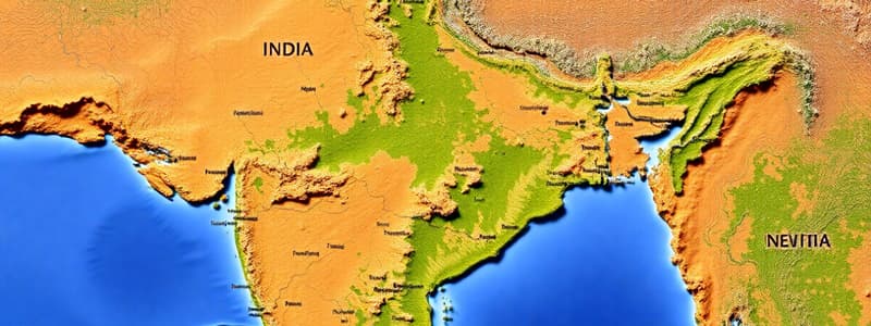
- Himalayas: Northern border, highest mountain range, includes Kanchenjunga (world's third-highest peak).
- Indo-Gangetic Plain: Fertile region between the Himalayas and the Deccan Plateau.
- Thar Desert: Located in the northwest (Rajasthan).
- Deccan Plateau: A large plateau in southern India, rich in minerals and agriculture.
- Western and Eastern Ghats: Mountain ranges running parallel to the western and eastern coasts, rich in biodiversity.
-
Rivers
- Major rivers:
- Ganges: Sacred river, flows through northern India, vital for agriculture and culture.
- Brahmaputra: Flows through northeastern India, convergence with the Ganges at the Sundarbans delta.
- Indus: Primarily flows through Pakistan, critical for irrigation in the northwest.
- Godavari and Krishna: Major rivers flowing through the Deccan Plateau.
- Major rivers:
-
Climate
- Four main seasons:
- Winter (December to February): Cool and dry.
- Summer (March to June): Hot and dry.
- Monsoon (June to September): Heavy rainfall, crucial for agriculture.
- Post-monsoon (October to November): Mild and pleasant.
- Variations across regions; northern plains experience a continental climate, while coastal areas have a tropical climate.
- Four main seasons:
-
Natural Resources
- Rich in natural resources including coal, iron ore, bauxite, and limestone.
- Significant agricultural sector, with major crops like rice, wheat, cotton, and sugarcane.
-
Biodiversity
- Home to a wide range of flora and fauna, with several biodiversity hotspots.
- Notable national parks and wildlife sanctuaries, such as Jim Corbett, Ranthambore, and Kaziranga.
-
Economic Geography
- Major economic activities:
- Agriculture: Dominant in rural areas.
- Industry: Textiles, automobile, IT services located primarily in urban areas.
- Services: Contributes significantly to GDP, particularly in areas like IT, tourism, and finance.
- Major economic activities:
-
Population Distribution
- Heavily populated in the Indo-Gangetic plain and coastal areas.
- Urbanization is increasing, with major cities like Mumbai, Delhi, Bangalore, and Kolkata.
-
Cultural Geography
- Diverse cultures, languages, and religions influenced by geography.
- Geographical features such as rivers and mountains often serve as cultural and historical boundaries.
ਭਾਰਤ ਦਾ ਭੂਗੋਲਿਕ ਵਰਣਨ
-
ਭਾਰਤ ਦੱਖਣੀ ਏਸ਼ੀਆ ਵਿੱਚ ਸਥਿਤ ਹੈ।
-
ਇਸਦੀਆਂ ਸਰਹੱਦਾਂ ਪਾਕਿਸਤਾਨ (ਪੱਛਮ), ਚੀਨ ਅਤੇ ਨੇਪਾਲ (ਉੱਤਰ), ਭੂਟਾਨ (ਉੱਤਰ-ਪੂਰਬ) ਅਤੇ ਬੰਗਲਾਦੇਸ਼ ਅਤੇ ਮਿਆਂਮਾਰ (ਪੂਰਬ) ਨਾਲ ਲੱਗਦੀਆਂ ਹਨ.
-
ਭਾਰਤ ਦਾ ਖੇਤਰਫਲ 3.287 ਮਿਲੀਅਨ ਵਰਗ ਕਿਲੋਮੀਟਰ ਹੈ, ਜੋ ਇਸਨੂੰ ਦੁਨੀਆ ਦਾ ਸੱਤਵਾਂ ਸਭ ਤੋਂ ਵੱਡਾ ਦੇਸ਼ ਬਣਾਉਂਦਾ ਹੈ.
-
ਭਾਰਤ ਦਾ ਭੂ-ਭਾਗ ਵਿਭਿੰਨ ਹੈ, ਜਿਸ ਵਿੱਚ ਪਹਾੜ, ਮੈਦਾਨ, ਮਾਰੂਥਲ ਅਤੇ ਤੱਟ ਸ਼ਾਮਲ ਹਨ.
- ਹਿਮਾਲਿਆ: ਉੱਤਰੀ ਸਰਹੱਦ, ਦੁਨੀਆ ਦੀ ਸਭ ਤੋਂ ਉੱਚੀ ਪਹਾੜੀ ਲੜੀ, ਜਿਸ ਵਿੱਚ ਕਾਂਚਨਜੰਗਾ (ਦੁਨੀਆ ਦੀ ਤੀਜੀ ਸਭ ਤੋਂ ਉੱਚੀ ਚੋਟੀ) ਸ਼ਾਮਲ ਹੈ.
- ਇੰਡੋ-ਗੰਗੇਟਿਕ ਮੈਦਾਨ: ਹਿਮਾਲਿਆ ਅਤੇ ਡੇੱਕਨ ਪਠਾਰ ਦੇ ਵਿਚਕਾਰ ਇੱਕ ਉਪਜਾਊ ਖੇਤਰ.
- ਥਾਰ ਮਾਰੂਥਲ: ਇਹ ਵਾਕਈ ਰਾਜਸਥਾਨ ਵਿਚ ਸਥਿਤ ਹੈ।
- ਡੇੱਕਨ ਪਠਾਰ: ਇਹ ਦੱਖਣੀ ਭਾਰਤ ਵਿੱਚ ਇੱਕ ਵੱਡਾ ਪਠਾਰ ਹੈ, ਜੋ ਖਣਿਜਾਂ ਅਤੇ ਖੇਤੀਬਾੜੀ ਵਿੱਚ ਸਮૃੱਧ ਹੈ.
- ਪੱਛਮੀ ਅਤੇ ਪੂਰਬੀ ਘਾਟ: ਪੱਛਮੀ ਅਤੇ ਪੂਰਬੀ ਤੱਟਾਂ ਦੇ ਸਮਾਨਾਂਤਰ ਚੱਲਣ ਵਾਲੀਆਂ ਪਹਾੜੀ ਲੜੀਆਂ, ਜੋ ਕਿ ਜੀਵ-ਵਿਭਿੰਨਤਾ ਵਿੱਚ ਸਮૃੱਧ ਹਨ।
-
ਨਦੀਆਂ:
- ਗੰਗਾ: ਇੱਕ ਪਵਿੱਤਰ ਨਦੀ, ਜੋ ਉੱਤਰੀ ਭਾਰਤ ਵਿੱਚੋਂ ਵਹਿੰਦੀ ਹੈ, ਖੇਤੀਬਾੜੀ ਅਤੇ ਸੱਭਿਆਚਾਰ ਲਈ ਜ਼ਰੂਰੀ ਹੈ.
- ਬ੍ਰਹਮਪੁੱਤਰ: ਇਹ ਨਦੀ, ਜੋ ਉੱਤਰ-ਪੂਰਬੀ ਭਾਰਤ ਵਿੱਚੋਂ ਵਹਿੰਦੀ ਹੈ, ਸੁੰਦਰਬਨ ਡੈਲਟਾ ਵਿੱਚ ਗੰਗਾ ਨਾਲ ਮਿਲਦੀ ਹੈ.
- ਸਿੰਧੂ: ਇਹ ਨਦੀ ਮੁੱਖ ਤੌਰ 'ਤੇ ਪਾਕਿਸਤਾਨ ਵਿੱਚੋਂ ਵਹਿੰਦੀ ਹੈ, ਜੋ ਉੱਤਰ-ਪੱਛਮ ਵਿੱਚ ਸਿੰਚਾਈ ਲਈ ਮਹੱਤਵਪੂਰਨ ਹੈ।
- ਗੋਦਾਵਰੀ ਅਤੇ ਕ੍ਰਿਸ਼ਨ: ਇਹ ਡੇੱਕਨ ਪਠਾਰ ਵਿੱਚੋਂ ਵਹਿੰਦੀਆਂ ਮੁੱਖ ਨਦੀਆਂ ਹਨ।
-
ਮੌਸਮ:
- ਭਾਰਤ ਵਿੱਚ ਚਾਰ ਮੁੱਖ ਮੌਸਮ ਹਨ:
- ਸਰਦੀ (ਦਸੰਬਰ ਤੋਂ ਫਰਵਰੀ): ਠੰਡਾ ਅਤੇ ਸੁੱਕਾ.
- ਗਰਮੀ (ਮਾਰਚ ਤੋਂ ਜੂਨ): ਗਰਮ ਅਤੇ ਸੁੱਕਾ.
- ਮਾਨਸੂਨ (ਜੂਨ ਤੋਂ ਸਤੰਬਰ): ਭਾਰੀ ਵਰਖਾ, ਖੇਤੀਬਾੜੀ ਲਈ ਜ਼ਰੂਰੀ.
- ਮਾਨਸੂਨ ਤੋਂ ਬਾਅਦ (ਅਕਤੂਬਰ ਤੋਂ ਨਵੰਬਰ): ਹਲਕਾ ਅਤੇ ਸੁਹਾਵਣਾ.
- ਖੇਤਰਾਂ ਦੇ ਅਨੁਸਾਰ, ਉੱਤਰੀ ਮੈਦਾਨ ਮਹਾਂਦੀਪੀ ਮੌਸਮ ਦਾ ਅਨੁਭਵ ਕਰਦੇ ਹਨ, ਜਦੋਂ ਕਿ ਤੱਟੀ ਖੇਤਰ ਟ੍ਰੋਪੀਕਲ ਮੌਸਮ ਦਾ ਅਨੁਭਵ ਕਰਦੇ ਹਨ.
- ਭਾਰਤ ਵਿੱਚ ਚਾਰ ਮੁੱਖ ਮੌਸਮ ਹਨ:
-
ਕੁਦਰਤੀ ਸੰਸਾਧਨ:
- ਭਾਰਤ ਕੋਲ ਕੋਲਾ, ਲੋਹਾ, ਬੌਕਸਾਈਟ ਅਤੇ ਚੂਨੇ ਦੇ ਪੱਥਰ ਸਮੇਤ ਕੁਦਰਤੀ ਸੰਸਾਧਨਾਂ ਵਿੱਚ ਸਮૃੱਧ ਹੈ.
- ਇੱਥੇ ਇੱਕ ਮਹੱਤਵਪੂਰਨ ਖੇਤੀਬਾੜੀ ਸੈਕਟਰ ਹੈ, ਜਿਸ ਵਿੱਚ ਚਾਵਲ, ਕਣਕ, ਕਪਾਹ ਅਤੇ ਗੰਨੇ ਵਰਗੀਆਂ ਮੁੱਖ ਫਸਲਾਂ ਹਨ.
-
ਜੀਵ-ਵਿਭਿੰਨਤਾ:
- ਇਹ ਨਵੇਂ ਕਈ ਪ੍ਰਕਾਰ ਦੇ ਪੌਦਿਆਂ ਅਤੇ ਜਾਨਵਰਾਂ ਦਾ ਘਰ ਹੈ।
- ਇੱਥੇ ਕਈ ਜੀਵ-ਵਿਭਿੰਨਤਾ ਹੌਟਸਪੌਟ ਹਨ।
- ਜਿਮ ਕੋਰਬੇਟ, ਰਣਥੰਭੋਰ ਅਤੇ ਕਾਜ਼ੀਰੰਗਾ ਵਰਗੇ ਮਹੱਤਵਪੂਰਨ ਰਾਸ਼ਟਰੀ ਪਾਰਕ ਅਤੇ ਵਾਈਲਡਲਾਈਫ ਸੈਂਕਚੂਰੀਜ਼ ਹਨ।
ਆਰਥਿਕ ਭੂਗੋਲ
- ਮੁੱਖ ਆਰਥਿਕ ਗਤੀਵਿਧੀਆਂ:
- ਖੇਤੀਬਾੜੀ: ਗ੍ਰਾਮੀਣ ਖੇਤਰਾਂ ਵਿੱਚ ਪ੍ਰਮੁੱਖ ਹੈ।
- ਉਦਯੋਗ: ਟੈਕਸਟਾਈਲ, ਆਟੋਮੋਬਾਈਲ, ਆਈਟੀ ਸੇਵਾਵਾਂ ਮੁੱਖ ਤੌਰ 'ਤੇ ਸ਼ਹਿਰੀ ਖੇਤਰਾਂ ਵਿੱਚ ਸਥਿਤ ਹਨ।
- ਸੇਵਾਵਾਂ: ਆਈਟੀ, ਸੈਰ-ਸਪਾਟਾ ਅਤੇ ਵਿੱਤ ਵਰਗੇ ਖੇਤਰਾਂ ਵਿੱਚ, ਇਹ ਜੀਡੀਪੀ ਵਿੱਚ ਮਹੱਤਵਪੂਰਨ ਯੋਗਦਾਨ ਪਾਉਂਦੀਆਂ ਹਨ।
জনসংখ্যার বিতরণ
- ਇੰਡੋ-ਗੰਗੇਟਿਕ ਮੈਦਾਨ ਅਤੇ ਤੱਟੀ ਖੇਤਰਾਂ ਵਿੱਚ ਭਾਰੀ ਆਬਾਦੀ ਹੈ।
- ਮੁੰਬਈ, ਦਿੱਲੀ, ਬੰਗਲੌਰ ਅਤੇ ਕੋਲਕਾਤਾ ਵਰਗੇ ਮੁੱਖ ਸ਼ਹਿਰਾਂ ਵਿੱਚ ਸ਼ਹਿਰੀਕਰਨ ਵਧ ਰਿਹਾ ਹੈ।
ਸੱਭਿਆਚਾਰਕ ਭੂਗੋਲ
- ਭੂਗੋਲ ਦੇ ਪ੍ਰਭਾਵ ਦੇ ਕਾਰਨ ਵਿਭਿੰਨ ਸੱਭਿਆਚਾਰ, ਭਾਸ਼ਾਵਾਂ ਅਤੇ ਧਰਮ ਹਨ.
- ਨਦੀਆਂ ਅਤੇ ਪਹਾੜ ਵਰਗੀਆਂ ਭੂਗੋਲਿਕ ਵਿਸ਼ੇਸ਼ਤਾਵਾਂ ਅਕਸਰ ਸੱਭਿਆਚਾਰਕ ਅਤੇ ਇਤਿਹਾਸਕ ਸੀਮਾਵਾਂ ਵਜੋਂ ਕੰਮ ਕਰਦੀਆਂ ਹਨ।
Studying That Suits You
Use AI to generate personalized quizzes and flashcards to suit your learning preferences.


