Explain the historical context and significance of the maps by Al-Idrisi and the later French cartographer, focusing on how they represent the Indian subcontinent and the changes i... Explain the historical context and significance of the maps by Al-Idrisi and the later French cartographer, focusing on how they represent the Indian subcontinent and the changes in cartographic understanding between the twelfth and eighteenth centuries.
Understand the Problem
The question is an image of a page in a textbook describing maps created by Al-Idrisi and a French cartographer. It would seem that the question is trying to understand the historical changes in cartography.
Answer
Al-Idrisi's map reverses India's orientation with Arabic place names, while the French map is more geographically accurate.
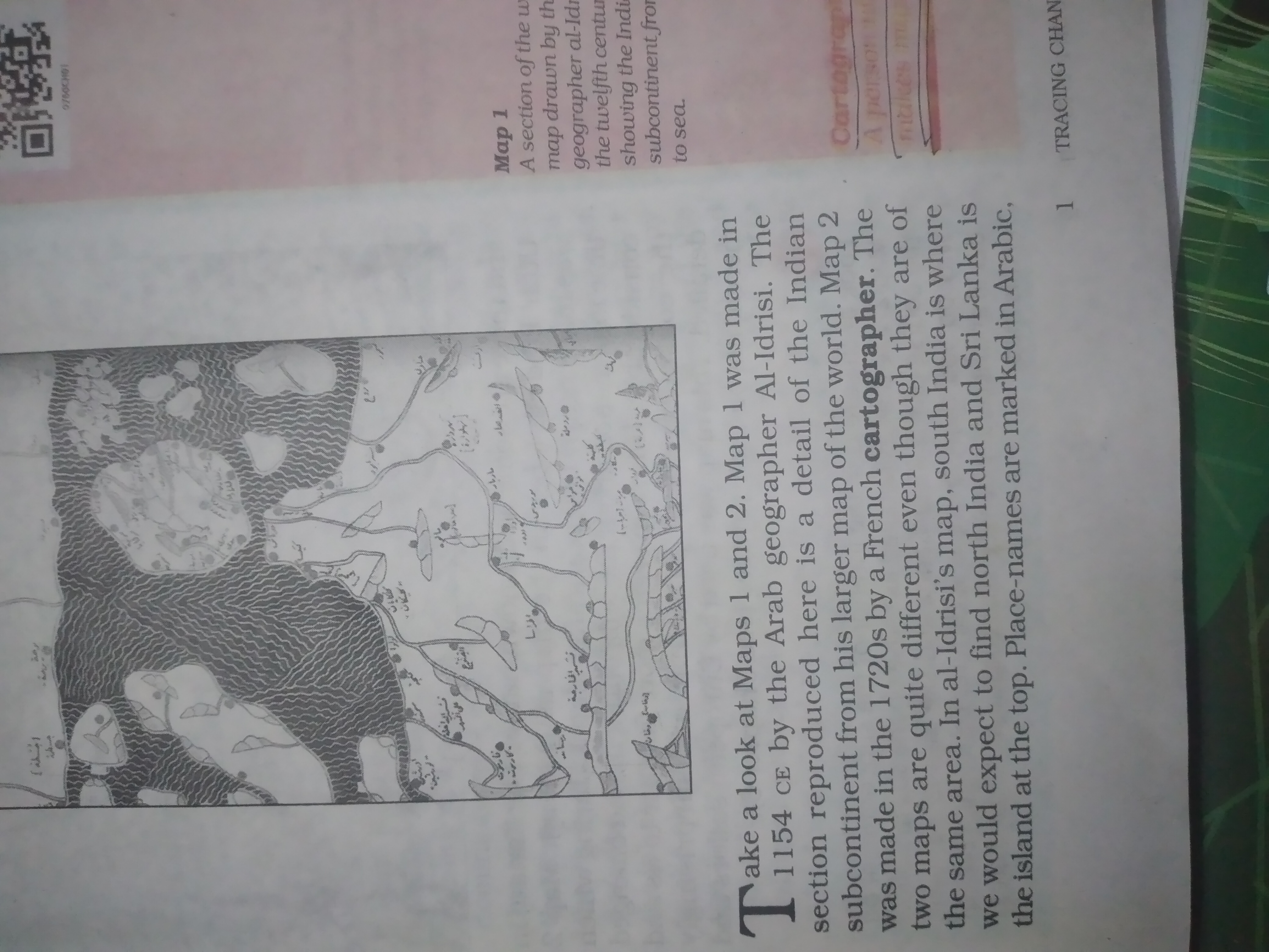
Al-Idrisi's 12th-century map reverses the orientation of the Indian subcontinent, placing south India in the north and Sri Lanka at the top. Place names are written in Arabic. By the 1720s, the French cartographer's map shows a more accurate understanding of the region's geography.
Answer for screen readers
Al-Idrisi's 12th-century map reverses the orientation of the Indian subcontinent, placing south India in the north and Sri Lanka at the top. Place names are written in Arabic. By the 1720s, the French cartographer's map shows a more accurate understanding of the region's geography.
More Information
Al-Idrisi's map combines Greek and Islamic cartographic knowledge. The French map made in the 1720s reflects advancements in geographical understanding over the centuries.
Tips
Focus on the orientation and labeling of the maps to understand the differences in cartographic understanding.
Sources
- The Complex Story Behind Al-Idrīsī's Iconic World Map - sacredfootsteps.com
- Al-Idrisi to Ptolemy: Early Maps of India - University of Michigan Library - apps.lib.umich.edu
- [PDF] Take a look at Maps 1 and 2. Map 1 was made in 1154 CE by the ... - aesahd.edunext1.com
AI-generated content may contain errors. Please verify critical information