Podcast
Questions and Answers
How does the orientation of mountain ranges typically influence precipitation patterns in an area?
How does the orientation of mountain ranges typically influence precipitation patterns in an area?
- Mountain ranges have no significant impact on precipitation, as atmospheric pressure is the primary determinant.
- The leeward side of the mountain range receives significantly more precipitation due to enhanced condensation.
- Precipitation is concentrated on the windward side, leading to a rain shadow effect on the leeward side. (correct)
- Precipitation is evenly distributed on both sides of the mountain range due to consistent wind patterns.
How do clouds influence the daily temperature range at the Earth's surface?
How do clouds influence the daily temperature range at the Earth's surface?
- Clouds reduce daytime highs by reflecting solar radiation and increase nighttime lows by trapping outgoing infrared radiation. (correct)
- Clouds always increase both daytime highs and nighttime lows by absorbing solar radiation and releasing it evenly.
- Clouds always decrease both daytime highs and nighttime lows by reflecting solar radiation and trapping heat.
- Clouds have no influence on daily temperature ranges, as temperature is solely determined by solar angle and latitude.
During an El Niño event, how are trade winds and ocean temperatures in the Pacific Ocean typically affected?
During an El Niño event, how are trade winds and ocean temperatures in the Pacific Ocean typically affected?
- Trade winds weaken, leading to warmer surface waters in the eastern Pacific and reduced upwelling. (correct)
- Trade winds remain constant, but a shift in ocean currents causes cooler water to accumulate in the central Pacific.
- Trade winds reverse direction, pushing warm water towards the western Pacific and upwelling along the Asian coast.
- Trade winds strengthen, causing colder water to upwell along the South American coast.
What is the primary long-term consequence of recurring El Niño events on agricultural practices in affected tropical regions?
What is the primary long-term consequence of recurring El Niño events on agricultural practices in affected tropical regions?
How does La Niña typically impact precipitation patterns in the regions surrounding Asia?
How does La Niña typically impact precipitation patterns in the regions surrounding Asia?
What is the most likely outcome of successive El Niño and La Niña events on global weather patterns?
What is the most likely outcome of successive El Niño and La Niña events on global weather patterns?
Why do certain regions such as Asia, Africa, and America experience higher precipitation levels compared to desert regions?
Why do certain regions such as Asia, Africa, and America experience higher precipitation levels compared to desert regions?
What is the defining characteristic of an air mass?
What is the defining characteristic of an air mass?
How does the source region influence the characteristics of an air mass?
How does the source region influence the characteristics of an air mass?
How do air masses change as they migrate away from their source region?
How do air masses change as they migrate away from their source region?
How does the Coriolis effect influence the movement of air masses in the Northern Hemisphere?
How does the Coriolis effect influence the movement of air masses in the Northern Hemisphere?
What is a key characteristic of a front?
What is a key characteristic of a front?
How does the speed of an approaching warm air mass influence the development of a warm front?
How does the speed of an approaching warm air mass influence the development of a warm front?
What type of cloud formation is typically associated with a cold front?
What type of cloud formation is typically associated with a cold front?
What is the primary characteristic of a stationary front?
What is the primary characteristic of a stationary front?
What process characterizes the formation of an occluded front?
What process characterizes the formation of an occluded front?
Which direction, relative to an observer's back in the Northern Hemisphere, is the location of lower pressure when determining the direction of high/low pressure systems?
Which direction, relative to an observer's back in the Northern Hemisphere, is the location of lower pressure when determining the direction of high/low pressure systems?
What does a tight spacing of isobars on a weather map indicate?
What does a tight spacing of isobars on a weather map indicate?
Isobars are a type of isoline used on weather to maps to represent what variable?
Isobars are a type of isoline used on weather to maps to represent what variable?
What does a low pressure zone with tightly spaced isotherms indicate on a weather map analysis?
What does a low pressure zone with tightly spaced isotherms indicate on a weather map analysis?
In the context of weather map analysis, what do isodrosotherms represent?
In the context of weather map analysis, what do isodrosotherms represent?
On a weather station model, how is wind direction typically indicated?
On a weather station model, how is wind direction typically indicated?
What atmospheric conditions are generally required for the formation of tropical cyclones?
What atmospheric conditions are generally required for the formation of tropical cyclones?
Why is the Coriolis effect essential for the development of tropical cyclones?
Why is the Coriolis effect essential for the development of tropical cyclones?
At which stage does a tropical cyclone reach its peak intensity?
At which stage does a tropical cyclone reach its peak intensity?
What are the primary factors that cause a tropical cyclone to weaken and decay?
What are the primary factors that cause a tropical cyclone to weaken and decay?
Which long term climate factor is most important in determining regional climates?
Which long term climate factor is most important in determining regional climates?
Which of the following best describes the effect of increased tilt (obliquity) of the Earth's axis on global climate patterns?
Which of the following best describes the effect of increased tilt (obliquity) of the Earth's axis on global climate patterns?
What is the primary concern regarding increasing levels of carbon dioxide ($CO_2$) in the atmosphere?
What is the primary concern regarding increasing levels of carbon dioxide ($CO_2$) in the atmosphere?
How do current atmospheric carbon dioxide ($CO_2$) levels compare to those of the past 800,000 years?
How do current atmospheric carbon dioxide ($CO_2$) levels compare to those of the past 800,000 years?
Flashcards
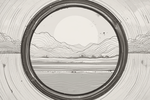
Orographic Lifting
Orographic Lifting
Air is forced up mountains, causing precipitation mainly on the windward side.
El Niño
El Niño
A climate pattern of warm waters in December, associated with Jesus, unusual temperature rises.
El Niño conditions
El Niño conditions
Trade Winds weaken, warm water moves east, western areas become colder, and eastern warmer
La Niña
La Niña
Signup and view all the flashcards
Air Mass
Air Mass
Signup and view all the flashcards
Continental Air Mass
Continental Air Mass
Signup and view all the flashcards
Maritime Air Mass
Maritime Air Mass
Signup and view all the flashcards
Front (Weather)
Front (Weather)
Signup and view all the flashcards
Warm Front
Warm Front
Signup and view all the flashcards
Cold Front
Cold Front
Signup and view all the flashcards
Stationary Front
Stationary Front
Signup and view all the flashcards
Occluded Front
Occluded Front
Signup and view all the flashcards
Isobars
Isobars
Signup and view all the flashcards
Climate
Climate
Signup and view all the flashcards
Eccentricity
Eccentricity
Signup and view all the flashcards
Obliquity
Obliquity
Signup and view all the flashcards
Precession
Precession
Signup and view all the flashcards
Greenhouse Effect
Greenhouse Effect
Signup and view all the flashcards
Global Warming
Global Warming
Signup and view all the flashcards
Study Notes
- Air is forced up by mountains (orographic lifting), causing precipitation on the windward side.
- Precipitation is concentrated on one side of a mountain, resulting in temperature variations.
- Clouds affect temperature differently based on height and thickness; higher, thinner clouds absorb more heat from the Earth.
- Clouds block sunlight, cooling the ground, while cloudless conditions lead to hot days and cool nights.
El Nino
- South American fishermen coined the term "El Nino" due to the unusual rise in water temperature around December.
- El Nino is associated with Christmas and is also known as "The Boy."
- El Nino Southern Oscillation (ENSO) is a broader climate pattern encompassing El Nino.
- Trade winds normally blow west, but during El Nino, they weaken.
- This causes warm water to move eastward, resulting in warm temperatures in the east and cold temperatures in the west.
- Waters flow from west to east, making the west colder and the east warmer during an El Nino phase.
- El Nino typically lasts 9-12 months.
- It leads to dry conditions, causing difficulty in farming and food production in tropical regions that usually receive rain.
La Nina
-
La Nina is a phase where trade winds strengthen.
-
Warm water is pushed towards Asia.
-
It also lasts 9-12 months.
-
It causes increased precipitation as warm water accumulates around Asia, increasing water vapor leading to rain.
-
Can destroy crops, flooding
-
La Nina and El Nino often occur back-to-back.
-
These events impact global precipitation patterns.
-
Asia, Africa, and America tend to receive the most precipitation.
Weather Patterns and Severe Storms
- Air masses are large bodies of air (approximately 1,600 km across and several km thick) with uniform temperature and humidity.
- The area where an air mass originates determines its characteristics.
- Air masses that stay over a source region longer are more likely to acquire its properties.
- Air masses at the poles are cold, while those at the equator are warm.
- Air mass characteristics change as they move.
- Land air masses are generally warmer than ocean air masses.
Types of Air Masses
-
Maritime (m) air masses are moist while Continental (c) air masses are dry.
-
Continental Polar (cP) air masses are cold and dry air masses originating from land (Arctic, Antarctica).
-
Continental Tropical (cT) air masses are warm and dry originating from land (Philippines, Australia, etc.).
-
Maritime Polar (mP) air masses are cold and moist originating from water (North Atlantic/Pacific).
-
Maritime Tropical (mT) air masses are warm and moist originating from water (Pacific, Indian Ocean)
-
As air masses move, their characteristics can change.
-
Air masses can move, interact, and converge.
-
Air masses move at different speeds, influenced by the Coriolis effect.
-
Fronts are boundaries separating different air masses, with one often being warmer and having higher moisture content.
-
Fronts can be identified by temperature changes and motion.
-
Warm fronts develop when a fast warm air mass slides over a slower, colder air mass.
-
Colliding warm air starts to replace cold air
-
These fronts often bring nimbostratus, altostratus, cirrostratus, and cirrus clouds.
-
There will be moderate precipitation, with nimbostratus and altostratus clouds leading to precipitation
-
The result is a white span of stratus clouds covering larger areas, leading to light or moderate precipitation that lasts for an extended period.
-
Leads to warm temperatures, moderate precipitation, and cirrus clouds.
-
Fair weather/clear skies
-
Cold fronts form when a fast cold air mass displaces a slower, warmer air mass.
-
Warm air is forced up, resulting in cumulonimbus clouds and heavy but short rain/thunderstorms.
-
Leads to colder weather and heavy precipitation
-
Characterized by cold temperatures and heavy but short precipitation
-
Stationary fronts occur when cold and warm air masses either don't move or move slowly.
-
Warm air masses will be warmer with cold air masses being colder
-
The weather changes based on which side you are on (boundaries).
-
Occluded fronts occur when a fast cold air mass overtakes a slower warm front ("sandwiched between").
-
Warm air is sandwiched by two cold air masses and forced upwards
-
This results in heavy rain/thunderstorms as precipitation occurs as the warm air rises.
-
It leads to cold temperatures and heavy precipitation
-
Triangles/symbols on weather maps indicate the direction the front is moving (N, S, W, E).
-
Pressure maps indicate zones of high and low pressure.
-
Isobars are lines connecting points of equal air pressure at sea level (4-point increment), such as 1008, 1012, and 1016.
-
In a high-pressure zone, wind goes down (descending air).
-
In a low-pressure zone, wind goes up (ascending air).
-
Wind blows clockwise around high pressure and counterclockwise around low pressure.
-
Tight isobars indicate a significant difference in air pressure, resulting in strong winds and high pressure.
-
Wide isobars indicate even, light or no wind.
-
To locate the direction of a high/low-pressure system in the Northern Hemisphere, stand with your back to the wind; low pressure will be to the left, and high pressure to the right.
-
Sailors discovered this to sail to safe spots (avoiding low-pressure systems).
-
Temperatures can be located using isotherms.
-
Tightly spaced isotherms indicate warmer weather, while widely spaced isobars and isotherms in high pressure are colder.
-
Surface dewpoint is the point where air is cold enough to condense into liquid.
-
Isodrosotherms are lines connecting points of equal dew point temperature at sea level.
-
Locations with high humidity mean high precipitation.
-
Low pressure = high temperature = high humidity = high pressure change = wet weather.
-
Pressure change helps define air masses and identify fronts based on boundaries.
-
Weather stations measure atmospheric characteristics, indicated by wind direction, wind speed
-
TL = air temperature, BL = dew point, TR = air pressure, R = pressure change/trend on weather maps
-
Minobars greater than 500 start with 9 (e.g., 760 becomes 976.0).
-
Minobars lower than 500 start with 10 (e.g., 150 becomes 1015.0).
-
Compare temperature and dew point to predict precipitation
-
Near 0°C/32°F, snow is likely
-
Above 20°C/72°F, rain is likely
Tropical Cyclones
- Warm ocean water warms the air above it.
- Warm air rises, creating an area of low pressure.
- Tropical cyclones are warm-core low-pressure systems with a spiral inflow of mass at the bottom and spiral outflow at the top.
- It develops over tropical and sub-tropical waters at any level with organized circulation.
- General direction of cyclones (latitudes 5-30) = West, then North
- Blown west by Trade Winds (latitudes 10-30)
Conditions for Tropical Cyclone Formation
- Ocean waters must have a minimum temperature of 26-27°C (79-80°F).
- Must be further than 5 degrees from the equator to allow the Coriolis effect to facilitate spinning.
- There must be a low-pressure disturbance.
- Winds at different altitudes should have similar speed and direction.
Stages of Tropical Cyclone Development
-
Formative Stage: Develops low-pressure system
-
Immature Stage: Speed increases, and pressure begins to drop with an inflow of air at the low-pressure system.
-
Mature Stage: Storm reaches its strongest point.
-
Decaying Stage: Storm decays over land or cooler areas
-
Storms rely on water vapor as an energy source, so lack of warm ocean water leads to weakening.
-
Moving north causes a storm to encounter higher pressure and cooler temperatures, also causing weakening.
-
Climate Change and Cyclones: Warmer waters feed cyclones, making them stronger.
-
The eye is the strongest point with clear conditions.
Categories of Typhoons
- Classified through wind speed; Tropical Depression, Tropical Storm, Severe Tropical Storm, Typhoon, Super Typhoon
Effects of Tropical Cyclones
- Storm surge: Abnormal water rise around coastal and inland areas
- Strong winds: Widespread damage and destruction
- Tornadoes: Localized destruction
- Rainfall and flooding: Heavy rain
World Climates + Global Climate Change
- Climate is the long-term weather pattern in a region.
- Factors affecting climate include temperature, pressure, wind, humidity, precipitation, cloudiness, and irradiance.
- Climate differs from weather only in timescale.
- Precipitation and temperature are most important in climate.
- Altitude, latitude, ocean currents, prevailing winds, albedo, cloud cover, continentality, and topography influence climate.
- Climates vary by region; some regions are more stable, while others fluctuate.
- Koppen Climate Classification categorizes five main climate types: tropical, dry, temperate, continental, and polar.
- Tropical climates have an average temperature above 18°C and average precipitation of 150-400 cm/year.
- Dry climate
- Climate changes naturally through oscillation (El Nino, La Nina)
Milankovitch Cycles
-
Milankovitch Cycles affect Earth's climate. These cycles involve changes in eccentricity, obliquity, and precession.
-
Eccentricity: Earth's orbit becomes more elliptical every 100,000 years.
-
Increased distance from the Sun results in cooler temperatures.
-
Obliquity: Changes in Earth's tilt (22.1 -> 24.5 degrees) every 41,000 years.
-
More tilt results in uneven temperature distribution.
-
Less tilt -> more even distribution -> temperatures go up.
-
Precession: Earth wobbles on its axis every 26,000 years.
-
Earth's climate has historically swung every ~100,000 years.
-
Little Ice Age, followed the Industrial Revolution
-
Little Ice Age started by volcanoes
-
Global temperatures dropped 2 degrees C (3.6 F) during 1300-1850 (~500 years)
Human-Caused Climate Change
- Relates to the Greenhouse Effect vs. Global Warming:
- Greenhouse Effect is a natural phenomenon where greenhouse gases trap heat near Earth's surface, keeping it warm.
- Three main greenhouse gases are water, carbon dioxide, and methane.
- Carbon dioxide is the most concerning and has steadily risen along with emissions
- Increases in atmospheric CO2 trap more heat, causing the globe to become warmer.
- Global Warming is a consequence of the Greenhouse Effect.
- CO2 levels have fluctuated over the last 800k years seeming to be a natural cycle but never higher than 300 ppm.
- With the Industrial Revolution, factories started using coal/fossil fuels = Replaced with cars, fueled by petroleum/gasoline = Electricity, made by burning fossil fuels
- Starts rising since with more CO2 production
Studying That Suits You
Use AI to generate personalized quizzes and flashcards to suit your learning preferences.