Podcast
Questions and Answers
How does water's role in moderating temperature and controlling climate directly influence global weather patterns?
How does water's role in moderating temperature and controlling climate directly influence global weather patterns?
- By accelerating the melting of polar ice caps through heat absorption.
- By uniformly distributing solar radiation across the planet.
- By increasing the frequency of extreme weather events.
- By creating a thermal buffer that reduces temperature extremes. (correct)
What aspects of Earth's geological history are most directly shaped by the erosional and depositional actions of water in its various forms?
What aspects of Earth's geological history are most directly shaped by the erosional and depositional actions of water in its various forms?
- The distribution of fossil fuels in sedimentary basins.
- The composition of Earth’s early atmosphere.
- The formation of all mountain ranges and plateaus.
- The specific patterns of coastal erosion and delta formation. (correct)
How do the unique chemical properties of water contribute to its essential role in supporting life?
How do the unique chemical properties of water contribute to its essential role in supporting life?
- By creating a magnetic field around living cells.
- By emitting a unique spectrum of electromagnetic radiation.
- By directly synthesizing complex organic molecules.
- By acting as a universal solvent, facilitating biochemical reactions. (correct)
Why is the ocean considered the largest reservoir in the hydrologic cycle, despite its limitations for direct human consumption?
Why is the ocean considered the largest reservoir in the hydrologic cycle, despite its limitations for direct human consumption?
What are the primary implications of the polar ice sheets holding the largest reservoir of freshwater on Earth?
What are the primary implications of the polar ice sheets holding the largest reservoir of freshwater on Earth?
What critical role does solar energy play in driving the movement of water through the hydrologic cycle?
What critical role does solar energy play in driving the movement of water through the hydrologic cycle?
What is the most accurate distinction between 'storm flow' and 'base flow' in the context of stream dynamics after a heavy rainfall?
What is the most accurate distinction between 'storm flow' and 'base flow' in the context of stream dynamics after a heavy rainfall?
What is the function of a drainage basin (or watershed) within a stream system?
What is the function of a drainage basin (or watershed) within a stream system?
Why is the stream's 'load,' which includes total sediment and dissolved matter, significant for understanding water quality and ecosystem health?
Why is the stream's 'load,' which includes total sediment and dissolved matter, significant for understanding water quality and ecosystem health?
How do streams and drainage systems play a fundamental role in both the hydrologic cycle and the rock cycle?
How do streams and drainage systems play a fundamental role in both the hydrologic cycle and the rock cycle?
Why are streams and drainage systems considered constantly evolving in response to changing relief, climate, and vegetation?
Why are streams and drainage systems considered constantly evolving in response to changing relief, climate, and vegetation?
How does the process of infiltration contribute to both groundwater recharge and soil moisture content?
How does the process of infiltration contribute to both groundwater recharge and soil moisture content?
What is the primary distinction between ephemeral and perennial streams in terms of their flow characteristics?
What is the primary distinction between ephemeral and perennial streams in terms of their flow characteristics?
Consider a landscape where deforestation has significantly reduced vegetation cover. What are the likely consequences for runoff and infiltration rates during a heavy rainfall event?
Consider a landscape where deforestation has significantly reduced vegetation cover. What are the likely consequences for runoff and infiltration rates during a heavy rainfall event?
How does the concept of 'mass balance' apply to the hydrologic cycle on a global scale?
How does the concept of 'mass balance' apply to the hydrologic cycle on a global scale?
What adjustments occur in a stream as it progresses from its source to its mouth?
What adjustments occur in a stream as it progresses from its source to its mouth?
Which scenario best describes the conditions that lead to the formation of braided stream channels?
Which scenario best describes the conditions that lead to the formation of braided stream channels?
How does the distribution of water velocity differ between the inside and outside of a meander bend, and what is the primary reason for this difference?
How does the distribution of water velocity differ between the inside and outside of a meander bend, and what is the primary reason for this difference?
Which of the following scenarios would primarily control the size and shape of a stream channel?
Which of the following scenarios would primarily control the size and shape of a stream channel?
How do streams minimize resistance to flow, and what observable feature results from this process?
How do streams minimize resistance to flow, and what observable feature results from this process?
How do streams adjust their characteristics—such as width, depth, gradient, and flow velocity—as they progress from their source to their mouth?
How do streams adjust their characteristics—such as width, depth, gradient, and flow velocity—as they progress from their source to their mouth?
What is the primary process behind a stream cutting off a meander loop, and what landform typically results from this action?
What is the primary process behind a stream cutting off a meander loop, and what landform typically results from this action?
How do the processes of sediment erosion and deposition contribute to the migration of meanders over time?
How do the processes of sediment erosion and deposition contribute to the migration of meanders over time?
What role does stream gradient play in determining stream behavior, and how does it typically change from a stream's headwaters to its mouth?
What role does stream gradient play in determining stream behavior, and how does it typically change from a stream's headwaters to its mouth?
How does the size of clasts within a stream typically change from the rocky headwaters to downstream locations, and what primary factor leads to this change?
How does the size of clasts within a stream typically change from the rocky headwaters to downstream locations, and what primary factor leads to this change?
What is the primary distinction between the formation of a floodplain and an alluvial fan?
What is the primary distinction between the formation of a floodplain and an alluvial fan?
How does the formation of natural levees directly contribute to the development of a floodplain's characteristic features?
How does the formation of natural levees directly contribute to the development of a floodplain's characteristic features?
Considering the connection between plate tectonics and stream basins, how might a significant tectonic event most likely influence the location and characteristics of a continental divide?
Considering the connection between plate tectonics and stream basins, how might a significant tectonic event most likely influence the location and characteristics of a continental divide?
How do real-time monitoring systems, combined with river basin geometry data, most effectively enhance flood forecasting capabilities?
How do real-time monitoring systems, combined with river basin geometry data, most effectively enhance flood forecasting capabilities?
How does the concept of a 'recurrence interval' aid in flood management and infrastructure planning, and what are its limitations?
How does the concept of a 'recurrence interval' aid in flood management and infrastructure planning, and what are its limitations?
How might significant alterations to a watershed's land use (e.g., urbanization), affect the stream's discharge and flood dynamics during a major storm event?
How might significant alterations to a watershed's land use (e.g., urbanization), affect the stream's discharge and flood dynamics during a major storm event?
What complex feedback mechanisms influence how the temporary storage of water in wetlands affects regional hydrology and ecosystem health?
What complex feedback mechanisms influence how the temporary storage of water in wetlands affects regional hydrology and ecosystem health?
In a region experiencing increased climate variability, what strategies could be implemented to enhance the resilience of floodplain ecosystems while accommodating human development?
In a region experiencing increased climate variability, what strategies could be implemented to enhance the resilience of floodplain ecosystems while accommodating human development?
How do lakes, particularly those at high latitudes, influence regional climate patterns and what factors make them vulnerable to climate change?
How do lakes, particularly those at high latitudes, influence regional climate patterns and what factors make them vulnerable to climate change?
How might the reduction in ice cap volume due to climate change affect the dynamics of continental divides and the distribution of freshwater resources?
How might the reduction in ice cap volume due to climate change affect the dynamics of continental divides and the distribution of freshwater resources?
Which of the following statements accurately describes a significant trade-off associated with the channelization of rivers for flood control?
Which of the following statements accurately describes a significant trade-off associated with the channelization of rivers for flood control?
Why might historic hydrologic data become invalidated after significant channelization projects?
Why might historic hydrologic data become invalidated after significant channelization projects?
Given that groundwater constitutes less than 1% of the liquid water in the hydrosphere, which statement correctly contextualizes the importance of groundwater?
Given that groundwater constitutes less than 1% of the liquid water in the hydrosphere, which statement correctly contextualizes the importance of groundwater?
Assuming that a geological study reveals a high concentration of chlorides, sulfates, and bicarbonates of calcium in local groundwater, what inference can be reliably drawn about the region's geology?
Assuming that a geological study reveals a high concentration of chlorides, sulfates, and bicarbonates of calcium in local groundwater, what inference can be reliably drawn about the region's geology?
How does the water table's behavior under hills and valleys influence groundwater availability?
How does the water table's behavior under hills and valleys influence groundwater availability?
Consider two adjacent geological formations: one with high porosity but low permeability, and another with lower porosity but higher permeability. How would groundwater flow likely differ between the two?
Consider two adjacent geological formations: one with high porosity but low permeability, and another with lower porosity but higher permeability. How would groundwater flow likely differ between the two?
What factors critically govern groundwater flow rates, and how do these rates relate to the sustainability of water resources?
What factors critically govern groundwater flow rates, and how do these rates relate to the sustainability of water resources?
In the context of groundwater dynamics, what is the most critical distinction between a 'recharge area' and a 'discharge area,' and how does this difference affect water management strategies?
In the context of groundwater dynamics, what is the most critical distinction between a 'recharge area' and a 'discharge area,' and how does this difference affect water management strategies?
Under what geological conditions would an artesian aquifer most likely develop, and why is it significant for water resource management?
Under what geological conditions would an artesian aquifer most likely develop, and why is it significant for water resource management?
Considering the interaction between groundwater and surface topography, how does the distribution of springs typically reflect the influence of subsurface geology and water table dynamics?
Considering the interaction between groundwater and surface topography, how does the distribution of springs typically reflect the influence of subsurface geology and water table dynamics?
How does the process of groundwater dissolving limestone or marble contribute to cave formation, and what conditions are necessary for this to occur?
How does the process of groundwater dissolving limestone or marble contribute to cave formation, and what conditions are necessary for this to occur?
What crucial assumption underlies the designation of an area as an 'aerated zone,' and what implications does this have for groundwater recharge?
What crucial assumption underlies the designation of an area as an 'aerated zone,' and what implications does this have for groundwater recharge?
How does the presence of an aquiclude above and below a confined aquifer influence the aquifer's vulnerability to pollution, and what management strategies are most appropriate in such settings?
How does the presence of an aquiclude above and below a confined aquifer influence the aquifer's vulnerability to pollution, and what management strategies are most appropriate in such settings?
How does the interconnection between surface water bodies (like streams and lakes) and groundwater reservoirs complicate water resource management, particularly in the context of overuse and contamination?
How does the interconnection between surface water bodies (like streams and lakes) and groundwater reservoirs complicate water resource management, particularly in the context of overuse and contamination?
What implications does the modification of river channels have on data integrity, considering the dependence of ecological studies on historical hydrological patterns?
What implications does the modification of river channels have on data integrity, considering the dependence of ecological studies on historical hydrological patterns?
Considering that karst topography is most developed in moist, tropical regions underlain by limestone, which of the following scenarios would most likely inhibit the formation of extensive karst landscapes?
Considering that karst topography is most developed in moist, tropical regions underlain by limestone, which of the following scenarios would most likely inhibit the formation of extensive karst landscapes?
How do laws and policies related to water quality and quantity most significantly challenge effective groundwater management?
How do laws and policies related to water quality and quantity most significantly challenge effective groundwater management?
Given that crop irrigation consumes 75% of the total water demand, what far-reaching consequences might arise from a widespread shift to more water-efficient irrigation technologies across various agricultural regions?
Given that crop irrigation consumes 75% of the total water demand, what far-reaching consequences might arise from a widespread shift to more water-efficient irrigation technologies across various agricultural regions?
How does the practice of interbasin water transfer most profoundly affect regional political dynamics and water resource management?
How does the practice of interbasin water transfer most profoundly affect regional political dynamics and water resource management?
In what way does excessive groundwater withdrawal pose the most significant long-term risk to environmental sustainability and infrastructure integrity?
In what way does excessive groundwater withdrawal pose the most significant long-term risk to environmental sustainability and infrastructure integrity?
Considering that approximately 1.2 billion people lack access to clean drinking water, mainly in developing countries, which intervention strategy would most effectively address this global crisis in the long term?
Considering that approximately 1.2 billion people lack access to clean drinking water, mainly in developing countries, which intervention strategy would most effectively address this global crisis in the long term?
What critical trade-off is typically encountered when employing chlorination as a method to ensure that North American water sources are free from microorganisms?
What critical trade-off is typically encountered when employing chlorination as a method to ensure that North American water sources are free from microorganisms?
What distinctive characteristic makes surface water resources particularly 'highly susceptible to contamination' compared to other water sources?
What distinctive characteristic makes surface water resources particularly 'highly susceptible to contamination' compared to other water sources?
In what way does 'cultural eutrophication' most severely degrade aquatic ecosystems compared to natural eutrophication processes?
In what way does 'cultural eutrophication' most severely degrade aquatic ecosystems compared to natural eutrophication processes?
Considering the challenges in addressing groundwater contamination, what critical advantage does 'active remediation' offer over 'passive remediation' in cleaning up contaminated sites?
Considering the challenges in addressing groundwater contamination, what critical advantage does 'active remediation' offer over 'passive remediation' in cleaning up contaminated sites?
How do cave formations primarily develop?
How do cave formations primarily develop?
What geological feature is characteristically described as a large dissolution cavity open to the sky?
What geological feature is characteristically described as a large dissolution cavity open to the sky?
What unifying characteristic defines regions with exceptionally soluble rocks where sinkholes and caves are so numerous that they create small basins, ridges, and pinnacles?
What unifying characteristic defines regions with exceptionally soluble rocks where sinkholes and caves are so numerous that they create small basins, ridges, and pinnacles?
Why is a reliable water supply critical for a society's well-being and sustainability?
Why is a reliable water supply critical for a society's well-being and sustainability?
Why is groundwater challenging to monitor effectively?
Why is groundwater challenging to monitor effectively?
Flashcards
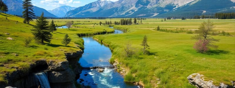
Hydrologic Cycle
Hydrologic Cycle
The continuous movement of water on, above, and below the surface of the Earth.
Water's Role in Climate
Water's Role in Climate
Water plays a key role in regulating temperature and influencing weather patterns globally.
Ocean Reservoir
Ocean Reservoir
The largest water reservoir in the hydrologic cycle, containing over 97.5% of Earth's water.
Polar Ice Sheets
Polar Ice Sheets
Signup and view all the flashcards
Groundwater
Groundwater
Signup and view all the flashcards
Processes of the Hydrologic Cycle
Processes of the Hydrologic Cycle
Signup and view all the flashcards
Sheet Flow
Sheet Flow
Signup and view all the flashcards
Stream Flow
Stream Flow
Signup and view all the flashcards
Base Flow
Base Flow
Signup and view all the flashcards
Storm Flow
Storm Flow
Signup and view all the flashcards
Ephemeral Streams
Ephemeral Streams
Signup and view all the flashcards
Perennial Streams
Perennial Streams
Signup and view all the flashcards
Stream System
Stream System
Signup and view all the flashcards
Stream Load
Stream Load
Signup and view all the flashcards
Drainage Basin
Drainage Basin
Signup and view all the flashcards
Stream Channel Controls
Stream Channel Controls
Signup and view all the flashcards
Stream Gradient
Stream Gradient
Signup and view all the flashcards
Factors Controlling Stream Behavior
Factors Controlling Stream Behavior
Signup and view all the flashcards
Stream Adjustments
Stream Adjustments
Signup and view all the flashcards
Meandering Channels
Meandering Channels
Signup and view all the flashcards
Point Bar
Point Bar
Signup and view all the flashcards
Cut Bank
Cut Bank
Signup and view all the flashcards
Oxbow Lake
Oxbow Lake
Signup and view all the flashcards
Braided Channels
Braided Channels
Signup and view all the flashcards
Clast Size Downstream
Clast Size Downstream
Signup and view all the flashcards
Floodplain
Floodplain
Signup and view all the flashcards
Alluvial Fan
Alluvial Fan
Signup and view all the flashcards
Delta
Delta
Signup and view all the flashcards
Natural Levees
Natural Levees
Signup and view all the flashcards
Continental Divide
Continental Divide
Signup and view all the flashcards
Wetlands
Wetlands
Signup and view all the flashcards
Flooding
Flooding
Signup and view all the flashcards
Recurrence Interval
Recurrence Interval
Signup and view all the flashcards
Channelization
Channelization
Signup and view all the flashcards
Aerated Zone
Aerated Zone
Signup and view all the flashcards
Saturated Zone
Saturated Zone
Signup and view all the flashcards
Water Table
Water Table
Signup and view all the flashcards
Porosity
Porosity
Signup and view all the flashcards
Permeability
Permeability
Signup and view all the flashcards
Aquifer
Aquifer
Signup and view all the flashcards
Confined Aquifer
Confined Aquifer
Signup and view all the flashcards
Aquiclude
Aquiclude
Signup and view all the flashcards
Artesian Aquifer
Artesian Aquifer
Signup and view all the flashcards
Spring
Spring
Signup and view all the flashcards
Cone of Depression
Cone of Depression
Signup and view all the flashcards
Cave Formations (Groundwater)
Cave Formations (Groundwater)
Signup and view all the flashcards
Sinkhole
Sinkhole
Signup and view all the flashcards
Karst Topography
Karst Topography
Signup and view all the flashcards
Reliable Water Supply
Reliable Water Supply
Signup and view all the flashcards
Crop Irrigation
Crop Irrigation
Signup and view all the flashcards
Industrial Water Demand
Industrial Water Demand
Signup and view all the flashcards
Domestic Water Use
Domestic Water Use
Signup and view all the flashcards
Interbasin Transfer
Interbasin Transfer
Signup and view all the flashcards
Groundwater Withdrawal (Excessive)
Groundwater Withdrawal (Excessive)
Signup and view all the flashcards
Surface Water Contamination
Surface Water Contamination
Signup and view all the flashcards
Eutrophication
Eutrophication
Signup and view all the flashcards
Passive Remediation
Passive Remediation
Signup and view all the flashcards
Groundwater Contamination
Groundwater Contamination
Signup and view all the flashcards
Active Remediation
Active Remediation
Signup and view all the flashcards
Study Notes
- The size and shape of a stream channel are controlled by rock erodibility, steepness of descent, and water volume
- A stream channel's gradient is the vertical distance it descends along its course, decreasing downstream, although not smoothly
- Stream behavior is controlled by average channel width and depth, channel gradient, average water velocity, discharge, and sediment load
- Streams experience a continuous interplay among these factors
- Orderly adjustments occur when following a stream from its source to its mouth include
- Width and depth increase
- Gradient decreases
- Flow velocity and discharge increase
- Turbulence decreases
- Straight channels are rare; low gradient streams typically assume a sinuous shape, with each bend forming a meander
- The shape of a stream minimizes resistance to flow
- Velocity is lowest along inside meanders and highest along outside meanders
- Sediment accumulates on the inner side of a meander, forming a point bar
- Collapse of the stream bank occurs on the outside of a meander, forming a cut bank
- Meanders tend to migrate, and streams may bypass a channel loop, cutting it off to form an oxbow lake
- A stream unable to transport its entire sediment load deposits the coarsest and densest sediment, forming a bar that divides and concentrates the flow
- Braided streams have many interlacing channels and bars, variable discharge, and easily erodible banks
- The size of clasts a stream can transport is mainly related to velocity
- Clast size decreases downstream from the rocky headwaters
- A stream's load consists of bed load, suspended load, and dissolved load
Bed Load
- Bed load constitutes 5-50% of the total sediment load
- Bed load moves by rolling, sliding, or saltation
Suspended Load
- Particles of silt and clay in suspended load provide the muddy character of many streams
Dissolved Load
- Dissolved load comprises primarily seven ions: bicarbonate, calcium, sulfate, chloride, sodium, magnesium, and potassium
- Streams form three major depositional landforms
- Floodplain: deposition of fine sediment beyond natural levees during a flood
- Alluvial fan: a fan-shaped body of alluvium at the base of an upland area
- Delta: triangular shaped deposit formed when a stream enters the standing water of a sea or lake
- Continents are divided into large regions from which major rivers flow to one of the world’s major oceans
- The line separating any two of these is called a continental divide
- Continental divides often coincide with crests of mountains
- There is a close relationship between plate tectonics and the locations of stream basins
- Water can remain stored in any of several surface water reservoirs
- Ice caps are the greatest of these
- Lakes are mainly found in high latitudes, form by glaciation, volcanism, tectonism, streamflow, natural dams, cave collapse, ice dam collapse, permafrost thaw, and coastal processes
- Wetlands are permanently or intermittently moist, including swamps, marshes and bogs and are highly biologically productive
- Flooding occurs when a stream’s discharge becomes so great that it exceeds the capacity of the channel
- Major floods occur infrequently, but can be devastating or catastrophic
- During a flood, the peak discharge comes well after the rains that produced it
- After rainfall, surface runoff moves into stream channels, quickly increasing discharge
- Prediction of floods has become essential
- The frequency of past floods can be plotted, calculating the average time interval between two floods of equal magnitude
- This is called the recurrence interval
- Real-time monitoring during storms in combination with information about the river basin’s geometry helps with forecasting
Flood Prevention and Channelization
- River channels are often modified for flood control, it is called channelization
- Channelization has benefits but also drawbacks, including interference with ecosystems and potential pollution aggravation
- Channelization does not guarantee flood protection, and may even worsen the risk and can lead to subsidence and invalidate historic hydrologic data
Water Under the Ground
- Less than 1% of the liquid water resides beneath the ground, forming groundwater
- The volume of groundwater is 35 times larger than all freshwater lakes and streams combined and nearly a third of all glaciers and sea ice
- Over 50% of groundwater is within 750 m depth of the surface
- Groundwater contains dissolved elements like chlorides, sulfates, and bicarbonates of calcium, magnesium, sodium, and potassium
- These elements dissolve from common rock-forming minerals
- Groundwater composition varies depending on the surrounding rocks
- From the ground surface down to the water table, the regolith has two zones
- Aerated zone is filled with air
- Saturated zone is filled with water
- The upper surface is water table
- The water table is the upper limit of readily usable groundwater, following the ground surface shape and higher under hills, lower under valleys
- Groundwater flows through pore spaces via percolation
- Flow depends on the porosity and permeability of the rock
- Porosity is the percentage of the total rock volume consisting of open pore spaces
- Permeability is how easily fluids pass through a solid
- Groundwater flows from high to low water table areas due to gravity
- Replenishment arises when rainfall/snowmelt enters the ground in recharge areas
- Water travels through the system to discharge areas, where it surfaces in streams, lakes, ponds, or wetlands
- An aquifer is a rock or regolith body with sufficient porosity and permeability to store and conduct groundwater in significant volumes
- An aquifer with a water table is unconfined
- If the rate of groundwater withdrawal exceeds the local groundwater flow rate, a cone of depression may form
- A confined aquifer is bordered above and below by impermeable rock called aquiclude
- An artesian aquifer has high hydrostatic pressure and is freely flowing
- A spring is a flow of groundwater emerging naturally at the surface
- Slowly moving groundwater can dissolve materials, particularly limestone and marble
- A cave forms when circulating groundwater dissolves an underground void with no surface opening
- Water flow enlarges the underground passage along the most favorable path
- Spectacular cave formations are deposited by precipitation of materials from the groundwater
- A sinkhole, in contrast to a cave, is a large dissolution cavity open to the sky
- In regions of exceptionally soluble rock, sinkholes and caves are so numerous that they combine to form a distinct topography of small basins, ridges, and pinnacles called karst
- Karst is best developed in moist, tropical regions underlain by limestone
Water and Society
- A reliable water supply is critical for
- Human survival and health
- Industry and agriculture
- Environmental services
- Water is under threat almost everywhere in the world in terms of quality and quantity
- Laws and policies are confusing and complicated, and groundwater is difficult to monitor
- Crop irrigation demands 75% of water
- Industry demands 20%
- Domestic use demands 5%
- Proportions can vary greatly from one region to another
- Population growth is partly responsible for increasing demand, as are improvements in living standards
- 29 countries worldwide suffer from water shortages, affecting 450 million people
- Interbasin transfer of water from one drainage basin to another to meet high water demands raises political issues and can have environmental impacts
- Excessive groundwater withdrawal can lead to lowering of the water table, drying of springs, compaction and subsidence
- About 1.2 billion people, mainly in developing countries, do not have access to clean drinking water
- In North America, water is drawn from relatively clean sources but is still monitored and treated with chlorination to kill microorganisms
- Surface water's accessibility makes it a useful resource, but also highly susceptible to contamination
- Contaminants come from
- Urban, suburban, and agricultural runoff
- Industrial and landfill effluents
- Mining, logging, and petroleum discharge
- Airborne contaminants
- Thermal pollution
- A common form of surface water contamination results from excess plant nutrients from fertilizers and detergents
- This contamination triggers algae growth, and aquatic weeds get out of control, creating an algal bloom
- The breakdown of algae and weeds causes oxygen depletion, killing other organisms in the water; this is called eutrophication
- Cultural eutrophication is eutrophication accelerated by the addition of anthropogenic pollutants
- Groundwater contamination is caused by many of the same pollutants that affect surface water
- Groundwater contamination is much more difficult to detect, control, and clean up
- Passive remediation involves relying on natural environmental processes to clean up the site
- Active remediation involves intervention by injecting oxygen or other chemicals to speed the breakdown of contaminants
Studying That Suits You
Use AI to generate personalized quizzes and flashcards to suit your learning preferences.