Podcast
Questions and Answers
Interakcija između ljudi i ______ istražuje kako ljudi modifikuju okolinu.
Interakcija između ljudi i ______ istražuje kako ljudi modifikuju okolinu.
okoline
______ ispitivanje obuhvata kako se ideje ili bolesti šire prostorno.
______ ispitivanje obuhvata kako se ideje ili bolesti šire prostorno.
Prostorno
Sistem za analizu i prikaz geografskih podataka se naziva ______.
Sistem za analizu i prikaz geografskih podataka se naziva ______.
GIS
Prikupljanje podataka putem direktnog posmatranja naziva se ______.
Prikupljanje podataka putem direktnog posmatranja naziva se ______.
Geografski uvidi su važni za ______ planiranje i razvoj infrastrukture.
Geografski uvidi su važni za ______ planiranje i razvoj infrastrukture.
Geografija je proučavanje površine Zemlje, njenih ______ i procesa koji ih oblikuju.
Geografija je proučavanje površine Zemlje, njenih ______ i procesa koji ih oblikuju.
Fizička geografija proučava prirodne ______ i procese Zemlje.
Fizička geografija proučava prirodne ______ i procese Zemlje.
Područje koje proučava raspodelu biljaka i životinja na Zemlji zove se ______.
Područje koje proučava raspodelu biljaka i životinja na Zemlji zove se ______.
Građanske ______ analizira prostornu organizaciju političkih sistema.
Građanske ______ analizira prostornu organizaciju političkih sistema.
Relativna lokacija se definiše u odnosu na druge ______.
Relativna lokacija se definiše u odnosu na druge ______.
Pokret proučava procese interakcije između ______ kroz migraciju i trgovinu.
Pokret proučava procese interakcije između ______ kroz migraciju i trgovinu.
Klima, vegetacija i kulturne osobine čine ______ sa sličnim karakteristikama.
Klima, vegetacija i kulturne osobine čine ______ sa sličnim karakteristikama.
Ekonomska geografija proučava raspodelu ekonomskih ______, resursa i trgovačkih obrazaca.
Ekonomska geografija proučava raspodelu ekonomskih ______, resursa i trgovačkih obrazaca.
Flashcards
Interakcija čoveka i okoline
Interakcija čoveka i okoline
Izučavanje odnosa između ljudskih društava i njihove prirodne okoline, uključujući kako ljudi modifikuju okolinu i kako okolina utiče na ljudske aktivnosti.
Prostorna difuzija
Prostorna difuzija
Proučavanje načina na koji ideje, inovacije ili bolesti šire se prostorom tokom vremena.
Geografski informacioni sistemi (GIS)
Geografski informacioni sistemi (GIS)
Sistem za snimanje, čuvanje, analiziranje i prikazivanje geografskih podataka. Koristi se za vizualizaciju obrazaca, identifikaciju veza i rešavanje problema.
Daljinsko sondiranje
Daljinsko sondiranje
Signup and view all the flashcards
Terenski rad
Terenski rad
Signup and view all the flashcards
Шта је географија?
Шта је географија?
Signup and view all the flashcards
Шта је физичка географија?
Шта је физичка географија?
Signup and view all the flashcards
Шта је геоморфологија?
Шта је геоморфологија?
Signup and view all the flashcards
Шта је хидрологија?
Шта је хидрологија?
Signup and view all the flashcards
Шта је климатологија?
Шта је климатологија?
Signup and view all the flashcards
Шта је биогеографија?
Шта је биогеографија?
Signup and view all the flashcards
Шта је хумана географија?
Шта је хумана географија?
Signup and view all the flashcards
Шта је популациона географија?
Шта је популациона географија?
Signup and view all the flashcards
Study Notes
Introduction to Geography
- Geography is the study of the Earth's surface, its features, and the processes that shape them.
- It encompasses the physical environment (natural landscapes, climate, ecosystems) and the human environment (populations, cultures, economies, societies).
- Geography uses spatial analysis to understand the location, distribution, and interrelationships of phenomena on Earth.
- This discipline includes various subfields like cartography, geomorphology, climatology, hydrology, population geography, economic geography, and political geography.
Branches of Geography
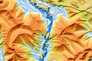
- Physical Geography: Studies natural features and processes of the Earth.
- Geomorphology: Addresses landforms, their origins, and evolution. Includes processes such as erosion, weathering, and deposition.
- Hydrology: Focuses on water resources, water cycles, and water bodies (rivers, lakes, oceans).
- Climatology: Analyzes weather patterns, atmospheric conditions, and climate change over time.
- Biogeography: Examines the distribution of plants and animals on Earth and their interactions with the environment.
- Human Geography: Studies human societies, their cultures, and their interactions with the environment.
- Population Geography: Examines population distribution, density, growth, and migration patterns.
- Cultural Geography: Analyzes the spatial distribution of cultural traits like language, religion, and traditions.
- Economic Geography: Studies the location and distribution of economic activities, resources, and trade patterns.
- Political Geography: Analyzes the spatial organization of political systems, including boundaries, territories, and governance.
Key Concepts in Geography
- Location: Refers to the position of a place on Earth's surface, using latitude and longitude. It can be absolute (precise coordinates) or relative (in relation to other places).
- Place: Characterizes the unique physical and human characteristics of a specific location, including its cultural, historical, and environmental aspects.
- Region: Describes areas with similar characteristics, such as climate, vegetation, or cultural traits.
- Movement: Focuses on the processes of interaction between places through migration, trade, communication, and transportation.
- Human-Environment Interaction: Examines the relationships between human societies and their natural environment, including how humans modify the environment and how the environment affects human activities.
- Spatial Diffusion: Investigates how ideas, innovations, or diseases spread across space over time.
Methods Used in Geography
- Geographic Information Systems (GIS): A system for capturing, storing, analyzing, and displaying geographical data.
- GIS uses maps and other spatial data to visualize patterns, identify relationships, and solve problems.
- Remote Sensing: The acquisition of information about an object or phenomenon without physical contact. This involves using satellites and aircraft to collect data about the Earth's surface.
- Fieldwork: The process of collecting data through direct observation and measurements in the field, often by conducting surveys and interviews.
Relevance and Applications of Geography
- Geographic knowledge is crucial for understanding global challenges such as climate change, resource management, urbanization, and conflict resolution.
- Geographical insights inform urban planning, infrastructure development, and environmental policy decisions.
- It provides a framework for analyzing and interpreting spatial patterns and processes in various fields like business, public health, and international relations.
Studying That Suits You
Use AI to generate personalized quizzes and flashcards to suit your learning preferences.