Podcast
Questions and Answers
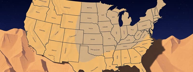
Why are state borders in the eastern United States often characterized as 'squiggly'?
Why are state borders in the eastern United States often characterized as 'squiggly'?
- They were determined by geological fault lines.
- They were intentionally designed to be irregular for aesthetic purposes.
- Rivers, used as primary transportation routes, defined many of these borders. (correct)
- They were defined by train tracks during the westward expansion.
What was the primary mode of transportation that influenced the location of major cities in the eastern United States?
What was the primary mode of transportation that influenced the location of major cities in the eastern United States?
- Railroads
- Stagecoaches
- Air travel
- Waterways (correct)
What geographic feature primarily defines the western border of Missouri?
What geographic feature primarily defines the western border of Missouri?
- The Missouri River
- A straight, man-made line
- The Rocky Mountains
- The Mississippi River (correct)
What distinguishes the 'Platte Purchase' from the rest of Missouri's geography?
What distinguishes the 'Platte Purchase' from the rest of Missouri's geography?
What is the likely primary reason for the creation of the Missouri bootheel?
What is the likely primary reason for the creation of the Missouri bootheel?
Which geographical event is sometimes falsely attributed to the creation of the Missouri bootheel?
Which geographical event is sometimes falsely attributed to the creation of the Missouri bootheel?
What was the primary cause of the Toledo War between Ohio and Michigan?
What was the primary cause of the Toledo War between Ohio and Michigan?
How did the Toledo War ultimately resolve the dispute between Ohio and Michigan?
How did the Toledo War ultimately resolve the dispute between Ohio and Michigan?
What geographical process led to the separation of a part of Kentucky from the rest of the state?
What geographical process led to the separation of a part of Kentucky from the rest of the state?
Based on available evidence, what is the primary land use of the detached part of Kentucky?
Based on available evidence, what is the primary land use of the detached part of Kentucky?
How did westward expansion influence the borders of western states differently than those of eastern states?
How did westward expansion influence the borders of western states differently than those of eastern states?
What is a plausible scenario if the Toledo War had never occurred?
What is a plausible scenario if the Toledo War had never occurred?
Which factors most likely contributed to the differing shapes of state borders between eastern and western states?
Which factors most likely contributed to the differing shapes of state borders between eastern and western states?
How might the geography of Missouri be different if the New Madrid earthquake was indeed the cause of the 'bootheel'?
How might the geography of Missouri be different if the New Madrid earthquake was indeed the cause of the 'bootheel'?
What implications did water transportation have on the development patterns of eastern states?
What implications did water transportation have on the development patterns of eastern states?
How might the economic development of Michigan have differed if it had retained control of Toledo after the Toledo War?
How might the economic development of Michigan have differed if it had retained control of Toledo after the Toledo War?
What is the most likely long-term consequence for the detached part of Kentucky due to its geographical isolation?
What is the most likely long-term consequence for the detached part of Kentucky due to its geographical isolation?
How do the historical narratives surrounding the Missouri bootheel reflect the complexities of state border creation?
How do the historical narratives surrounding the Missouri bootheel reflect the complexities of state border creation?
Considering the reliance on rivers for transportation in the East, what strategic advantages did cities located on these waterways possess?
Considering the reliance on rivers for transportation in the East, what strategic advantages did cities located on these waterways possess?
How did the Industrial Revolution specifically influence the shaping of state borders during westward expansion?
How did the Industrial Revolution specifically influence the shaping of state borders during westward expansion?
Flashcards
Eastern State Borders
Eastern State Borders
Eastern states have irregular borders due to the historical use of rivers as major transportation routes.
Western State Borders
Western State Borders
Western states have straight borders because they were defined by train tracks laid during westward expansion.
Platte Purchase
Platte Purchase
A small section on the top left of Missouri acquired from Native Americans.
Missouri Bootheel
Missouri Bootheel
Signup and view all the flashcards
Michigan's Upper Peninsula
Michigan's Upper Peninsula
Signup and view all the flashcards
Toledo War
Toledo War
Signup and view all the flashcards
Toledo War Outcome
Toledo War Outcome
Signup and view all the flashcards
Kentucky's Detached Part
Kentucky's Detached Part
Signup and view all the flashcards
Cause of Kentucky Detachment
Cause of Kentucky Detachment
Signup and view all the flashcards
Study Notes
The provided text repeats the information already existing in the study notes, so there are no factual updates or changes to be made.
Studying That Suits You
Use AI to generate personalized quizzes and flashcards to suit your learning preferences.


