Podcast
Questions and Answers
What does the African City Model describe?
What does the African City Model describe?
- Colonial city structures
- Fastest growing cities with high diversity (correct)
- The world's highest levels of urbanization
- Economic models of African cities
What is the Concentric Zone Model?
What is the Concentric Zone Model?
A structural model of the American central city that has five concentric land-use rings.
What is the Sector Model?
What is the Sector Model?
It models the internal structure of cities where social groups are arranged around sectors radiating from the CBD.
What does the Southeast Asian City Model focus on?
What does the Southeast Asian City Model focus on?
What is the Griffin-Ford Latin American City Model?
What is the Griffin-Ford Latin American City Model?
What does the Galactic City Model represent?
What does the Galactic City Model represent?
What is blockbusting?
What is blockbusting?
What is white flight?
What is white flight?
What is redlining?
What is redlining?
What are boomburbs?
What are boomburbs?
What does Borchert's Model of Urban Evolution describe?
What does Borchert's Model of Urban Evolution describe?
What are brownfields?
What are brownfields?
What is a Central Business District (CBD)?
What is a Central Business District (CBD)?
What is central place theory?
What is central place theory?
What does range refer to in urban studies?
What does range refer to in urban studies?
What is threshold in terms of service?
What is threshold in terms of service?
What is a census tract?
What is a census tract?
What is a conurbation?
What is a conurbation?
What is density gradient?
What is density gradient?
What is a disamenity zone?
What is a disamenity zone?
What is an edge city?
What is an edge city?
What is eminent domain?
What is eminent domain?
What is exurbanization?
What is exurbanization?
What is filtering in housing?
What is filtering in housing?
What is a gateway city?
What is a gateway city?
What is gentrification?
What is gentrification?
What are greenbelts?
What are greenbelts?
What does infilling refer to in urban planning?
What does infilling refer to in urban planning?
What is infrastructure?
What is infrastructure?
Flashcards are hidden until you start studying
Study Notes
African City Model
- Africa experiences the lowest levels of urbanization globally, despite rapid city growth.
- Features three Central Business Districts (CBDs): a colonial CBD, an informal market zone, and a transitional business center.
- Colonial CBDs exhibit vertical development; traditional centers usually have one-story buildings.
- Ethnic neighborhoods are common, often near zones of mining and manufacturing.
- Surrounding areas consist of squatter settlements and informal townships.
Concentric Zone Model
- Illustrates five concentric land-use rings around a central point in American cities.
Sector Model
- Cities structured around social groups arranged in sectors or wedges radiating from a central business district.
Southeast Asian City Model
- Developed by Terry McGee, this model identifies similar land-use patterns in medium-sized Southeast Asian cities.
- Central focus is on the old colonial port zone with elements of CBD existing as separate clusters.
Griffin-Ford Latin American City Model
- Integrates Latin American cultural elements and globalization, merging radial sectors with concentric zones.
- Features a vibrant CBD and a commercial spine; housing quality declines with distance from the CBD, especially in Disamenity sectors.
Galactic City Model (Peripheral Model)
- Represents decentralization of urban commercial landscapes influenced by a transition to service-based economies.
- Marked decline in manufacturing, shifting towards specialized industrial parks.
Multiple Nuclei Model
- Model representing cities structured around multiple activity nodes, accommodating various social groups.
Blockbusting
- Real estate agents influence white homeowners to sell cheaply due to fears of incoming racial minorities.
White Flight
- Movement of working and middle-class white populations from racially diverse areas to predominantly white suburbs.
Redlining
- Banks deny loans within certain mapped boundaries, impacting investment in those neighborhoods.
Boomburbs
- Rapidly expanding suburban cities that reach large populations but retain suburban characteristics.
Borchert's Model of Urban Evolution
- Identifies four phases of urban growth related to transportation: sail wagon (1790-1830), iron horse (1830-1870), steel rail (1870-1920), and the contemporary automobile/air travel era post-1920.
Brownfields
- Previously used industrial/commercial sites requiring environmental cleanup before redevelopment or expansion.
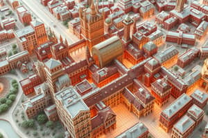
Central Business District (CBD)
- The heart of a city characterized by high densities of retail, offices, and cultural activities, where transportation systems converge.
Central Place Theory
- Explains service distribution through settlement size, with larger centers serving broader markets compared to smaller settlements.
Range
- The greatest distance consumers are willing to travel for a service.
Threshold
- Minimum number of potential customers necessary to support a service.
Census Tract
- Defined by the U.S. Bureau of the Census for statistical publication, generally aligning with neighborhood boundaries in urban areas.
Conurbation
- A vast, extended urban region formed by the merging of several growing cities.
Density Gradient
- The change in population density from the urban center to the outskirts.
Disamenity Zone
- Areas lacking services and characterized by poor surroundings.
Edge City
- Significant nodal concentrations of retail and office activities located outside central cities, often near major highways.
Eminent Domain
- Government's authority to acquire private property for public use, with compensation offered to property owners.
Exurbanization
- Population movement from urban centers to surrounding areas within commuting distance.
Filtering
- Change in house usage from owner-occupied to abandonment over time.
Gateway City
- Cities that function as significant entry and distribution points due to their geographic locations.
Gentrification
- Transition of neighborhoods from low-income rental areas to predominantly middle-class owner-occupied spaces.
Greenbelts
- Areas reserved as open space, parks, or agriculture to limit urban sprawl.
Infilling
- Increasing urban population density by developing vacant or underutilized land.
Infrastructure
- Essential physical and organizational facilities (e.g., roads, buildings) necessary for societal function.
Studying That Suits You
Use AI to generate personalized quizzes and flashcards to suit your learning preferences.