Podcast
Questions and Answers
Which of the following is NOT considered a major type of landform?
Which of the following is NOT considered a major type of landform?
- Canyons
- Deserts (correct)
- Hills
- Mountains
How are landforms primarily created?
How are landforms primarily created?
- By tectonic plate movement, weathering, and erosion (correct)
- Through rapid volcanic eruptions
- By extraterrestrial impacts
- By human activities
Which of the following is NOT mentioned as one of the most famous landforms in the United States?
Which of the following is NOT mentioned as one of the most famous landforms in the United States?
- Grand Canyon
- Mississippi River
- Amazon River (correct)
- Great Lakes
What type of landform is the Sierra Nevada Mountains?
What type of landform is the Sierra Nevada Mountains?
Which department in the U.S. is responsible for creating national parks and wilderness preserves to protect landforms?
Which department in the U.S. is responsible for creating national parks and wilderness preserves to protect landforms?
Which mountain range in the United States is the youngest among the three major ranges mentioned in the text?
Which mountain range in the United States is the youngest among the three major ranges mentioned in the text?
Where is Death Valley, known as the hottest place on Earth, located?
Where is Death Valley, known as the hottest place on Earth, located?
Which state is home to Palo Duro Canyon, the second largest canyon in the United States?
Which state is home to Palo Duro Canyon, the second largest canyon in the United States?
Why are canyons formed, according to the text?
Why are canyons formed, according to the text?
Which of the Great Lakes has the largest surface area of any lake in the world?
Which of the Great Lakes has the largest surface area of any lake in the world?
Which major landform is located to the east of California on the topographical map of the United States?
Which major landform is located to the east of California on the topographical map of the United States?
Which river travels from Minnesota to Louisiana on the topographical map of the United States?
Which river travels from Minnesota to Louisiana on the topographical map of the United States?
Which mountain range extends from northern New Mexico to the Canadian border on the topographical map of the United States?
Which mountain range extends from northern New Mexico to the Canadian border on the topographical map of the United States?
Which body of water forms a clear boundary between the United States and Canada on the North American landforms map?
Which body of water forms a clear boundary between the United States and Canada on the North American landforms map?
Which mountain range is shown extending into Mexico and Canada on the North American landforms map?
Which mountain range is shown extending into Mexico and Canada on the North American landforms map?
Flashcards are hidden until you start studying
Study Notes
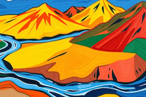
Landforms
- There are several major types of landforms, but not islands.
Landform Creation
- Landforms are primarily created through tectonic plate movement and volcanic activity.
Famous Landforms in the United States
- The Rocky Mountains, the Appalachian Mountains, and the Sierra Nevada Mountains are famous landforms in the United States, but not the Himalayan Mountains.
Sierra Nevada Mountains
- The Sierra Nevada Mountains are a mountain range.
National Parks and Wilderness Preserves
- The Department of the Interior is responsible for creating national parks and wilderness preserves to protect landforms.
Mountain Ranges in the United States
- The Rocky Mountains are the youngest among the three major mountain ranges mentioned.
Death Valley
- Death Valley, known as the hottest place on Earth, is located in California.
Palo Duro Canyon
- Palo Duro Canyon, the second largest canyon in the United States, is located in Texas.
Canyon Formation
- Canyons are formed through the erosive action of rivers.
Great Lakes
- Lake Superior has the largest surface area of any lake in the world.
Topographical Map of the United States
- The Great Plains are located to the east of California on the topographical map.
- The Mississippi River travels from Minnesota to Louisiana on the topographical map.
- The Rocky Mountains extend from northern New Mexico to the Canadian border on the topographical map.
North American Landforms Map
- The Great Lakes form a clear boundary between the United States and Canada on the North American landforms map.
- The Rocky Mountains extend into Mexico and Canada on the North American landforms map.
Studying That Suits You
Use AI to generate personalized quizzes and flashcards to suit your learning preferences.