Podcast
Questions and Answers
What is the process of gathering information about the Earth's surface and atmosphere without physically being present?
What is the process of gathering information about the Earth's surface and atmosphere without physically being present?
Remote sensing
What is the crucial step in UAS-based mapping that involves the conversion of raw data collected by the aircraft's sensors into usable information?
What is the crucial step in UAS-based mapping that involves the conversion of raw data collected by the aircraft's sensors into usable information?
Image processing
What are the Unmanned Aircraft Systems (UAS) also known as?
What are the Unmanned Aircraft Systems (UAS) also known as?
Drones
What types of data can UAS capture, which can be used to create maps and visualizations of the Earth's surface?
What types of data can UAS capture, which can be used to create maps and visualizations of the Earth's surface?
What are datums used to define?
What are datums used to define?
What is the purpose of georeferencing?
What is the purpose of georeferencing?
What are GNSS, INS, and IMU critical components of?
What are GNSS, INS, and IMU critical components of?
What is pseudo-range a measure of?
What is pseudo-range a measure of?
What does geomatics involve the collection, analysis, and interpretation of?
What does geomatics involve the collection, analysis, and interpretation of?
What do UAS-based mapping techniques and technologies encompass?
What do UAS-based mapping techniques and technologies encompass?
Flashcards are hidden until you start studying
Study Notes
UAS-Based Mapping: Basic Principles
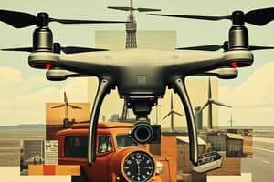
Unmanned Aircraft Systems (UAS), also known as drones, have revolutionized the field of mapping and remote sensing. These aircraft, equipped with high-resolution cameras, sensors, and mapping tools, can capture a wealth of data from the air, providing valuable insights for various applications, such as environmental monitoring, urban planning, and resource management. In this article, we will explore the basic principles of UAS-based mapping, focusing on remote sensing, image processing, aerial photography, datums, geoids, projections, GNSS, INS, IMU, pseudo-range, georeferencing (direct and indirect), geomatics, cameras, radiation, waves, reflection, and refraction.
Remote Sensing
Remote sensing is the process of gathering information about the Earth's surface and atmosphere without physically being present. UAS-based mapping relies heavily on remote sensing, as they can capture various types of data, such as electromagnetic radiation, thermal imagery, and multispectral data, which can be used to create maps and visualizations of the Earth's surface.
Image Processing
Image processing is a crucial step in UAS-based mapping. It involves the conversion of raw data collected by the aircraft's sensors into usable information. This process can include tasks such as geometric correction, radiometric correction, and feature extraction.
Aerial Photography
Aerial photography is the practice of taking photographs from an aircraft, including UAS. These images can be used for a variety of applications, such as creating maps, monitoring changes in land use, and assessing the condition of infrastructure.
Datums, Geoids, and Projections
Datums are reference systems used to define the shape of the Earth. Geoids are imaginary surfaces that represent the Earth's gravitational pull, and projections are methods used to represent the Earth's surface on a two-dimensional plane. UAS-based mapping relies on these concepts to accurately represent and analyze data collected from the field.
GNSS, INS, and IMU
Global Navigation Satellite Systems (GNSS), Inertial Navigation Systems (INS), and Integrated Motion Units (IMU) are all critical components of UAS-based mapping. GNSS provides accurate location data, INS provides information about an aircraft's motion and orientation, and IMU combines data from both GNSS and INS to provide even more precise information.
Pseudo-Range
Pseudo-range is a measure of the distance between a UAS and a known reference point. It is calculated by comparing the signal strength received from a GPS satellite with the expected signal strength. This information is used to determine the UAS's position and movement.
Georeferencing (Direct and Indirect)
Georeferencing is the process of associating geographic coordinates with image data. There are two types of georeferencing: direct and indirect. Direct georeferencing uses ground control points (GCPs) to establish a direct connection between image data and real-world coordinates. Indirect georeferencing uses a secondary reference system, such as a digital elevation model or a topographic map, to establish the connection.
Geomatics
Geomatics is a multidisciplinary field that involves the collection, analysis, and interpretation of geospatial data. It encompasses a wide range of techniques and technologies, including UAS-based mapping.
Cameras, Radiation, Waves, Reflection, and Refraction
UAS-based mapping relies on a variety of cameras and sensors to collect data. These devices can detect different types of radiation, including visible light, infrared, and ultraviolet. Waves, such as sound and gravitational waves, can also be used to collect data. Reflection and refraction occur when waves, such as light, bounce off or pass through materials, and they play a significant role in how data is collected and interpreted.
In conclusion, UAS-based mapping is a complex and multifaceted field that requires a deep understanding of various principles and technologies. By leveraging the power of UAS, remote sensing, image processing, aerial photography, and other techniques, we can gain valuable insights into our world and make informed decisions about its management and preservation.
Studying That Suits You
Use AI to generate personalized quizzes and flashcards to suit your learning preferences.