Podcast
Questions and Answers
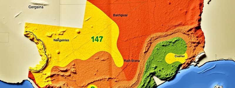
What are ecoregions of Texas?
What are ecoregions of Texas?
an area defined by its environmental conditions, especially climate, landforms, and soil characteristics
Which region of Texas is known as the wettest?
Which region of Texas is known as the wettest?
- Gulf Coast Prairies and Marshes
- Blackland Prairie
- Trans-Pecos
- Piney Woods (correct)
What is significant about the Blackland Prairie?
What is significant about the Blackland Prairie?
It was the number one in the number of cotton farmers and is sub-region of Coastal Plains.
Describe the Gulf Coast Prairies and Marshes.
Describe the Gulf Coast Prairies and Marshes.
What are the defining characteristics of the South Texas Plains?
What are the defining characteristics of the South Texas Plains?
What is notable about the Edwards Plateau?
What is notable about the Edwards Plateau?
Where is the Llano Uplift located?
Where is the Llano Uplift located?
Describe the Rolling Plains.
Describe the Rolling Plains.
What defines the High Plains?
What defines the High Plains?
What is the Trans-Pecos ecoregion known for?
What is the Trans-Pecos ecoregion known for?
Flashcards are hidden until you start studying
Study Notes
Ecoregions of Texas
- Defined by environmental conditions such as climate, landforms, and soil properties.
Piney Woods
- Located in Northeast Texas; characterized as the wettest region with 45-60 inches of rainfall annually.
- Features healthy, rich soils and is a subregion of the Coastal Plains, significant for the lumber industry.
Blackland Prairie
- Found in the northeast corner of Texas; historically the leading area for cotton farming.
- Dallas is situated within this region, which is also a subregion of the Coastal Plains.
Gulf Coast Prairies and Marshes
- Positioned at very low elevations along the Gulf of Mexico coast.
- Experiences humid, warm conditions with substantial rainfall, and is highly vulnerable to wind and water erosion.
South Texas Plains
- Located in South Texas; known for its mild winters and good water resources.
- Terrain is mostly flat with rolling hills, characterized by shrubs and small trees, featuring acidic sandy soil.
Edwards Plateau
- Borders dry western plains and various prairies and woods; shaped by erosion resulting in shallow soils.
- Experiences sudden rain leading to flooding; the Edwards Aquifer is a primary water source, forming a subregion of the Great Plains.
Llano Uplift
- Central region of Texas with ample water resources, known for its large granite dome.
- Terrain features hilly landscapes.
Rolling Plains
- Located in North/Central Texas; offers low water resources and experiences cold winters.
- Predominantly grasslands with rough terrain.
High Plains
- Found in the Northwest Texas Panhandle; features low water resources and cold winters.
- Characterized by very flat land, primarily composed of grasses and shrubs.
Trans-Pecos
- Dry, brown ecoregion situated in the western part of Texas.
Studying That Suits You
Use AI to generate personalized quizzes and flashcards to suit your learning preferences.


